Avo
- 8 routes
- V3 – V9
- Bouldering
- Apr–Oct
- best months
Is Avo open right now?
Closure in the area
There's a closure order in George Washington and Jefferson National Forest. It doesn't name Avo, so check the source for the area it covers (2 listed).
Enchanted Creek Road (National Forest System Road 1881) will be closed for repairs until 12/31/27
Agency closure covering George Washington and Jefferson National Forest · USFS · George Washington and Jefferson National Forest
Bolar Mountain Recreation Area - Twin Ridge Road Closure
Agency closure covering George Washington and Jefferson National Forest · USFS · George Washington and Jefferson National Forest
Prescribed Fire Operations Mount Rogers National Recreation Area- Porter and Little Mountain
Agency alert covering George Washington and Jefferson National Forest · USFS · George Washington and Jefferson National Forest
Road Closures James River and Warm Springs Ranger District
Agency alert covering George Washington and Jefferson National Forest · USFS · George Washington and Jefferson National Forest
Virginia Creeper National Recreation Trail Closure Update
Agency alert covering George Washington and Jefferson National Forest · USFS · George Washington and Jefferson National Forest
As of · Source: USFS · George Washington and Jefferson National Forest. Agencies don't list every closure — check before you go.
Avo is a climbing area in Virginia's George Washington and Jefferson National Forest, within the Glenwood and Pedlar Ranger Districts. The land is managed by the Forest Service, and the area is dedicated to bouldering, with nine routes all rated in the V scale from V3 up to V9. The boulders sit among several other outdoor options. The closest is the Lovingston Springs hike, about 0.7 miles away, and the Appalachian Trail passes within roughly 2.3 miles. Climbers can also head to Pirate Crags, about 6.2 miles away, or The Spot, about 6.8 miles away.
 Lovingston SpringsHikingPhoto: Ben Schumin from Montgomery Village, Maryland, USA, CC BY-SA 2.0 (via Wikimedia Commons)0.7 mi
- Henry LanumHiking2 mi
- Appalachian TrailHiking2.3 mi
 OronocoCampingPhoto: Famartin, CC BY-SA 4.0 (via Wikimedia Commons)5.8 mi
- Pirate CragsRock climbing6.2 mi
- The SpotRock climbing6.8 mi
- Pinnacle RidgeRock climbing6.9 mi
- Piney RiverCanoeing7.2 mi
Source: Roamze catalog (indexable pages within 10 miles, PostGIS distance)
- Pirate CragsRock climbing · ~11 min drive
- Pinnacle RidgeRock climbing · ~12 min drive
- Blue Ridge ParkwayRock climbing · ~13 min drive
- Dripping Rock OverlookRock climbing · ~14 min drive
- Left of Rock FenceRock climbing · ~14 min drive
- Mile Post 6.25 CragRock climbing · ~14 min drive
- Dripping Rock Main CragRock climbing · ~14 min drive
- Reid Hollow RoadRock climbing · ~15 min drive
- Greenstonia (Ridgeline)Rock climbing · ~17 min drive
- Big BoyRock climbing · ~17 min drive
Also worth it near here
- Lovingston SpringsHiking · ~1 min drivePhoto: Ben Schumin from Montgomery Village, Maryland, USA, CC BY-SA 2.0 (via Wikimedia Commons)
 Seeley-Woodworth a.t. ShelterCamping · ~4 min drivePhoto: vastateparksstaff, CC BY 2.0 (via Wikimedia Commons)
 The PriestSummit · ~11 min drivePhoto: Wickedender, CC BY-SA 3.0 (via Wikimedia Commons)
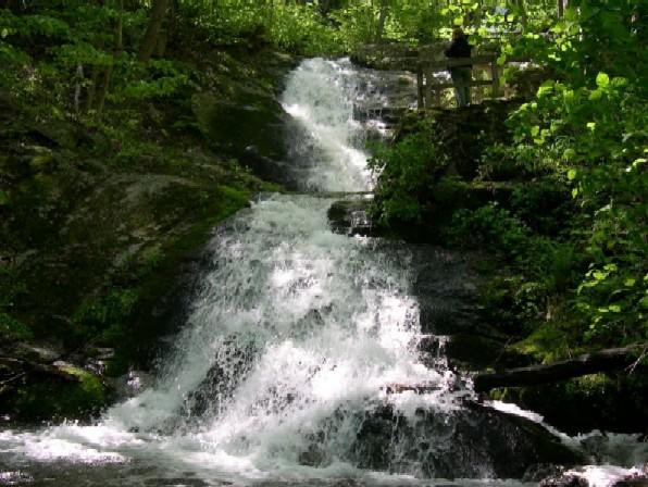 Crabtree FallsWaterfall · ~11 min drivePhoto: Public domain (via Wikimedia Commons)
Best time to visit Avo
Best months: April–October. Best months have typical highs of 55–85 °F, lows of 30 °F or warmer (32 °F where the station doesn't record snow), at most one snowy day and no more than 12 wet days.
Jan
41° / 19°
Feb
45° / 20°
Mar
52° / 25°
Apr
64° / 36°
May
71° / 46°
Jun
80° / 56°
Jul
83° / 60°
Aug
81° / 58°
Sep
75° / 51°
Oct
65° / 39°
Nov
53° / 29°
Dec
44° / 24°
Typical high / low (°F) and days with rain or snow, 1991–2020. Measured at Montebello Fish Cultural Stn, VA, 4.6 mi away at 2,667 ft. The station sits about 700 ft lower than this place, so expect it a little cooler here. This station doesn't record snowfall. Source: NOAA NCEI U.S. Climate Normals 1991–2020.
