Thomas Knob a.t. Shelter
Campground
Campground · 0.8 mi from the trail
Closure in the area
There's a closure order in George Washington and Jefferson National Forest. It doesn't name Pine Mountain Trail, so check the source for the area it covers (3 listed).
Enchanted Creek Road (National Forest System Road 1881) will be closed for repairs until 12/31/27
Agency closure covering George Washington and Jefferson National Forest · USFS · George Washington and Jefferson National Forest
List of trail closures post-Hurricane Helene
Park closure covering Appalachian National Scenic Trail · NPS · Appalachian National Scenic Trail
Bolar Mountain Recreation Area - Twin Ridge Road Closure
Agency closure covering George Washington and Jefferson National Forest · USFS · George Washington and Jefferson National Forest
Prescribed Fire Operations Mount Rogers National Recreation Area- Porter and Little Mountain
Agency alert covering George Washington and Jefferson National Forest · USFS · George Washington and Jefferson National Forest
Road Closures James River and Warm Springs Ranger District
Agency alert covering George Washington and Jefferson National Forest · USFS · George Washington and Jefferson National Forest
As of · Source: USFS · George Washington and Jefferson National Forest. Agencies don't list every closure — check before you go.
Pine Mountain Trail is an easy hike of about 4 miles in the Lewis Fork Wilderness, within the Mount Rogers National Recreation Area of the George Washington and Jefferson National Forest in Virginia. The Forest Service manages the land, and the trail also passes through the Appalachian National Scenic Trail. The route is an out-and-back that starts at about 5,380 feet and reaches a high point of 5,380 feet. The climb is rolling, with a total gain and loss of about 750 feet, and the steepest stretch comes early, around the 0.23-mile mark, where the grade reaches about 15%. The elevation gain of 162 feet listed in the trail's stats is one way, and the total for the full trip is about 750 feet. The trip takes about 1.5 hours, and the trail sits in wilderness, so plan for a trip into the backcountry. The Rhododendron Gap Trail starts just 0.2 miles away, and the Wilburn Ridge hike is about 0.4 miles off. Climbers can reach Bluefield Boulders and Spray Boulder within a mile, and Old Orchard a.t. Shelter is about 1.8 miles away for an overnight stay.
Thomas Knob a.t. Shelter
Campground
Log House Trading Post and Restaurant
Restaurant
Mountain Farm Life Museum
Museum
Places © OpenStreetMap contributors
More in JeffersonNot on Roamze yet. Their page has how to reach them.
Daily highs and lows, wind and the chance of precipitation at the summit and route start for the next 7 days, from the Open-Meteo model.
 Old Orchard a.t. ShelterCampingPhoto: Famartin, CC BY-SA 4.0 (via Wikimedia Commons)1.8 mi
Source: Roamze catalog (indexable pages within 10 miles, PostGIS distance)
 Appalachain Spur TrailHiking · ~3 min drivePhoto: bobistraveling, CC BY 2.0 (via Wikimedia Commons)
Also worth it near here
 Thomas Knob a.t. ShelterCamping · ~1 min drivePhoto: Famartin, CC BY-SA 4.0 (via Wikimedia Commons)
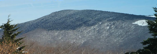 Mount RogersSummit · ~2 min drivePhoto: USDA-FS, Public domain (via Wikimedia Commons)
 Briar Patch BouldersRock climbing · ~4 min drivePhoto: vastateparksstaff, CC BY 2.0 (via Wikimedia Commons)
About 2.0 mi round trip.
About 752 ft of climbing round trip.
It is rated easy.
About 0.5 hours round trip.
2: Pine Mountain Trail and PINE MOUNTAIN.
Map and trail data © OpenStreetMap contributors
