Middle Hollow Trail
- 0.8 mi
- round trip
- 407 ft
- climb
- 1,935 ft
- high point
- Out and back
- route
- Jun–Oct
- best months
Is Middle Hollow Trail open right now?
Closure in the area
There's a closure order in George Washington and Jefferson National Forest. It doesn't name Middle Hollow Trail, so check the source for the area it covers (2 listed).
Enchanted Creek Road (National Forest System Road 1881) will be closed for repairs until 12/31/27
Agency closure covering George Washington and Jefferson National Forest · USFS · George Washington and Jefferson National Forest
Bolar Mountain Recreation Area - Twin Ridge Road Closure
Agency closure covering George Washington and Jefferson National Forest · USFS · George Washington and Jefferson National Forest
Prescribed Fire Operations Mount Rogers National Recreation Area- Porter and Little Mountain
Agency alert covering George Washington and Jefferson National Forest · USFS · George Washington and Jefferson National Forest
Road Closures James River and Warm Springs Ranger District
Agency alert covering George Washington and Jefferson National Forest · USFS · George Washington and Jefferson National Forest
Virginia Creeper National Recreation Trail Closure Update
Agency alert covering George Washington and Jefferson National Forest · USFS · George Washington and Jefferson National Forest
As of · Source: USFS · George Washington and Jefferson National Forest. Agencies don't list every closure — check before you go.
Middle Hollow Trail is a short, easy hike in Douthat State Park, part of the Warm Springs Ranger District of the George Washington and Jefferson National Forest in Virginia. The State Department of Conservation manages the land, and the trail is about 0.8 miles long, with a total climb of about 400 feet. The route is an out-and-back that starts at about 1,560 feet and reaches a high point of about 1,935 feet. The climb is front-loaded, with the steepest stretch at about 0.6 miles in, where the grade reaches about 14 percent. The trail is short enough to fit into a longer day of exploring the park. For comfortable weather, aim for late spring or early fall. Typical averages from the Hot Springs, VA weather station, about 6.6 miles away, show May highs around 72°F and September highs around 74°F, with October and November cooling to the low 60s. Heron Run Trail starts just 0.1 mile away, and Buck Hollow Trail and Wilson Creek Trail are each about 0.4 mile off. Climbers can find Gotham City Wall about 6.5 miles away.
Local outfitters
- Otter Back Outfitters50 mi away
Not on Roamze yet. Their page has how to reach them.
- Heron Run TrailHiking0.1 mi
- Wilson Creek TrailMountain biking0.4 mi
- Buck Hollow TrailHiking0.4 mi
- Gotham City WallRock climbing6.5 mi
- Fetish WallRock climbing6.7 mi
 Morris Hill Group CampgroundCampingPhoto: Ben Schumin from Montgomery Village, Maryland, USA, CC BY-SA 2.0 (via Wikimedia Commons)9 mi
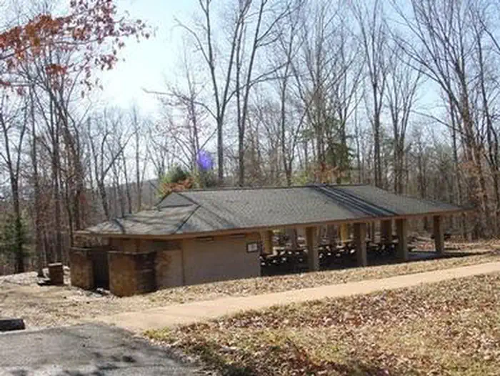 Coles PointLake fishing9.3 mi
 Morris Hill CampgroundCampingPhoto: Recreation.gov (RIDB) / public domain9.4 mi
Source: Roamze catalog (indexable pages within 10 miles, PostGIS distance)
 Short CutHiking · ~6 min drivePhoto: Virginia State Parks, CC BY 2.0 (via Wikimedia Commons)
- Buck Hollow TrailHiking · Next door
- Blue Suck Falls TrailHiking · ~3 min drive
- Fore Mountain TrailHiking · ~8 min drive
- Heron Run TrailHiking · Next door
- Pine Tree TrailHiking · ~2 min drive
- Middle Mountain (South)Hiking · ~5 min drive
- Wilson Creek TrailHiking · Next door
- Mountain Side TrailHiking · ~2 min drive
- McgrawHiking · ~8 min drive
Best time to visit Middle Hollow Trail
Best months: June–October. Best months have typical highs of 55–85 °F, lows of 30 °F or warmer (32 °F where the station doesn't record snow), at most one snowy day and no more than 12 wet days.
Jan
40° / 21°
10 wet
Feb
44° / 23°
10 wet
Mar
52° / 30°
11 wet
Apr
64° / 39°
13 wet
May
72° / 48°
14 wet
Jun
79° / 56°
12 wet
Jul
82° / 60°
12 wet
Aug
80° / 59°
11 wet
Sep
74° / 53°
9 wet
Oct
64° / 41°
9 wet
Nov
53° / 31°
9 wet
Dec
43° / 25°
10 wet
Typical high / low (°F) and days with rain or snow, 1991–2020. Measured at Hot Springs, VA, 6.6 mi away at 2,244 ft. This station doesn't record snowfall. Source: NOAA NCEI U.S. Climate Normals 1991–2020.
Map and trail data © OpenStreetMap contributors
