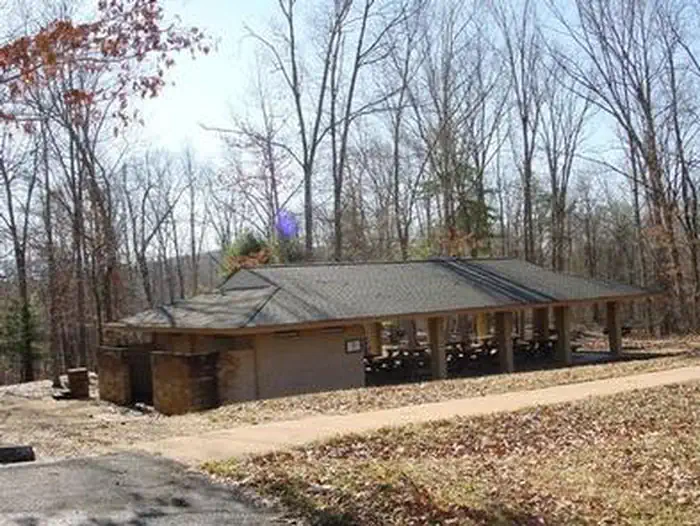
Whispering Pines Campground
Campground
Campground · 0.9 mi from the trail
 Photo: Virginia State Parks, CC BY 2.0 (via Wikimedia Commons)
Closure in the area
There's a closure order in George Washington and Jefferson National Forest. It doesn't name Short Cut, so check the source for the area it covers (2 listed).
Enchanted Creek Road (National Forest System Road 1881) will be closed for repairs until 12/31/27
Agency closure covering George Washington and Jefferson National Forest · USFS · George Washington and Jefferson National Forest
Bolar Mountain Recreation Area - Twin Ridge Road Closure
Agency closure covering George Washington and Jefferson National Forest · USFS · George Washington and Jefferson National Forest
Prescribed Fire Operations Mount Rogers National Recreation Area- Porter and Little Mountain
Agency alert covering George Washington and Jefferson National Forest · USFS · George Washington and Jefferson National Forest
Road Closures James River and Warm Springs Ranger District
Agency alert covering George Washington and Jefferson National Forest · USFS · George Washington and Jefferson National Forest
Virginia Creeper National Recreation Trail Closure Update
Agency alert covering George Washington and Jefferson National Forest · USFS · George Washington and Jefferson National Forest
As of · Source: USFS · George Washington and Jefferson National Forest. Agencies don't list every closure — check before you go.
Short Cut is a short, easy out-and-back hike in the James River Ranger District of the George Washington and Jefferson National Forest in Virginia, managed by the Forest Service. The trail is about a mile long, with a low point of 1,286 feet and a high of 1,322 feet, so the climb is gentle, with only about 23 feet of elevation gain one way. The trail is natural-surfaced and open to both horses and bikes, which makes it a flexible choice for riders and riders alike. It is open year-round, and the surrounding forest district offers plenty of other routes within a short drive. For comfortable weather, aim for late spring or early fall. Typical averages from a nearby weather station show May highs around 74°F and September highs around 77°F, with September also seeing the fewest wet days of the year. McGraw Loop is about half a mile away, and Flat Run Trail and the McGraw hike are each within a mile. Climbers can find Gotham City Wall about 3.5 miles off.
Whispering Pines Campground
Campground
Family TreeTs Restaurant and Catering
Theme restaurant
 If it rainsCarol M. Highsmith, Public domain · Wikimedia Commons
Stonewall Jackson House
Museum
Places © OpenStreetMap contributors, Places © Overture Maps Foundation · Photos: Carol M. Highsmith, Public domain (commons)
More in BuchananNot on Roamze yet. Their page has how to reach them.
 Morris Hill CampgroundCampingPhoto: Recreation.gov (RIDB) / public domain9.3 mi
 Morris Hill Group CampgroundCampingPhoto: Ben Schumin from Montgomery Village, Maryland, USA, CC BY-SA 2.0 (via Wikimedia Commons)9.4 mi
 Coles PointLake fishing9.7 mi
Source: Roamze catalog (indexable pages within 10 miles, PostGIS distance)
Best months: April and June–October. Best months have typical highs of 55–85 °F, lows of 30 °F or warmer (32 °F where the station doesn't record snow), at most one snowy day and no more than 12 wet days.
Jan
42° / 23°
9 wet
Feb
45° / 24°
9 wet
Mar
54° / 30°
11 wet
Apr
66° / 39°
12 wet
May
74° / 48°
14 wet
Jun
81° / 57°
12 wet
Jul
84° / 61°
12 wet
Aug
83° / 60°
11 wet
Sep
77° / 53°
8 wet
Oct
67° / 42°
9 wet
Nov
55° / 31°
9 wet
Dec
45° / 26°
10 wet
Typical high / low (°F) and days with rain or snow, 1991–2020. Measured at Covington Fltr Plt, VA, 9.4 mi away at 1,244 ft. This station doesn't record snowfall. Source: NOAA NCEI U.S. Climate Normals 1991–2020.
