
Eagle Crags
About
Eagle Crags is a summit in Washington County, Utah, at about 6,355 feet. It sits in the Canaan Mountain Wilderness.
Summit Facts
Summit elevation
6,355 ft
Land manager
Bureau of Land Management
Elevation from USGS 3D Elevation Program terrain data (about 10 m resolution).
Location
Eagle Crags
Utah
Name and location: U.S. Geological Survey, Geographic Names Information System (GNIS). Elevation: USGS 3D Elevation Program. View the GNIS record.
Facts about this place
When to go
Best time to go: Mar–May. The mildest months here, with typical highs of 61–78°F and lows of 33–46°F.
Typical monthly averages (not a forecast) from the Colorado City, AZ weather station, 9.5 mi away. High / low in °F.
- Jan49° high24° low
- Feb53° high28° low
- Mar61° high33° low
- Apr68° high38° low
- May78° high46° low
- Jun89° high54° low
- Jul95° high62° low
- Aug92° high62° low
- Sep84° high54° low
- Oct72° high42° low
- Nov59° high31° low
- Dec48° high24° low
The station sits about 1,400 ft lower than this spot, so expect it to run cooler up here.
Where it is
- Canaan Mountain Wilderness · Wilderness
- St. George Field Office · Bureau of Land Management
- Nearest town
- Rockville, Utah · 2.7 mi
- Managed by
- Bureau of Land Management
Source: Wilderness.net boundaries; USGS PAD-US 4.1; USGS GNIS populated places
Nearby
- Chinle TrailHiking2.3 mi
 Nung’wu Poa (Paiute) Trail - Phase 2HikingPhoto: Ken Lund, CC BY-SA 2.0 (via Wikimedia Commons)3.1 mi
- Wire Mesa Loop TrailMountain biking3.3 mi
- Mary Bonner Nature TrailHiking3.4 mi
 The WatchmanRock climbingPhoto: Christopher Michel, CC BY 2.0 (via Wikimedia Commons)4.3 mi
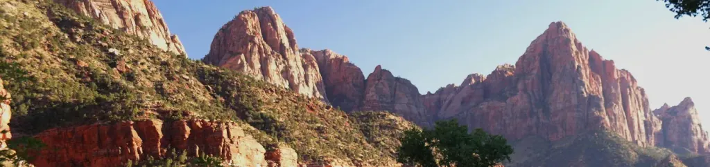 Watchman CampgroundCampingPhoto: Recreation.gov (RIDB) / public domain5.1 mi
 Drilled Pocket BoulderRock climbingPhoto: © Pierre André, CC BY-SA 4.0 (via Wikimedia Commons)5.7 mi
 Zion BoulderingRock climbingPhoto: Don Graham from Redlands, CA, USA - God bless it!, CC BY-SA 2.0 (via Wikimedia Commons)5.8 mi
Source: Roamze catalog (indexable pages within 10 miles, PostGIS distance)
Best time to visit Eagle Crags
Best months: March–May and September–October. Best months have typical highs of 55–85 °F, lows of 30 °F or warmer (32 °F where the station doesn't record snow), at most one snowy day and no more than 12 wet days.
Jan
49° / 24°
6 wet
Feb
53° / 28°
7 wet
Mar
61° / 33°
7 wet
Apr
68° / 38°
5 wet
May
78° / 46°
3 wet
Jun
89° / 54°
3 wet
Jul
95° / 62°
5 wet
Aug
92° / 62°
6 wet
Sep
84° / 54°
4 wet
Oct
72° / 42°
4 wet
Nov
59° / 31°
4 wet
Dec
48° / 24°
5 wet
Typical high / low (°F) and days with rain or snow, 1991–2020. Measured at Colorado City, AZ, 9.5 mi away at 5,001 ft. The station sits about 1,400 ft lower than this place, so expect it a little cooler here. This station doesn't record snowfall. Source: NOAA NCEI U.S. Climate Normals 1991–2020.
