Checkerboard Mesa
 Photo: Nikater, Public domain (via Wikimedia Commons)
- 6,679 ft
- summit
- National Park Service
- managed by
- Apr–May, Sep–Oct
- best months
Is Checkerboard Mesa open right now?
Closure in the area
There's a closure order in Zion National Park. It doesn't name Checkerboard Mesa, so check the source for the area it covers (2 listed).
Narrows are Closed.
Park closure covering Zion National Park · NPS · Zion National Park
Watchman Trail closed
Park closure covering Zion National Park · NPS · Zion National Park
Toxic cyanobacteria in rivers, streams, and pools
Park alert covering Zion National Park · NPS · Zion National Park
Large vehicle restrictions on Zion-Mt. Carmel Highway
Park alert covering Zion National Park · NPS · Zion National Park
As of · Source: NPS · Zion National Park. Agencies don't list every closure — check before you go.
Checkerboard Mesa is a summit of 6,679 feet in Zion National Park in Utah, managed by the National Park Service. The nearest town is Springdale, about 7 miles away. Spring and fall are the most comfortable times to visit. Typical averages from a nearby weather station in Orderville show May highs around 75°F and October highs near 69°F, while July averages about 91°F and January highs sit near 48°F. That station sits roughly 1,200 feet lower than the summit, so temperatures on the mesa run cooler. Several trails and climbing areas lie close by. The Hayduke Trail #13 and the Zion Park Scenic Byway are each about a mile away, and the Many Pools Hike is about 2 miles off. Watchman Campground, about 6 miles away, offers a place to stay.
Conditions and forecast
Daily highs and lows, wind and the chance of precipitation at the summit for the next 7 days, from the Open-Meteo model.
- Summit elevation
- 6,679 ft
- Land manager
- National Park Service
Elevation from USGS 3D Elevation Program terrain data (about 10 m resolution).
We don't know of a mapped trail or route to the summit of Checkerboard Mesa. Plan the approach with local maps, a guidebook or a local guide, and check conditions before you go.
Questions about Checkerboard Mesa
How tall is Checkerboard Mesa?
6,679 ft (2,036 m).
Is there a trail to the top of Checkerboard Mesa?
We don't know of a mapped trail or route to the summit. Plan the approach with local maps, a guidebook or a local guide.
- Cable Mountain6,537 ft · Utah1 route4.6 mi away
 Angels Landing5,792 ft · Utah1 route5.2 mi awayPhoto: Óðinn, CC BY-SA 2.5 ca (via Wikimedia Commons)
 Observation Point6,519 ft · Utah1 route5.5 mi awayPhoto: Aaron Zhu, CC BY-SA 3.0 (via Wikimedia Commons)
- Elephant Temple5,493 ft · Utah1 route7.4 mi away
- Imlay Temple5,517 ft · Utah1 route7.6 mi away
- Wire Valley Knoll4,539 ft · Utah1 route11 mi away
 Hayduke Trail #13HikingPhoto: Greg Willis from Denver, CO, usa, CC BY-SA 2.0 (via Wikimedia Commons)1.2 mi
- Zion Park Scenic BywayHikingPhoto: Greg Willis from Denver, CO, usa, CC BY-SA 2.0 (via Wikimedia Commons)1.2 mi
 Many Pools HikeHikingPhoto: Ken Lund from Reno, Nevada, USA, CC BY-SA 2.0 (via Wikimedia Commons)2 mi
 East SideRock climbingPhoto: Don Graham from Redlands, CA, USA - God bless it!, CC BY-SA 2.0 (via Wikimedia Commons)2.4 mi
- Jolly's MTB TrailHiking2.9 mi
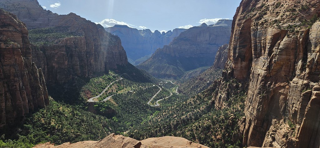 East TempleRock climbingPhoto: Capt' Gorgeous, CC BY 2.0 (via Flickr)3.8 mi
 CragmontRock climbingPhoto: Frans-Banja Mulder, CC BY 3.0 (via Wikimedia Commons)4.1 mi
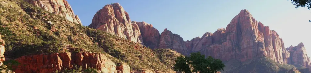 Watchman CampgroundCampingPhoto: Recreation.gov (RIDB) / public domain6 mi
Source: Roamze catalog (indexable pages within 10 miles, PostGIS distance)
 The East TempleSummit · ~7 min drivePhoto: An Errant Knight, CC BY-SA 4.0 (via Wikimedia Commons)
 Mountain of the SunSummit · ~7 min drivePhoto: oliver.dodd, CC BY 2.0 (via Wikimedia Commons)
 The Great White ThroneSummit · ~8 min drivePhoto: Brian Dunaway:, CC BY 2.5 (via Wikimedia Commons)
 Mount SprySummit · ~8 min drivePhoto: Ivy I Anderson, CC BY-SA 4.0 (via Wikimedia Commons)
 Red Arch MountainSummit · ~8 min drivePhoto: Patrick MILANO, CC BY-SA 2.0 (via Wikimedia Commons)
 Bridge MountainSummit · ~8 min drivePhoto: Fredlyfish4, CC BY-SA 4.0 (via Wikimedia Commons)
 Mount MoroniSummit · ~9 min drivePhoto: Cody Allison, CC BY-SA 2.0 (via Wikimedia Commons)
 The OrganSummit · ~9 min drivePhoto: See1,Do1,Teach1, CC BY 2.0 (via Wikimedia Commons)
- Angels LandingSummit · ~9 min drivePhoto: Óðinn, CC BY-SA 2.5 ca (via Wikimedia Commons)
 Mount ZionSummit · ~9 min drivePhoto: John A. Taylor, CC BY-SA 3.0 (via Wikimedia Commons)
Best time to visit Checkerboard Mesa
Best months: April–May and September–October. Best months have typical highs of 55–85 °F, lows of 30 °F or warmer (32 °F where the station doesn't record snow), at most one snowy day and no more than 12 wet days.
Jan
48° / 19°
Feb
50° / 23°
Mar
59° / 28°
Apr
65° / 32°
May
75° / 40°
Jun
86° / 48°
Jul
91° / 55°
Aug
89° / 54°
Sep
82° / 47°
Oct
69° / 36°
Nov
57° / 26°
Dec
48° / 19°
Typical high / low (°F) and days with rain or snow, 1991–2020. Measured at Orderville, UT, 13.9 mi away at 5,460 ft. The station sits about 1,200 ft lower than this place, so expect it a little cooler here. This station doesn't record snowfall. Source: NOAA NCEI U.S. Climate Normals 1991–2020.
