Campsite 2
Campground
Campground · 1.7 mi from the trail
 Photo: Óðinn, CC BY-SA 2.5 ca (via Wikimedia Commons)
Angels Landing (hikes March 1 – May 31) · day hike
Reserve on Recreation.govClosure in the area
There's a closure order in Zion National Park. It doesn't name Angels Landing, so check the source for the area it covers (2 listed).
Narrows are Closed.
Park closure covering Zion National Park · NPS · Zion National Park
Watchman Trail closed
Park closure covering Zion National Park · NPS · Zion National Park
Toxic cyanobacteria in rivers, streams, and pools
Park alert covering Zion National Park · NPS · Zion National Park
Large vehicle restrictions on Zion-Mt. Carmel Highway
Park alert covering Zion National Park · NPS · Zion National Park
As of · Source: NPS · Zion National Park. Agencies don't list every closure — check before you go.
Angels Landing is a summit of 5,792 feet in Zion National Park, Utah, managed by the National Park Service. The nearest town is Springdale, about 7 miles away. Spring and fall are the most comfortable times to go. Typical averages from the nearby Orderville weather station show May highs around 75°F and October highs near 69°F, while July averages about 91°F. The Angels Landing Trail starts about 0.4 miles away, and the Angel's Landing climbing area is just 0.1 mile off. Walter's Wiggles is about half a mile away, and Watchman Campground, roughly 5 miles out, is the closest place to camp.
Campsite 2
Campground
Red Rock Grill
Restaurant
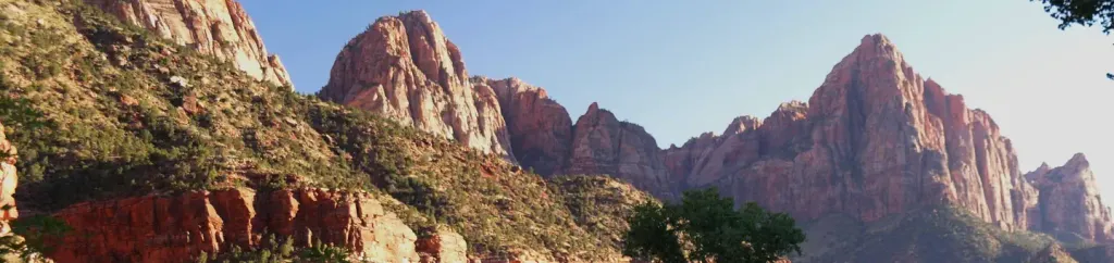
 If it rainsDon Graham from Redlands, CA, USA - God bless it!, CC BY-SA 2.0 · Wikimedia Commons
Places © OpenStreetMap contributors · Photos: Don Graham from Redlands, CA, USA - God bless it!, CC BY-SA 2.0 (commons)
More in HurricaneDaily highs and lows, wind and the chance of precipitation at the summit and route start for the next 7 days, from the Open-Meteo model.
Elevation from USGS 3D Elevation Program terrain data (about 10 m resolution).
Everyone who hikes Angels Landing (beyond Scout Lookout) must have a permit obtained by lottery on Recreation.gov. Season: year-round (seasonal lotteries plus day-before lottery). Official source: https://www.nps.gov/zion/planyourvisit/angels-landing-hiking-permits.htm
5,792 ft (1,765 m).
One: Angels Landing Trail.
Everyone who hikes Angels Landing (beyond Scout Lookout) must have a permit obtained by lottery on Recreation.gov. Season: year-round (seasonal lotteries plus day-before lottery). Official source: https://www.nps.gov/zion/planyourvisit/angels-landing-hiking-permits.htm

 Angel's LandingRock climbingPhoto: Pavel Špindler, CC BY 3.0 (via Wikimedia Commons)0.1 mi
 Cerberus GendarmeRock climbingPhoto: Frans-Banja Mulder, CC BY 3.0 (via Wikimedia Commons)0.4 mi
 Angels Landing TrailHikingPhoto: Greg Willis from Denver, CO, usa, CC BY-SA 2.0 (via Wikimedia Commons)0.4 mi
 Walter's WigglesHikingPhoto: Greg Willis from Denver, CO, usa, CC BY-SA 2.0 (via Wikimedia Commons)0.5 mi
 Desert Shield ButtressRock climbingPhoto: Ken Lund from Reno, Nevada, USA, CC BY-SA 2.0 (via Wikimedia Commons)0.5 mi
 Hidden Canyon - Closed IndefinitelyHikingPhoto: Klaus Eltrop, CC BY-SA 3.0 (via Wikimedia Commons)0.6 mi
 Watchman CampgroundCampingPhoto: Recreation.gov (RIDB) / public domain5.3 mi
Source: Roamze catalog (indexable pages within 10 miles, PostGIS distance)
 The OrganSummit · Next doorPhoto: See1,Do1,Teach1, CC BY 2.0 (via Wikimedia Commons)
 The Great White ThroneSummit · ~1 min drivePhoto: Brian Dunaway:, CC BY 2.5 (via Wikimedia Commons)
 Cathedral MountainSummit · ~1 min drivePhoto: Chris Game, CC BY-SA 2.0 (via Wikimedia Commons)
 Mount MajesticSummit · ~1 min drivePhoto: Zion National Park, CC BY 2.0 (via Wikimedia Commons)
 Red Arch MountainSummit · ~2 min drivePhoto: Patrick MILANO, CC BY-SA 2.0 (via Wikimedia Commons)
 Castle DomeSummit · ~2 min drivePhoto: inkknife_2000, CC BY-SA 2.5 (via Wikimedia Commons)
 Mount ZionSummit · ~2 min drivePhoto: John A. Taylor, CC BY-SA 3.0 (via Wikimedia Commons)
 Lady MountainSummit · ~3 min drivePhoto: inkknife_2000, CC BY-SA 2.5 (via Wikimedia Commons)
 Jacob PeakSummit · ~3 min drivePhoto: James St. John, CC BY 2.0 (via Wikimedia Commons)
 Mount MoroniSummit · ~3 min drivePhoto: Cody Allison, CC BY-SA 2.0 (via Wikimedia Commons)
Also worth it near here
Next lottery expected to open Saturday, February 13
For hikes March 1 – May 31, 2027. Recreation.gov hasn't announced this date yet.
A lottery for each three-month season, a few weeks before it starts. A day-before lottery covers each hiking day too.
Apply on Recreation.gov · Dates checked Oct 22
Best months: April–May and September–October. Best months have typical highs of 55–85 °F, lows of 30 °F or warmer (32 °F where the station doesn't record snow), at most one snowy day and no more than 12 wet days.
Jan
48° / 19°
Feb
50° / 23°
Mar
59° / 28°
Apr
65° / 32°
May
75° / 40°
Jun
86° / 48°
Jul
91° / 55°
Aug
89° / 54°
Sep
82° / 47°
Oct
69° / 36°
Nov
57° / 26°
Dec
48° / 19°
Typical high / low (°F) and days with rain or snow, 1991–2020. Measured at Orderville, UT, 17 mi away at 5,460 ft. This station doesn't record snowfall. Source: NOAA NCEI U.S. Climate Normals 1991–2020.
Angels Landing Temporarily Closed for Maintenance
Zion National Park · seen Sep 19, 2026 → lifted Oct 4, 2026 · National Park Service
