
Little Cottonwood Canyon Scenic Byway
Utah
Map
Byway Details
- Designation
- National Forest Scenic Byway
- Length
- 11 mi in Utah
- Managed by
- Forest Service
About Little Cottonwood Canyon Scenic Byway
Little Cottonwood Canyon Scenic Byway is a 10.8-mile drive in Utah's Uinta-Wasatch-Cache National Forest, within the Salt Lake Ranger District. The route links the towns of Granite and Alta, and the Forest Service manages the land along it. Late spring and early fall are the most comfortable times to go. Typical averages from the nearby Cottonwood Weir weather station show May highs around 71°F and September highs near 79°F, while July averages about 91°F. The byway makes a good base for other outings. Tanners Flat Campground and the Little Cottonwood Creek Trail sit right along the route, and Lisa Falls is close by. Lake Catherine, about a mile away, offers fishing.
Scenic byway data: U.S. Department of Transportation, Federal Highway Administration
Facts about this place
When to go
Best time to go: Apr–Jun. The mildest months here, with typical highs of 61–82°F and lows of 39–57°F.
Typical monthly averages (not a forecast) from the Cottonwood Weir, UT weather station, 3.2 mi away. High / low in °F.
- Jan38° high23° low
- Feb44° high27° low
- Mar54° high34° low
- Apr61° high39° low
- May71° high48° low
- Jun82° high57° low
- Jul91° high67° low
- Aug89° high66° low
- Sep79° high56° low
- Oct64° high43° low
- Nov49° high32° low
- Dec38° high23° low
Where it is
- Salt Lake Ranger District · Ranger district
- Uinta-Wasatch-Cache National Forest · National forest
- Towns along the route
- Granite · Alta
Conditions
Active alerts for Salt Lake Ranger District as of Oct 9, 2026:
Portions of Bonneville Shoreline Trail closure, Salt Lake Ranger District
information · posted Aug 29, 2026
information · posted Aug 24, 2026
information · posted Aug 24, 2026
Camping Fire Restrictions Mill Creek, Little and Big Cottonwood Canyons
information · posted Aug 24, 2026
Swimming Camping Animal in Watersheds
information · posted Aug 24, 2026
Source: USFS forest alerts
Nearby
- Chinese BouldersRock climbing0.1 mi
- FarsideRock climbing0.1 mi
 Cabbage PatchRock climbingPhoto: AndreyZharkikh, CC BY 2.0 (via Flickr)0.1 mi
- Tanners Flat CgCamping0.1 mi
- Lost and FoundRock climbing0.1 mi
- Lisa FallsHiking0.1 mi
- LITTLE COTTONWOOD CREEKHiking0.1 mi
- Little Cottonwood Creek TrailHiking0.1 mi
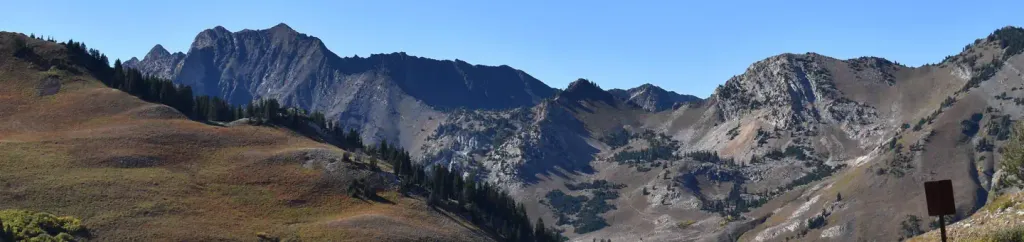 Albion BasinCampingPhoto: Recreation.gov (RIDB) / public domain0.1 mi
- Lake CatherineLake fishing1.1 mi
- Lake MarthaLake fishing1.2 mi
- Lake MaryLake fishing1.4 mi
Source: Roamze catalog (indexable pages within 2 miles of the route, PostGIS distance)
