Site 24
Campground
Campground · 0.2 mi from the trail
Caution today
Agency alerts are in effect for this area; weather is good · USFS, OpenWeather · checked just now
Alert in the area
The Forest Service lists 3 alerts for Dixie National Forest.
Duck Creek OHV Trail Closure
Agency alert covering Dixie National Forest · Order 0407-26-11 · USFS · Dixie National Forest
Pine Valley Ranger District Area and Trail and Road Closure
Agency alert covering Dixie National Forest · Order 0407-26-01 · USFS · Dixie National Forest
Cedar City Temporary Road Closure Webster Flat Road (Order 0407-25-02)
Agency alert covering Dixie National Forest · Order 0407-25-02 · USFS · Dixie National Forest
As of · Source: USFS · Dixie National Forest. Agencies don't list every closure — check before you go.
Spruces Trail is a short mountain biking route in the Cedar City Ranger District of Dixie National Forest, about half a mile long with a 306-foot climb from 9,115 to 9,439 feet. The Forest Service manages the land. Summer is the most comfortable time to ride. Typical July averages from a nearby weather station at Brian Head run around 71°F for highs and 42°F for lows, while winter highs there sit near freezing. Spruces Campground is about 0.2 miles away, and the Virgin River Rim Trail from Cascade Falls to Te-Ah Campground is about 0.3 miles away. The Navajo Trail and Navajo Lake Campground are both within a mile.
Site 24
Campground
State park and museum in the United States
Places © OpenStreetMap contributors, Places © Overture Maps Foundation
More in EnochNot on Roamze yet. Their page has how to reach them.
 Virgin River Rim Trail - Cascade Falls to Te-Ah CampgroundMountain bikingPhoto: The Dye Clan, CC BY-SA 3.0 (via Wikimedia Commons)0.3 mi
 Navajo TrailMountain bikingPhoto: inkknife_2000 (7.5 million views +), CC BY-SA 2.0 (via Wikimedia Commons)0.7 miDike TrailMountain bikingPhoto: The Dye Clan, CC BY-SA 3.0 (via Wikimedia Commons)0.8 mi
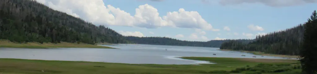 TE-AHCampingPhoto: Recreation.gov (RIDB) / public domain2.3 mi
Source: Roamze catalog (indexable pages within 10 miles, PostGIS distance)
Virgin River Rim Trail - Cascade Falls to Te-Ah CampgroundMountain biking · Next doorPhoto: The Dye Clan, CC BY-SA 3.0 (via Wikimedia Commons)Navajo TrailMountain biking · ~1 min drivePhoto: inkknife_2000 (7.5 million views +), CC BY-SA 2.0 (via Wikimedia Commons)Dike TrailMountain biking · ~1 min drivePhoto: The Dye Clan, CC BY-SA 3.0 (via Wikimedia Commons) Cascade Falls TrailMountain biking · ~3 min drivePhoto: The Dye Clan, CC BY-SA 3.0 (via Wikimedia Commons)
 Sage Valley Snowmobile TrailMountain biking · ~3 min drivePhoto: Ken Lund from Reno, Nevada, USA, CC BY-SA 2.0 (via Wikimedia Commons)Marathon TrailMountain biking · ~4 min drivePhoto: inkknife_2000 (7.5 million views +), CC BY-SA 2.0 (via Wikimedia Commons)Duck Creek Snowmobile TrailMountain biking · ~7 min drivePhoto: Ken Lund from Reno, Nevada, USA, CC BY-SA 2.0 (via Wikimedia Commons)
 Virgin River Rim TrailMountain biking · ~7 min drivePhoto: DXR, CC BY-SA 4.0 (via Wikimedia Commons)Virgin River Rim Trail - Te-Ah Campground to Woods RanchMountain biking · ~8 min drivePhoto: DXR, CC BY-SA 4.0 (via Wikimedia Commons)
 Marathon TrailMountain biking · ~20 min drivePhoto: Bill Ward from El Cerrito, CA, USA, CC BY 2.0 (via Wikimedia Commons)
Best months: June–September. Best months have typical highs of 55–85 °F, lows of 30 °F or warmer (32 °F where the station doesn't record snow), at most one snowy day and no more than 12 wet days.
Jan
30° / 10°
Feb
32° / 12°
Mar
39° / 17°
Apr
44° / 18°
May
55° / 27°
Jun
67° / 36°
Jul
71° / 42°
Aug
68° / 43°
Sep
61° / 35°
Oct
48° / 24°
Nov
38° / 17°
Dec
28° / 10°
Typical high / low (°F) and days with rain or snow, 1991–2020. Measured at Brian Head, UT, 12.9 mi away at 9,770 ft. This station doesn't record snowfall. Source: NOAA NCEI U.S. Climate Normals 1991–2020.
Map and trail data © OpenStreetMap contributors
