Upper Two Mile Trail
- 4.0 mi
- round trip
- 1,572 ft
- climb
- 8,059 ft
- high point
- Out and back
- route
- Apr–Jun, Aug–Oct
- best months
Is Upper Two Mile Trail open right now?
No closures listed
The Forest Service lists no closures for Manti-La Sal National Forest.
As of · Source: USFS · Manti-La Sal National Forest. Agencies don't list every closure — check before you go.
Upper Two Mile Trail is a moderate out-and-back hike in Utah's Manti-La Sal National Forest, within the Moab Ranger District. The trail is about 8 miles long, with a total elevation gain of 1,572 feet, and it reaches a high point of 8,059 feet. The climb is steepest around the 1.1-mile mark, where the grade reaches about 10 percent. The trail starts at roughly 7,108 feet and ends at the same elevation, so the 1,572-foot gain is split evenly between the ascent and descent. The route is rated moderate, and the trip is estimated to take about 3.5 hours. Spring and fall are the most comfortable times to go. Typical averages from a nearby weather station show May highs around 69°F and October highs around 62°F, while July highs reach about 86°F and winter highs sit near 37°F. That station sits about 1,272 feet lower than the trail's high point, so temperatures on the route run cooler. The Lower Two Mile Trail lies just 0.4 miles away, and Trinity Canyon and the Pine Ridge East Trail are within about 3 miles. For an overnight stay, Upper Onion Creek Campground is about 7 miles off.
Local outfitters
- Red Desert RV Park20 mi away
- Spanish Trail RV Park24 mi away
Not on Roamze yet. Their page has how to reach them.
- Lower Two Mile TrailHiking0.4 mi
- TRINITY CANYONHiking2.7 mi
- Trinity Canyon TrailHiking2.7 mi
- Pine Ridge East TrailHiking2.8 mi
- Buckeye Recreation AreaCamping7.1 mi
- Upper Onion Creek CampgroundCamping7.2 mi
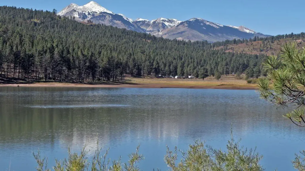 Buckeye Recreation Area (co)CampingPhoto: Recreation.gov (RIDB) / public domain7.5 mi
- Dewey Bridge CampgroundCamping9.5 mi
Source: Roamze catalog (indexable pages within 10 miles, PostGIS distance)
 Doe CanyonHiking · ~11 min drivePhoto: Ken Lund from Reno, Nevada, USA, CC BY-SA 2.0 (via Wikimedia Commons)
 Nyswonger Mesa TrailHiking · ~12 min drivePhoto: randomduck, CC BY-SA 2.0 (via Flickr)
 Medicine LakeHiking · ~14 min drivePhoto: Ken Lund from Reno, Nevada, USA, CC BY-SA 2.0 (via Wikimedia Commons)
- Pole CanyonHiking · ~12 min drive
- Pole CanyonHiking · ~13 min drivePhoto: Ken Lund from Reno, Nevada, USA, CC BY-SA 2.0 (via Wikimedia Commons)
- South Mountain TrailHiking · ~16 min drivePhoto: Ken Lund from Reno, Nevada, USA, CC BY-SA 2.0 (via Wikimedia Commons)
- TerracesHiking · ~15 min drivePhoto: Ken Lund from Reno, Nevada, USA, CC BY-SA 2.0 (via Wikimedia Commons)
- Mount Peale TrailHiking · ~15 min drive
- South Mountain (Sz)Hiking · ~16 min drivePhoto: Ken Lund from Reno, Nevada, USA, CC BY-SA 2.0 (via Wikimedia Commons)
- Mount Tukuhnikivatz TrailHiking · ~14 min drive
Also worth it near here
- Buckeye Recreation Area (co)Camping · ~13 min drive
- Buckeye Recreation AreaLake fishing · ~13 min drive
 Mount PealeSummit · ~14 min drivePhoto: Suffusion of Yellow, CC BY-SA 3.0 (via Wikimedia Commons)
 Geyser to BurroMountain biking · ~19 min drivePhoto: The Greater Southwestern Exploration Company, CC BY 2.0 (via Wikimedia Commons)
Best time to visit Upper Two Mile Trail
Best months: April–June and August–October. Best months have typical highs of 55–85 °F, lows of 30 °F or warmer (32 °F where the station doesn't record snow), at most one snowy day and no more than 12 wet days.
Jan
37° / 17°
6 wet
Feb
41° / 21°
6 wet
Mar
51° / 28°
6 wet
Apr
59° / 32°
6 wet
May
69° / 40°
5 wet
Jun
81° / 50°
4 wet
Jul
86° / 57°
7 wet
Aug
84° / 55°
7 wet
Sep
75° / 48°
6 wet
Oct
62° / 36°
5 wet
Nov
48° / 26°
5 wet
Dec
37° / 17°
5 wet
Typical high / low (°F) and days with rain or snow, 1991–2020. Measured at La Sal 1sw, UT, 8.8 mi away at 6,787 ft. The station sits about 1,300 ft lower than this place, so expect it a little cooler here. This station doesn't record snowfall. Source: NOAA NCEI U.S. Climate Normals 1991–2020.
Map and trail data © OpenStreetMap contributors
