Straight Cliffs Trail
- 3.5 mi
- round trip
- 1,215 ft
- climb
- 5,976 ft
- high point
- Out and back
- route
- Apr–May, Sep–Oct
- best months
Straight Cliffs Trail is a 7-mile out-and-back hike on Bureau of Land Management land in the Kanab Field Office in southern Utah. The trail rises from about 4,740 feet to about 5,976 feet, with a total elevation gain of 1,215 feet, and is rated moderate. Spring and fall are the most comfortable times to go. Typical averages from the nearby Escalante weather station show May highs around 76°F and October highs around 68°F, while July averages about 92°F and January highs sit near 43°F. Several other trails lie within a few miles, including Lower Dry Fork Trail about 1.8 miles away and Betty Pass Caves Trail, Brimstone Gulch Trail and Dry Fork Narrows Trail, each about 2.4 miles off.
Local outfitters
- Escalante Outfitters31 mi away
- Canyons of Escalante RV Park31 mi away
Not on Roamze yet. Their page has how to reach them.
Best time to go · Apr–May, Sep–Oct
Best time to visit Straight Cliffs Trail
Best months: April–May and September–October. Best months have typical highs of 55–85 °F, lows of 30 °F or warmer (32 °F where the station doesn't record snow), at most one snowy day and no more than 12 wet days.
Jan
43° / 19°
4 wet
Feb
48° / 23°
5 wet
Mar
58° / 29°
4 wet
Apr
66° / 35°
4 wet
May
76° / 42°
4 wet
Jun
87° / 50°
3 wet
Jul
92° / 57°
7 wet
Aug
89° / 56°
9 wet
Sep
81° / 47°
6 wet
Oct
68° / 37°
4 wet
Nov
54° / 26°
3 wet
Dec
43° / 19°
4 wet
Typical high / low (°F) and days with rain or snow, 1991–2020. Measured at Escalante, UT, 30.4 mi away at 5,810 ft. This station doesn't record snowfall. Source: NOAA NCEI U.S. Climate Normals 1991–2020.
Keep exploring — more trails worth the drive
 Photo: Greg Willis from Denver, CO, usa, CC BY-SA 2.0 (via Wikimedia Commons)
Lower Dry Fork Trail
~3 min drive
2.88-mile out-and-back trail in Utah with 1,262 ft elevation gain/loss
Photo: Greg Willis from Denver, CO, usa, CC BY-SA 2.0 (via Wikimedia Commons)Brimstone Gulch Trail
~4 min drive
1.03-mile out-and-back hike in Utah with 246 ft of elevation gain.
 Photo: Greg Willis from Denver, CO, usa, CC BY-SA 2.0 (via Wikimedia Commons)
Coyote Gulch - Jacob Hamblin Arch Trail
~17 min drive
4.0-mile out-and-back hike in Utah with 740 ft elevation gain.
HIKE
Window Wind Arch Trail
~12 min drive
1.85-mile out-and-back hike in Utah with 1,737 ft elevation gain.
 Photo: John Fowler from Placitas, NM, USA, CC BY 2.0 (via Wikimedia Commons)
Dry Fork Narrows Trail
~4 min drive
1.1-mile out-and-back hike in Utah with 149 ft of elevation gain
 Photo: Greg Willis from Denver, CO, usa, CC BY-SA 2.0 (via Wikimedia Commons)
Coyote Gulch - Crack-In-The-Wall Trail
~20 min drive
5.06-mile out-and-back hike in Utah with 1,037 ft elevation gain and loss.
HIKE
Harris Wash Trail
~24 min drive
4.28-mile out-and-back hike in Utah with 1,773 ft gain.
Photo: John Fowler from Placitas, NM, USA, CC BY 2.0 (via Wikimedia Commons)Dry Fork Coyote Gulch Trail
~4 min drive
3.2-mile out-and-back hike in Utah with 993 ft elevation gain
 Photo: Jason Hollinger, CC BY 2.0 (via Wikimedia Commons)
Reflection Canyon Trail
~33 min drive
15.14-mile out-and-back hike in Utah with 1,667 ft elevation gain.
HIKE
Fifty-Mile Canyon Trail
~26 min drive
2.98-mile out-and-back trail in Utah with 4,551 ft elevation gain.
Also worth it near here
 Photo: John Fowler from Placitas, NM, USA, CC BY 2.0 (via Wikimedia Commons)
Sunset Natural Arch
~18 min drive
 Photo: Reid Priedhorsky (R27182818), CC BY-SA 2.5 (via Wikimedia Commons)
Escalante River
~35 min drive
 Photo: Bernard Spragg. NZ from Christchurch, New Zealand, CC0 (via Wikimedia Commons)
Lake Powell
~42 min drive
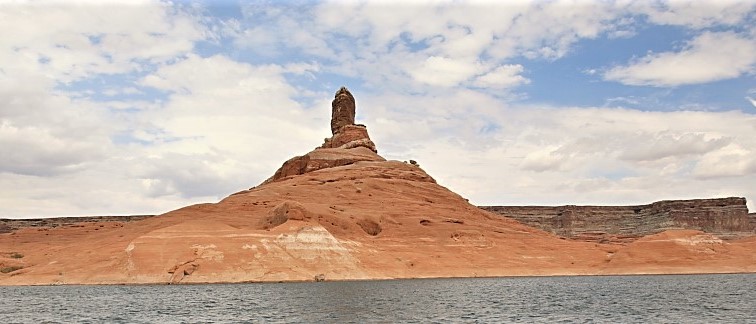 Photo: MS-R / Michael S-R, CC BY-SA 2.0 (via Wikimedia Commons)
Cookie Jar Butte
~43 min drive
Map and trail data © OpenStreetMap contributors
