

Ruby's Inn Bryce Canyon RV Park & Campground
Hiking business nearby (~3 mi away) — hasn't claimed their Roamze page yet
Free — you'll pick up right here.
Watch this trail
Sign up to watch it — saving subscribes you to gate, closure and report changes.
Utah
0.8 mi
Distance
235 ft
Gain
22 min
Time
We won't guess. Here is exactly what we do and don't know.
What we do know
Inside Bryce Canyon National Park
National Park unit boundary is mapped — agency alerts for it feed this page automatically.
Boundary data
What's missing
No access route mapped
We don't yet know which road reaches this trailhead, so we can't tell you if it's gated.
Nobody's filed a report here yet — be the first.
Why you'll love it
Queens Garden Trailhead
AI-suggested draft · review before you go
No permit or access details on file for this trail — check with the local land manager before you go.
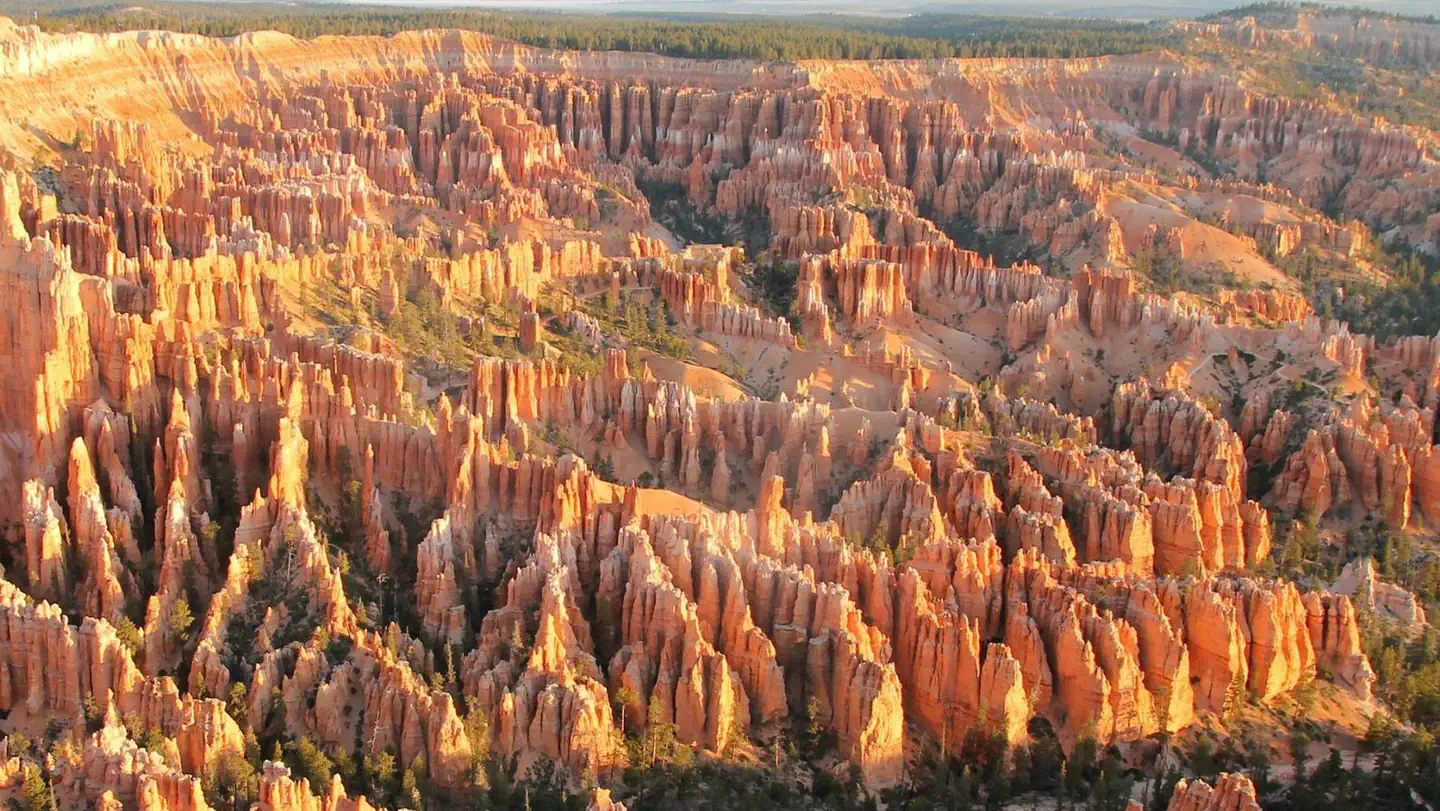
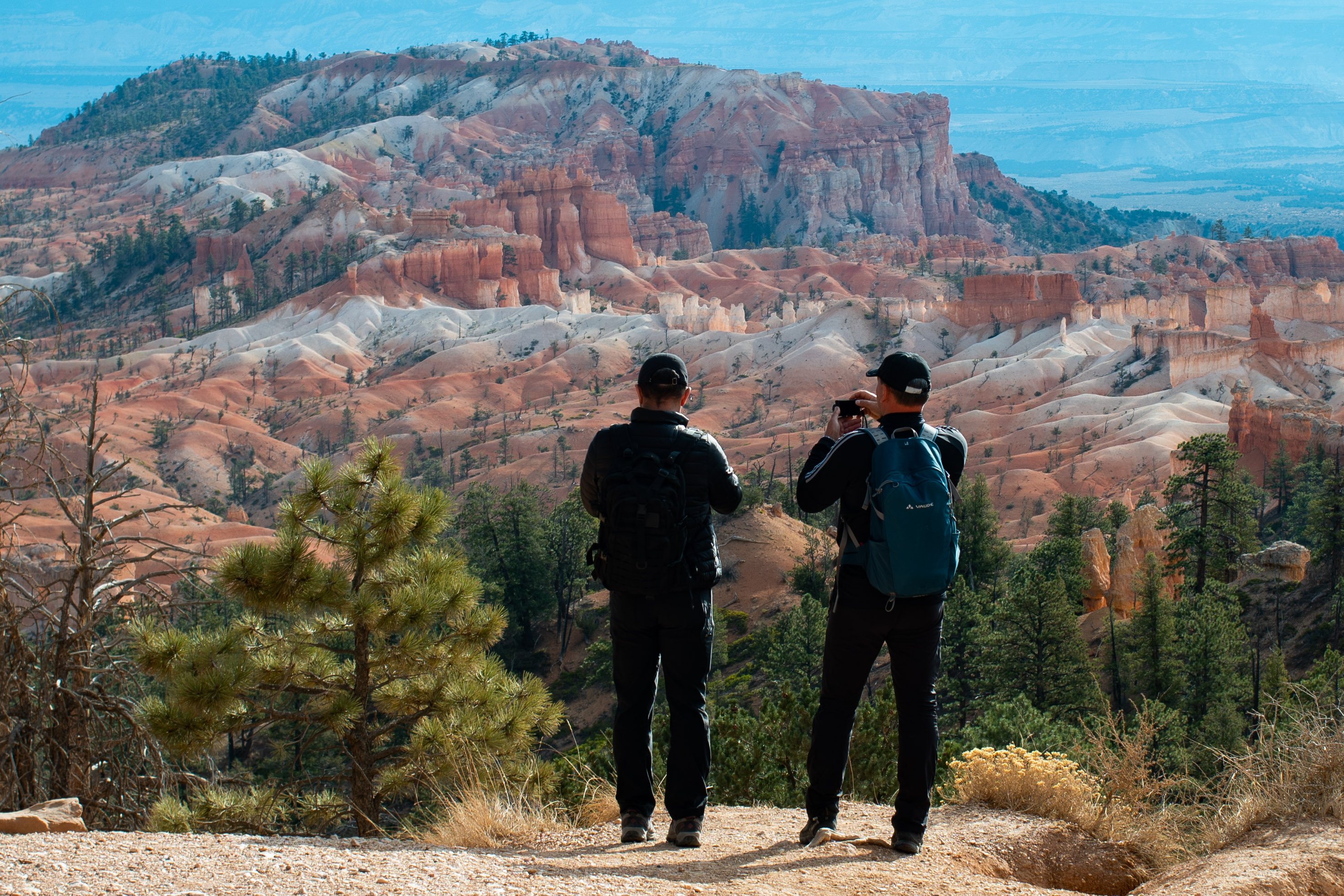
<h3>Queen's Garden Trail</h3> <p><strong>Difficulty: Moderate<br /> Total Distance: 1.8 miles (3.0 km)<br /> Elevation change: 320 feet (98 m)<br /> Average time: 1-2 hours</strong><br /> <br /> One of the park's most popular trails, the Queen's Garden trail descends and bends 0.9 miles (1.4 km) along a ridgeline down to a unique hoodoo said to resemble Queen Victoria (be sure to travel down the spur trail at the bottom of the trail to see this hoodoo). The varied and colorful rock formations that surround this hoodoo, are described as many sculptures and other ornaments within the Queen's "Garden". Of the six trails that descend into the Bryce Amphitheater, the Queen's Garden Trail is considered the least strenuous; though due to the park's high elevation and steep grades in some areas, it is still categorized as a moderately strenuous hike (other Bryce Amphitheater trails include the Tower Bridge Trail, Navajo Loop Trail, Fairyland Loop Trail, Tower Bridge Trail, and Peekaboo Loop Trail). The trail also provides views of a grove of bristlecone pines near the Horse Trail junction.<br /> <a href="https://www.nps.gov/brca/planyourvisit/queensgarden.htm">More about the trail</a></p> <h2>Combination Loops</h2> <p>This trail can be combined with the Navajo Loop to form the 2.9 mile (4.6 km) <strong>Queen's / Navajo Combination Loop</strong> and the Peekaboo Loop to form the 6.4 mile (10.2 km) <strong>Figure-8 Combination Loop</strong>.</p> <h3>Queen's / Navajo Combination Loop</h3> <p><strong>Difficulty: Moderate<br /> Total Distance: 2.9 miles (4.6 km)<br /> Elevation change: 600 feet (138 m)<br /> Average time: 2-3 hours</strong><br /> Perhaps the park's most popular and iconic trail, the Queen's / Navajo Combination Loop can begin at either Sunrise or Sunset Point but is recommended in a clockwise direction; this is done by descending on the Queen's Garden Trail and ascending the Navajo Loop Trail (Two Bridges side recommended for year-round use and iconic views of Thor's Hammer; Wall Street side is only open in summer). Whether one begins at Sunset or Sunrise Point, these two viewpoints are connected by a flat, 0.5 mile (0.8 km) section of the Rim Trail that completes the loop. If one begins at Sunset Point, they should begin by hiking this section of the Rim Trail to Sunrise Point.<br /> <a href="https://www.nps.gov/brca/planyourvisit/qgnavajocombo.htm">More about the trail</a></p> <h3>Figure-8 Combination Loop</h3> <p><strong>Difficulty: Strenuous<br /> Total Distance: 6.4 miles (10.2 km)<br /> Elevation change: 320 feet (98 m)<br /> Average time: 4-5 hours</strong><br /> The Figure-8 Combination combines the Peekaboo Loop Trail with the Queen's / Navajo Combination Loop to create a 6.4 mile (10.2 km) combination of two loops. Like the Queen's / Navajo Combination Loop, the Peekaboo Loop should be hiked in a clockwise direction. One can begin at either Sunset or Sunrise Point. From Sunset Point, one would begin by first hiking the 0.5 mile (0.8 km) section of the Rim Trail that leads north to Sunrise Point, then descend the Queen's Garden Trail to its intersection with the Navajo Loop. A short connecting trail leads from here across Bryce Creek to the Peekaboo Loop Trail. Keeping left will take hikers in a clockwise direction around the strenuous Peekaboo Loop and return them to the intersection of Navajo and Queen's Garden Trails. From here hikers ascend back up to Sunset Point (Two Bridges side recommended for year-round use; Wall Street only open in summer).</p> <h2>Nature</h2> <h3>Bristlecone Pines</h3> <p><strong>Note that bristlecone pines share dolomitic limestones with some of the park's most delicate plants. Stay on the trail and help us to protect them.</strong><br /> Though Bryce Canyon is well known for its geology, the park also contains a fantastic diversity of trees. Among the most impressive of these is the Great Basin bristlecone pine (Pinus longaeva). These trees are known for thriving where few other plants can, and for far longer too. Look for bristlecone pines on exposures of dolomitic limestone. These areas of white to grey stone are found in the park's hoodoo-forming Claron formation as low as the Queen's Garden and Fairyland Loop trails. Dolomitic limestone is high in calcium and magnesium, and low in phosphorus. This chemistry is difficult for other plants to tolerate, giving the bristlecone pine plenty of room to grow as slowly as it likes. You'll also typically find higher-elevation bristlecones growing at the edges of cliffs, where competition is even further reduced. Free to take its time, bristlecones pines can grow as slowly as an inch (2.5 cm) per century if conditions are challenging. This gives these trees incredibly dense heartwood, which is capable of providing structural support to the tree long after a section of limb or trunk has lost its life-protecting bark. The oldest tree at Bryce Canyon was estimated to be 1,600 years old, though trees across its range into Nevada and California have been dated at over 5,000 years old, giving Pinus longaeva the honor of being the longest living non-clonal species on Earth.<br /> You can identify a Bristlecone pine by its densely bundled needles of five (making it a white pine). Unlike many other pines that shed their needles every few years, bristlecone pines can retain needles for up to forty years. Their 1.5 in (1.2 cm) long needles remain vibrant and green for typically a full 12 inches (30 cm) along the branch. This appearance is often compared to that of a bottlebrush or pipe cleaner.<br /> Like the limber pine (another white pine found at Bryce Canyon) seeds of the bristlecone pine may be harvested and dispersed to unlikely places by Clark's nutcrackers (Nucifraga columbiana). The seeds of their bristle-tipped cones are often among the first to colonize recently burnt areas.</p>
Queens Garden Hike the Hoodoos
~0 min drive
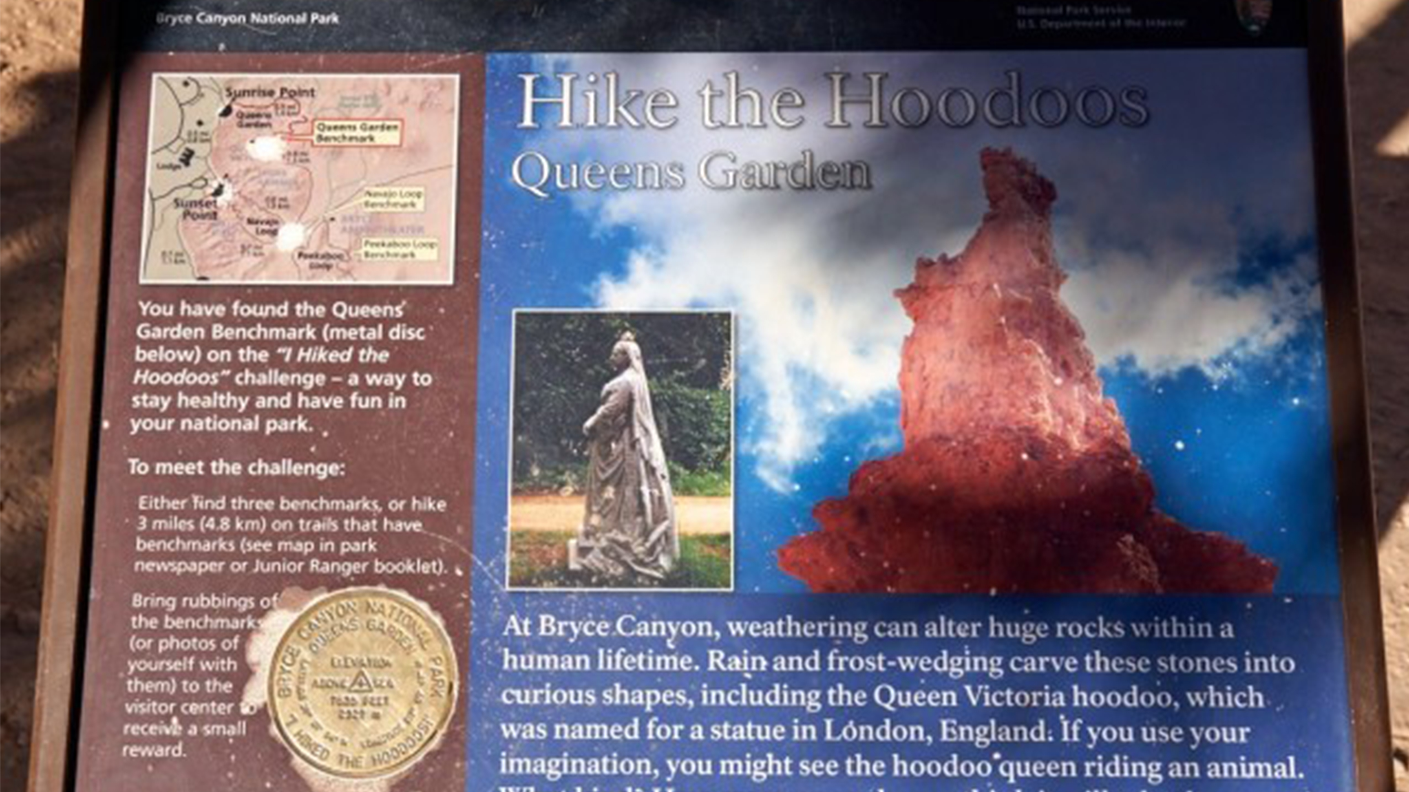
<h2>I Hiked the Hoodoos</h2> <p>Hiking is great exercise and Bryce Canyon's "I Hiked the Hoodoos!" program is not just hiking, it's also a scavenger hunt with a special reward!<br /> <br /> <strong>1. Hike a minimum of 3 mi / 4.8 km, or find at least 3 benchmarks and complete…
Rubys Inn 2 Snow Trail
~4 min drive
Easy 2.7-mile winter snow trail near Bryce Canyon with minimal elevation gain.
Old Bryce Town Loop Snow Trail
~5 min drive
Easy winter loop near Bryce Canyon with gentle terrain and seasonal snow.
Tower Bridge and Fairyland Loop Trailheads
~0 min drive
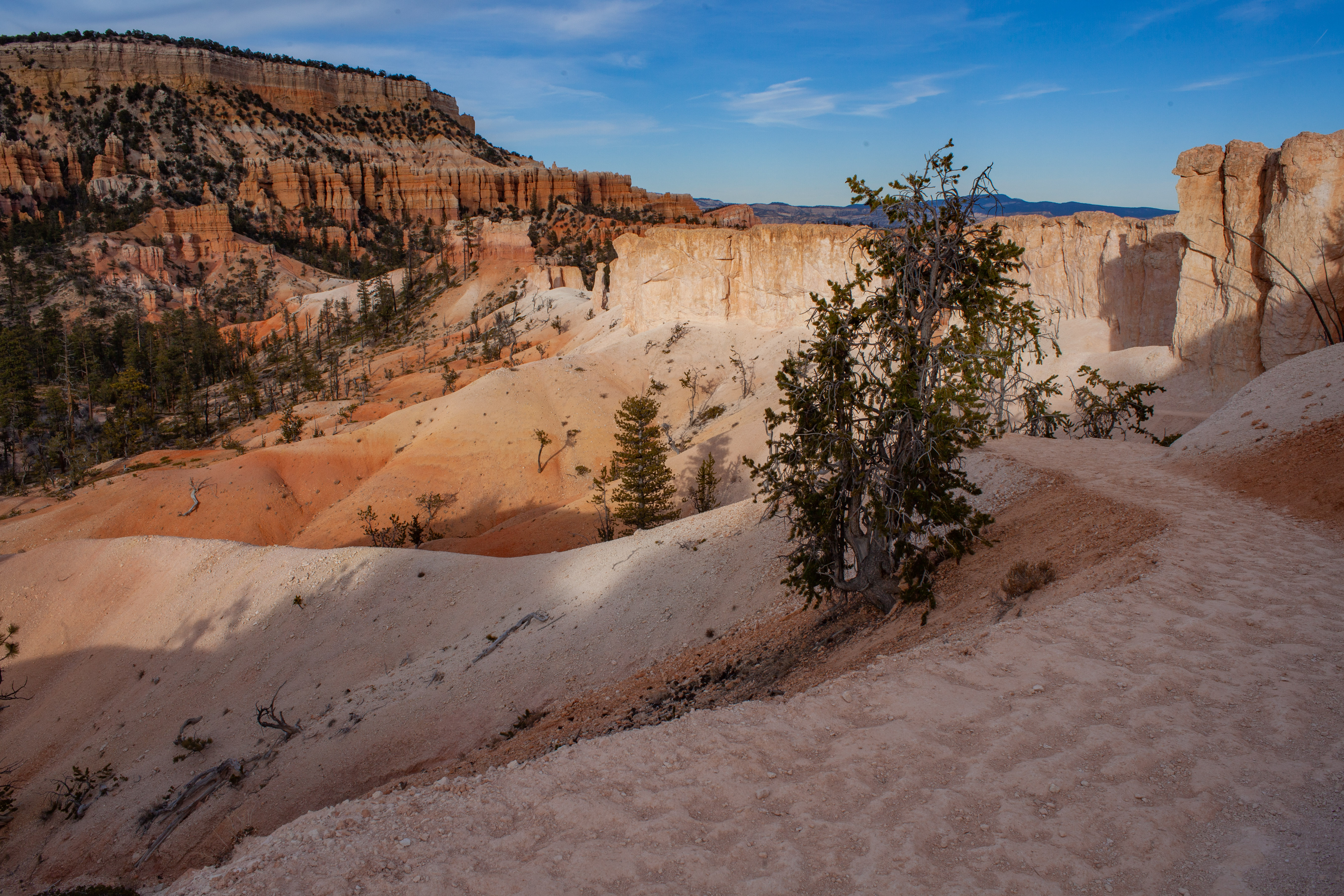
<h3>Tower Bridge Trail</h3> <p><strong>Difficulty: Moderate<br /> Total Distance: 3.0 miles (4.8 km)<br /> Elevation change: 802 feet (245 m)<br /> Average time: 2-3 hours</strong><br /> Similar in difficulty to the Queen's / Navajo Combination loop, but far less travelled, th…
Rim Snow Trail
~4 min drive
Easy 1.32-mile rim walk with minimal elevation gain.
Daves Hollow Snow Trail
~5 min drive
Easy 3-mile winter snowshoe trail with minimal elevation gain.
Tower Bridge Hike the Hoodoos wayside
~0 min drive
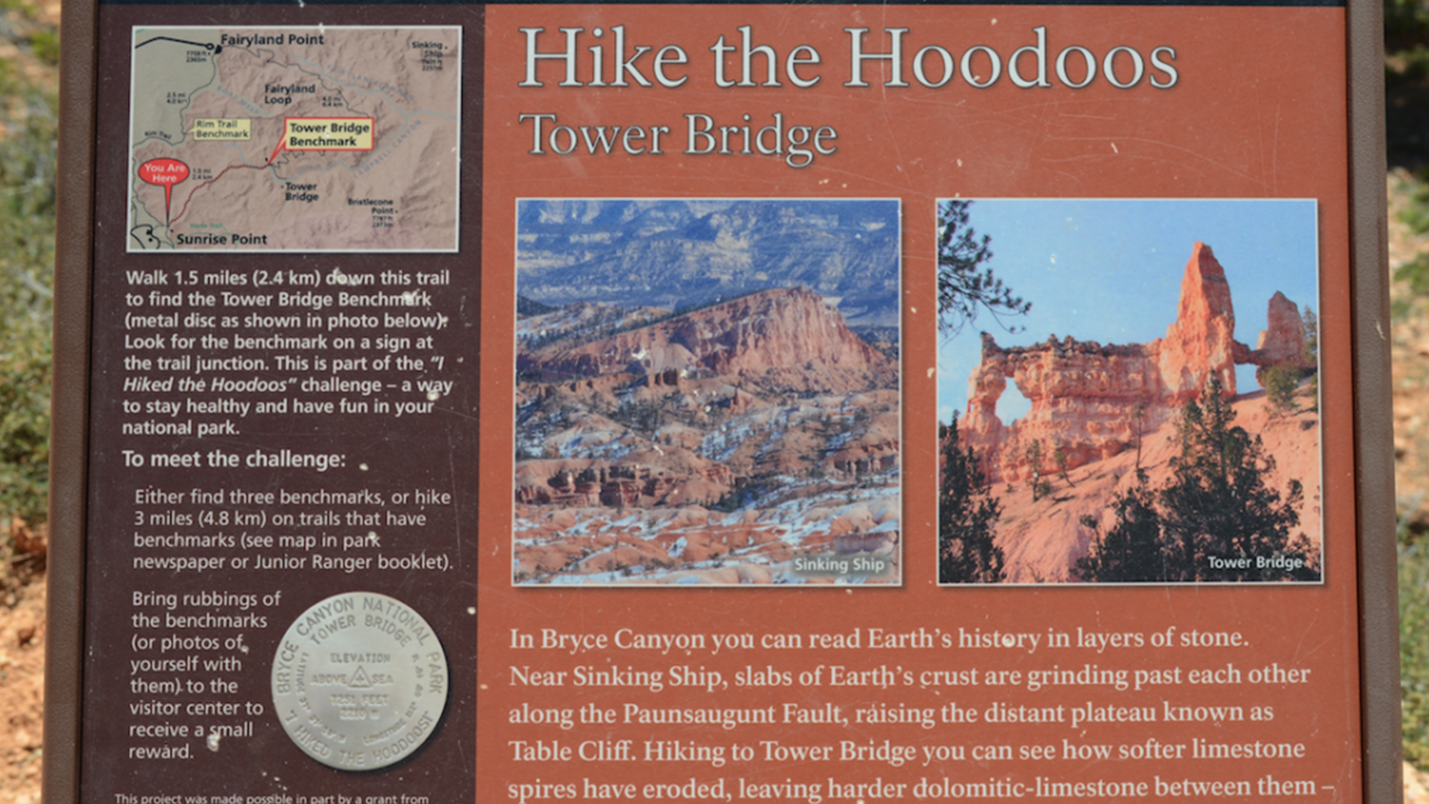
<h2>I Hiked the Hoodoos</h2> <p>Hiking is great exercise and Bryce Canyon's "I Hiked the Hoodoos!" program is not just hiking, it's also a scavenger hunt with a special reward!<br /> <br /> <strong>1. Hike a minimum of 3 mi / 4.8 km, or find at least 3 benchmarks and complete…
Ruby Rim B Loop
~5 min drive
Easy 1.68-mile loop with minimal elevation gain near Ruby Rim.
Rim Trail Sunset Point Trailhead
~1 min drive
<h3>The Rim Trail</h3> <p><strong>Difficulty: Varies (Easy to Moderate)<br /> Total Distance: 5.5 miles (8.9 km)<br /> Ascent/Descent (South to North): 1,330 feet (405 m) / 1,825 feet (556 m)<br /> Average time: 3-4 hours</strong></p> <p>The 5.5 mile (8.9 km) Rim Trail begins…
Ruby Rim Loop
~5 min drive
Easy 2.3-mile rim loop with minimal elevation gain near Ruby, Utah.
Local operatorsoffering guided trips. You book directly with them — Roamze doesn’t take a cut.
Ruby's Inn Bryce Canyon RV Park & Campground
Hiking business nearby (~3 mi away) — hasn't claimed their Roamze page yet
Bryce Canyon Horseback Tours
Hiking business nearby (~3 mi away) — hasn't claimed their Roamze page yet
Red Canyon Village
Hiking business nearby (~14 mi away) — hasn't claimed their Roamze page yet