Lambs Knoll Campground
Campground
Campground · 3.1 mi from the trail
 Photo: au_ears, CC BY-SA 2.0 (via Wikimedia Commons)
Closure in the area
There's a closure order in Zion National Park. It doesn't name Northgate Peaks Trail, so check the source for the area it covers (2 listed).
Narrows are Closed.
Park closure covering Zion National Park · NPS · Zion National Park
Watchman Trail closed
Park closure covering Zion National Park · NPS · Zion National Park
Toxic cyanobacteria in rivers, streams, and pools
Park alert covering Zion National Park · NPS · Zion National Park
Large vehicle restrictions on Zion-Mt. Carmel Highway
Park alert covering Zion National Park · NPS · Zion National Park
As of · Source: NPS · Zion National Park. Agencies don't list every closure — check before you go.
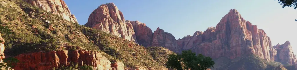
Northgate Peaks Trail is a short, easy hike in Utah's Zion National Park, within the Zion Wilderness. The route is an out-and-back that covers about 2.2 miles, with a low point of 6,884 feet and a high of 6,941 feet. The National Park Service manages the land, and the trail lies within the park's wilderness boundaries. The climb is gentle, with an elevation gain of about 36 feet one way. That makes it a quick outing for anyone already exploring the park's backcountry. Spring and fall are the most comfortable times to go. Typical averages from a nearby weather station in Cedar City show May highs around 69°F and October highs around 65°F, while July peaks near 85°F and winter lows drop to about 20°F. A fee is charged for the hike. The Connector Trail and Wildcat Canyon Trail both lie about a mile away, and the Tabernacle Dome Access Trail is roughly 2.9 miles off. Climbers can find Shady Corridor about 3.1 miles away.
Lambs Knoll Campground
Campground
 If it rainsDon Graham from Redlands, CA, USA - God bless it!, CC BY-SA 2.0 · Wikimedia Commons
Places © OpenStreetMap contributors, Places © Overture Maps Foundation · Photos: Don Graham from Redlands, CA, USA - God bless it!, CC BY-SA 2.0 (commons)
More in HurricaneNot on Roamze yet. Their page has how to reach them.
 Connector TrailHikingPhoto: Fredlyfish4, CC BY-SA 4.0 (via Wikimedia Commons)1 miWildcat Canyon TrailHikingPhoto: Fredlyfish4, CC BY-SA 4.0 (via Wikimedia Commons)1 mi
 Tabernacle Dome Access TrailHikingPhoto: John Fowler from Placitas, NM, USA, CC BY 2.0 (via Wikimedia Commons)2.9 mi
 Shady CorridorRock climbingPhoto: Steve Montgomery, CC BY-SA 3.0 (via Wikimedia Commons)3.1 miEwe WallRock climbingPhoto: Steve Montgomery, CC BY-SA 3.0 (via Wikimedia Commons)3.1 miLambs KnollRock climbingPhoto: Steve Montgomery, CC BY-SA 3.0 (via Wikimedia Commons)3.1 mi
 Sawmill Springs TrailHikingPhoto: John Fowler from Placitas, NM, USA, CC BY 2.0 (via Wikimedia Commons)3.9 mi
 Watchman CampgroundCampingPhoto: Recreation.gov (RIDB) / public domain9.6 mi
Source: Roamze catalog (indexable pages within 10 miles, PostGIS distance)
Tabernacle Dome Access TrailHiking · ~5 min drivePhoto: John Fowler from Placitas, NM, USA, CC BY 2.0 (via Wikimedia Commons)West Rim TrailHiking · ~7 min drivePhoto: John Fowler from Placitas, NM, USA, CC BY 2.0 (via Wikimedia Commons) Orderville Canyon Day Hike SectionHiking · ~11 min drivePhoto: Wrathernaut, CC BY-SA 3.0 (via Wikimedia Commons)Wildcat Canyon TrailHiking · ~2 min drivePhoto: Fredlyfish4, CC BY-SA 4.0 (via Wikimedia Commons)Sawmill Springs TrailHiking · ~7 min drivePhoto: John Fowler from Placitas, NM, USA, CC BY 2.0 (via Wikimedia Commons)
 The Narrows Day Hike SectionHiking · ~11 min drivePhoto: Frans-Banja Mulder, CC BY 3.0 (via Wikimedia Commons)Riverside WalkHiking · ~11 min drivePhoto: Frans-Banja Mulder, CC BY 3.0 (via Wikimedia Commons)
 The Narrows Top DownHiking · ~9 min drivePhoto: Don Graham from Redlands, CA, USA - God bless it!, CC BY-SA 2.0 (via Wikimedia Commons)
Best months: April–October. Best months have typical highs of 55–85 °F, lows of 30 °F or warmer (32 °F where the station doesn't record snow), at most one snowy day and no more than 12 wet days.
Jan
43° / 20°
6 wet
Feb
45° / 22°
6 wet
Mar
53° / 27°
7 wet
Apr
60° / 32°
6 wet
May
69° / 40°
5 wet
Jun
80° / 48°
3 wet
Jul
85° / 56°
5 wet
Aug
84° / 55°
5 wet
Sep
77° / 47°
4 wet
Oct
65° / 36°
4 wet
Nov
51° / 27°
4 wet
Dec
42° / 19°
6 wet
Typical high / low (°F) and days with rain or snow, 1991–2020. Measured at Cedar City 5e, UT, 23.1 mi away at 6,465 ft. This station doesn't record snowfall. Source: NOAA NCEI U.S. Climate Normals 1991–2020.
Map and trail data © OpenStreetMap contributors

