Group Site D
Campground
Campground · 2.5 mi from the trail
No closures listed
The Forest Service lists no closures for Uinta-Wasatch-Cache National Forest.
As of · Source: USFS · Uinta-Wasatch-Cache National Forest. Agencies don't list every closure — check before you go.
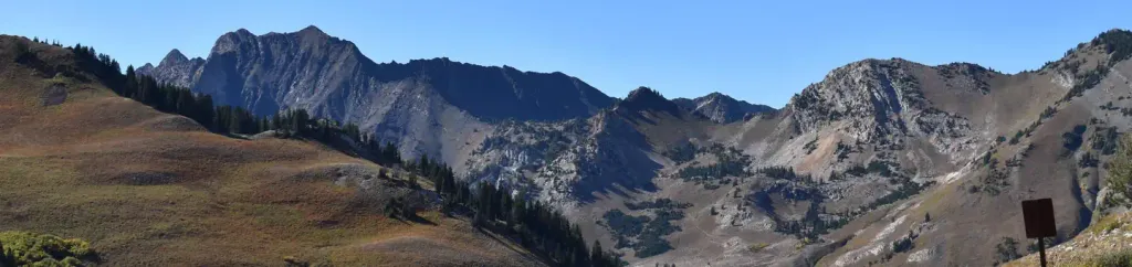
Mount Superior Trail is a moderate out-and-back hike in Utah's Uinta-Wasatch-Cache National Forest, within the Salt Lake Ranger District. The trail is about 1.9 miles long, with a total elevation gain of 1,630 feet, and it starts at roughly 10,050 feet, reaching a high point of about 10,911 feet. The climb is a steady one, with the trail gaining about 1,222 feet from the start to the top. The round trip adds up to about 1,630 feet of total gain and loss. The hike takes about 1.5 hours to complete. The trail sits close to several other destinations. Cardiff Fork Trail is about 0.4 miles away, and the climbing areas of Mt. Superior / Monte Cristo and Hellgate Cliffs are each about 0.5 miles off. Lake Blanche, a fishing spot, is about 2 miles away.
Group Site D
Campground
Wildflower Restaurant & Lounge
Restaurant
 If it rainsSaalebaer, CC0 · Wikimedia Commons
Park City Museum
Museum
Places © OpenStreetMap contributors, Places © Overture Maps Foundation · Photos: Saalebaer, CC0 (commons)
More in HeberNot on Roamze yet. Their page has how to reach them.
 Albion BasinCampingPhoto: Recreation.gov (RIDB) / public domain2.8 mi
Source: Roamze catalog (indexable pages within 10 miles, PostGIS distance)
 Observation Point TrailHiking · ~2 min drivePhoto: kallahar, CC BY 3.0 (via Wikimedia Commons)
 Wasatch Mine TrailHiking · ~3 min drivePhoto: Spgruss, CC BY-SA 4.0 (via Wikimedia Commons)
 Mount Baldy North TrailHiking · ~4 min drivePhoto: michaelwm25, CC BY 3.0 (via Wikimedia Commons)
 Big Mountain TrailHiking · ~4 min drivePhoto: michaelwm25, CC BY 3.0 (via Wikimedia Commons)Mid-Way TrailHiking · ~2 min drivePhoto: kallahar, CC BY 3.0 (via Wikimedia Commons)
 Mount Baldy TrailHiking · ~4 min drivePhoto: kallahar, CC BY 3.0 (via Wikimedia Commons)Mount Baldy Southeast TrailHiking · ~4 min drivePhoto: michaelwm25, CC BY 3.0 (via Wikimedia Commons)Mineral Fork TrailHiking · ~3 min drivePhoto: Spgruss, CC BY-SA 4.0 (via Wikimedia Commons)
 SnakepitHiking · ~3 min drivePhoto: kallahar, CC BY 3.0 (via Wikimedia Commons)Baby Thunder TrailHiking · ~2 min drivePhoto: kallahar, CC BY 3.0 (via Wikimedia Commons)
Also worth it near here
 Superior PeakSummit · ~1 min drivePhoto: Derrellwilliams, CC BY-SA 4.0 (via Wikimedia Commons)
 Alta Ski AreaDownhill skiing · ~4 min drivePhoto: Baileypalblue, Public domain (via Wikimedia Commons)
 Doughnut FallsWaterfall · ~4 min drivePhoto: Leijurv, CC BY-SA 4.0 (via Wikimedia Commons)
Map and trail data © OpenStreetMap contributors
