Group Site D
Campground
Campground · 1.8 mi from the trail
 Photo: kallahar, CC BY 3.0 (via Wikimedia Commons)
Caution today
Agency alerts are in effect for this area; weather is marginal · USFS, OpenWeather · checked just now
No closures listed
The Forest Service lists no closures for Uinta-Wasatch-Cache National Forest.
As of · Source: USFS · Uinta-Wasatch-Cache National Forest. Agencies don't list every closure — check before you go.
Baby Thunder Trail is a moderate out-and-back hike in Utah's Uinta-Wasatch-Cache National Forest, within the Salt Lake Ranger District. The trail is about 0.85 miles long, and the round trip adds up to roughly 1.7 miles with a total elevation gain of 848 feet. The high point on the route reaches 8425 feet, and the steepest stretch comes at about 0.7 miles in, with a grade of 12 percent. Summer is the most comfortable time to go. Typical averages from a nearby weather station in Alta, at a similar elevation, show July highs around 73°F with lows near 50°F, while winter highs stay around 30°F. The trail sits close to several other outings. Mid-Way Trail and Observation Point Trail are both within a third of a mile, and the climbing areas Sea Monster Rises From the Deep and Inception are each under a mile away.
Group Site D
Campground
Mid Gad Restaurant
Restaurant
 If it rainsSaalebaer, CC0 · Wikimedia Commons
Park City Museum
Museum
Places © OpenStreetMap contributors · Photos: Saalebaer, CC0 (commons)
More in HeberNot on Roamze yet. Their page has how to reach them.
Mid-Way TrailHikingPhoto: kallahar, CC BY 3.0 (via Wikimedia Commons)0.2 miObservation Point TrailHikingPhoto: kallahar, CC BY 3.0 (via Wikimedia Commons)0.3 mi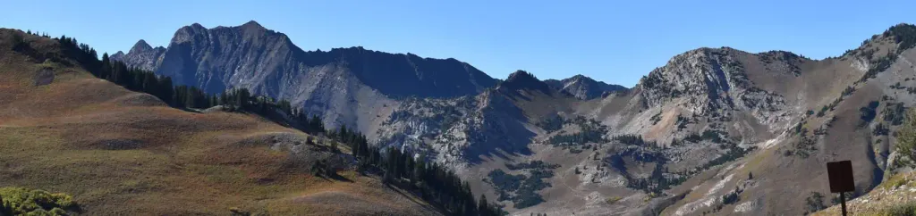 Albion BasinCampingPhoto: Recreation.gov (RIDB) / public domain2.8 mi
Source: Roamze catalog (indexable pages within 10 miles, PostGIS distance)
Mid-Way TrailHiking · Next doorPhoto: kallahar, CC BY 3.0 (via Wikimedia Commons) Big Mountain TrailHiking · ~2 min drivePhoto: michaelwm25, CC BY 3.0 (via Wikimedia Commons)
 Mount Baldy TrailHiking · ~2 min drivePhoto: kallahar, CC BY 3.0 (via Wikimedia Commons)Twin Peaks TrailHiking · ~2 min drivePhoto: kallahar, CC BY 3.0 (via Wikimedia Commons)Observation Point TrailHiking · Next doorPhoto: kallahar, CC BY 3.0 (via Wikimedia Commons)
 Powder Paradise TrailHiking · ~2 min drivePhoto: kallahar, CC BY 3.0 (via Wikimedia Commons)
 Mount Baldy North TrailHiking · ~2 min drivePhoto: michaelwm25, CC BY 3.0 (via Wikimedia Commons)Gad ValleyHiking · ~2 min drivePhoto: michaelwm25, CC BY 3.0 (via Wikimedia Commons)Mark Malu TrailHiking · ~3 min drivePhoto: kallahar, CC BY 3.0 (via Wikimedia Commons)
Also worth it near here
 Superior PeakSummit · ~2 min drivePhoto: Derrellwilliams, CC BY-SA 4.0 (via Wikimedia Commons)
 Alta Ski AreaDownhill skiing · ~4 min drivePhoto: Baileypalblue, Public domain (via Wikimedia Commons)
 Red Pine CragRock climbing · ~4 min drivePhoto: Derrellwilliams, CC BY-SA 4.0 (via Wikimedia Commons)
Best months: June–September. Best months have typical highs of 55–85 °F, lows of 30 °F or warmer (32 °F where the station doesn't record snow), at most one snowy day and no more than 12 wet days.
Jan
31° / 15°
14 wet
Feb
31° / 15°
13 wet
Mar
37° / 20°
13 wet
Apr
42° / 25°
12 wet
May
53° / 33°
10 wet
Jun
64° / 42°
7 wet
Jul
73° / 50°
7 wet
Aug
71° / 49°
9 wet
Sep
62° / 41°
9 wet
Oct
49° / 31°
9 wet
Nov
37° / 21°
11 wet
Dec
30° / 15°
14 wet
Typical high / low (°F) and days with rain or snow, 1991–2020. Measured at Alta, UT, 1.8 mi away at 8,710 ft. This station doesn't record snowfall. Source: NOAA NCEI U.S. Climate Normals 1991–2020.
Map and trail data © OpenStreetMap contributors
