Grand Gulch Trail
 Photo: Greg Willis, CC BY-SA 3.0 (via Wikimedia Commons)
- 22.0 mi
- round trip
- 3,773 ft
- climb
- 5,439 ft
- high point
- Out and back
- route
- Mar–May, Sep–Nov
- best months
Get a permit
Cedar Mesa (overnight trips) · overnight
Reserve on Recreation.govClear at last check
Weather is good · OpenWeather · checked 17 h ago
Grand Gulch Trail is an expert-level, out-and-back hike on Bureau of Land Management land within the Monticello Field Office in southern Utah. The route is 44 miles long, with a high point of 5,439 feet and a low point of 4,782 feet. The trail's steady climb and descent add up to a total gain of 3,773 feet one way, and the steepest stretch comes at about 14.7 miles, where the grade reaches 12 percent. Spring and fall are the most comfortable times to go. Typical averages from a nearby weather station in the Valley of the Gods put May highs around 77°F and October highs near 69°F, while July averages climb to about 94°F. The trip takes about 16.5 hours to complete, so plan for a full day or two. Skeiks Canyon Trail starts about 1.2 miles away, and Government Trail lies roughly 3 miles off. Bullet Canyon Trail and Emigrant Trail are both within about 6 miles.
Local outfitters
- Coral Sands RV Park28 mi away
- Sacred Monument Tours32 mi away
Not on Roamze yet. Their page has how to reach them.
- Skeiks Canyon TrailHikingPhoto: Greg Willis, CC BY-SA 3.0 (via Wikimedia Commons)1.2 mi
- Government TrailHiking3 mi
 Bullet Canyon TrailHikingPhoto: Greg Willis, CC BY-SA 3.0 (via Wikimedia Commons)5.3 mi
- Emigrant TrailHiking5.6 mi
 Todie Canyon TrailHikingPhoto: Greg Willis, CC BY-SA 3.0 (via Wikimedia Commons)5.6 mi
 Kane Gulch TrailHikingPhoto: Greg Willis, CC BY-SA 3.0 (via Wikimedia Commons)8.4 mi
- Fallen Roof Ruin TrailHiking9.4 mi
 Canyon TrailHikingPhoto: SkybirdForever, CC BY-SA 3.0 (via Wikimedia Commons)9.6 mi
Source: Roamze catalog (indexable pages within 10 miles, PostGIS distance)
- Skeiks Canyon TrailHiking · ~2 min drivePhoto: Greg Willis, CC BY-SA 3.0 (via Wikimedia Commons)
- Bullet Canyon TrailHiking · ~9 min drivePhoto: Greg Willis, CC BY-SA 3.0 (via Wikimedia Commons)
- Todie Canyon TrailHiking · ~10 min drivePhoto: Greg Willis, CC BY-SA 3.0 (via Wikimedia Commons)
 West Rim Texas CanyonHiking · ~29 min drivePhoto: Ken Lund from Reno, Nevada, USA, CC BY-SA 2.0 (via Wikimedia Commons)
- Canyon TrailHiking · ~16 min drivePhoto: SkybirdForever, CC BY-SA 3.0 (via Wikimedia Commons)
 Honaker TrailHiking · ~32 min drivePhoto: Peter K., CC BY-SA 3.0 (via Wikimedia Commons)
- Grand Gulch TrailHiking · ~14 min drivePhoto: Greg Willis, CC BY-SA 3.0 (via Wikimedia Commons)
- Texas TrailHiking · ~30 min drivePhoto: Ken Lund from Reno, Nevada, USA, CC BY-SA 2.0 (via Wikimedia Commons)
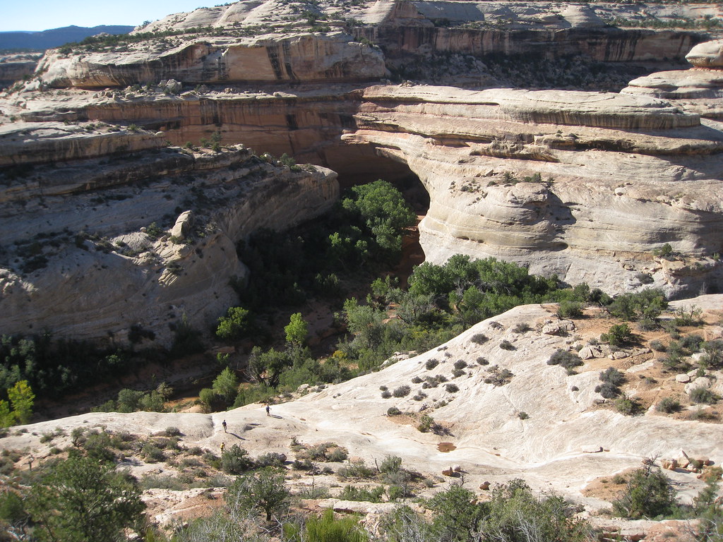 Kachina TrailHiking · ~18 min drivePhoto: brewbooks — CC BY-SA 2.0 (via Flickr)
- Grand Gulch TrailHiking · ~10 min drivePhoto: Greg Willis, CC BY-SA 3.0 (via Wikimedia Commons)
Also worth it near here
- The Thumb Pour OffWaterfall · ~3 min drive
- Todie CanyonCamping · ~12 min drive
 Owachomo BridgeNatural arch · ~16 min drivePhoto: W. Bulach, CC BY-SA 4.0 (via Wikimedia Commons)
 Castle ButteSummit · ~24 min drivePhoto: The Greater Southwestern Exploration Company from Claremont, California, United States, CC BY 2.0 (via Wikimedia Commons)
Best time to visit Grand Gulch Trail
Best months: March–May and September–November. Best months have typical highs of 55–85 °F, lows of 30 °F or warmer (32 °F where the station doesn't record snow), at most one snowy day and no more than 12 wet days.
Jan
43° / 25°
Feb
51° / 30°
Mar
60° / 36°
Apr
68° / 44°
May
77° / 52°
Jun
90° / 63°
Jul
94° / 69°
Aug
91° / 66°
Sep
84° / 58°
Oct
69° / 47°
Nov
55° / 34°
Dec
42° / 26°
Typical high / low (°F) and days with rain or snow, 1991–2020. Measured at Valley Of The Gods, UT, 13.8 mi away at 5,287 ft. This station doesn't record snowfall. Source: NOAA NCEI U.S. Climate Normals 1991–2020.
Map and trail data © OpenStreetMap contributors
