Coyote Gulch - Jacob Hamblin Trail
 Photo: Greg Willis from Denver, CO, usa, CC BY-SA 2.0 (via Wikimedia Commons)
- 0.1 mi
- distance
- 190 ft
- climb
- 4,218 ft
- high point
- Lollipop
- route
- Mar–May, Oct–Nov
- best months
Is Coyote Gulch - Jacob Hamblin Trail open right now?
Closure in the area
There's a closure order in Glen Canyon National Recreation Area. It doesn't name Coyote Gulch - Jacob Hamblin Trail, so check the source for the area it covers (2 listed).
Chains Road and The Chains day-use area are temporarily closed
Park closure covering Glen Canyon National Recreation Area · NPS · Glen Canyon National Recreation Area
Launch Ramp Updates
Park closure covering Glen Canyon National Recreation Area · NPS · Glen Canyon National Recreation Area
Lees Ferry Campground Partial Closure
Park alert covering Glen Canyon National Recreation Area · NPS · Glen Canyon National Recreation Area
Lake Powell Recreational Water Advisory
Park alert covering Glen Canyon National Recreation Area · NPS · Glen Canyon National Recreation Area
As of · Source: NPS · Glen Canyon National Recreation Area. Agencies don't list every closure — check before you go.
Coyote Gulch - Jacob Hamblin Trail is a short, easy hike in Glen Canyon National Recreation Area in Utah, managed by the National Park Service. The route is just 0.06 miles long, with a total elevation gain of 190 feet from a low point of 4,028 feet to a high of 4,218 feet. It makes a quick stop for anyone already exploring the Coyote Gulch area. Spring and fall are the most comfortable times to go. Typical averages from the nearby Bullfrog Basin weather station show April highs around 72°F and October highs around 73°F, while July averages about 100°F. A fee is charged for this hike. Plan on about half an hour for the trip. The Coyote Gulch - Jacob Hamblin Arch Trail starts just 0.1 mile away, and Coyote Gulch is about 0.8 mile off. Sunset and Moonrise Arch Trail and Fortymile Ridge Trail are both about 2 miles away.
Local outfitters
- Escalante Outfitters39 mi away
- Canyons of Escalante RV Park39 mi away
Not on Roamze yet. Their page has how to reach them.
Best time to go · Mar–May, Oct–Nov
Best time to visit Coyote Gulch - Jacob Hamblin Trail
Best months: March–May and October–November. Best months have typical highs of 55–85 °F, lows of 30 °F or warmer (32 °F where the station doesn't record snow), at most one snowy day and no more than 12 wet days.
Jan
46° / 26°
4 wet · 1 snow
Feb
53° / 30°
4 wet · 1 snow
Mar
63° / 36°
4 wet
Apr
72° / 44°
3 wet
May
82° / 53°
3 wet
Jun
94° / 64°
1 wet
Jul
100° / 71°
3 wet
Aug
97° / 68°
4 wet
Sep
88° / 60°
4 wet
Oct
73° / 46°
3 wet
Nov
58° / 34°
3 wet
Dec
46° / 26°
3 wet · 1 snow
Typical high / low (°F) and days with rain or snow, 1991–2020. Measured at Bullfrog Basin, UT, 19.3 mi away at 3,822 ft. Source: NOAA NCEI U.S. Climate Normals 1991–2020.
Keep exploring — more trails worth the drive
Photo: Greg Willis from Denver, CO, usa, CC BY-SA 2.0 (via Wikimedia Commons)Coyote Gulch - Jacob Hamblin Arch Trail
Next door
4.0-mile out-and-back hike in Utah with 740 ft elevation gain.
 Photo: John Fowler from Placitas, NM, USA, CC BY 2.0 (via Wikimedia Commons)
Sunset and Moonrise Arch Trail
~3 min drive
1.30-mile out-and-back hike in Utah with 292 ft elevation loss.
 Photo: Greg Willis from Denver, CO, usa, CC BY-SA 2.0 (via Wikimedia Commons)
Lower Dry Fork Trail
~17 min drive
2.88-mile out-and-back trail in Utah with 1,262 ft elevation gain/loss
HIKE
Halls Creek and Narrows
~37 min drive
14.06-mile out-and-back trail in Utah with 1,368 ft gain and 2,879 ft loss.
 Photo: Greg Willis from Denver, CO, usa, CC BY-SA 2.0 (via Wikimedia Commons)
Coyote Gulch - Crack-In-The-Wall Trail
~4 min drive
5.06-mile out-and-back hike in Utah with 1,037 ft elevation gain and loss.
Photo: Greg Willis from Denver, CO, usa, CC BY-SA 2.0 (via Wikimedia Commons)Fortymile Ridge Trail
~3 min drive
0.57-mile out-and-back hike on Fortymile Ridge in Utah with 42 ft of elevation gain.
HIKE
Window Wind Arch Trail
~15 min drive
1.85-mile out-and-back hike in Utah with 1,737 ft elevation gain.
HIKE
Hole In the Rock Trail
~39 min drive
37.64-mile out-and-back trail in Utah with 3,398 ft elevation gain and loss.
 Photo: Jason Hollinger, CC BY 2.0 (via Wikimedia Commons)
Reflection Canyon Trail
~21 min drive
15.14-mile out-and-back hike in Utah with 1,667 ft elevation gain.
Photo: Greg Willis from Denver, CO, usa, CC BY-SA 2.0 (via Wikimedia Commons)Brimstone Gulch Trail
~16 min drive
1.03-mile out-and-back hike in Utah with 246 ft of elevation gain.
Also worth it near here
 Photo: John Fowler from Placitas, NM, USA, CC BY 2.0 (via Wikimedia Commons)
Coyote Natural Bridge
~1 min drive
 Photo: Bernard Spragg. NZ from Christchurch, New Zealand, CC0 (via Wikimedia Commons)
Lake Powell
~37 min drive
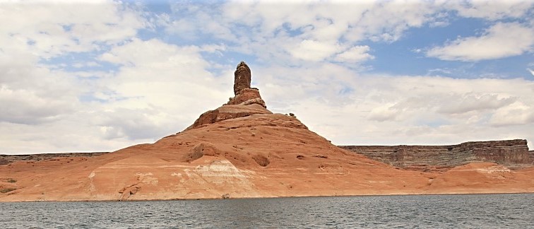 Photo: MS-R / Michael S-R, CC BY-SA 2.0 (via Wikimedia Commons)
Cookie Jar Butte
~46 min drive
Map and trail data © OpenStreetMap contributors
