Site 43
Campground
Campground · 1.7 mi from the trail
Cottontail Loop is an easy out-and-back hike in Wasatch Mountain State Park in Utah, managed by State Park and Recreation. The route is about 2.5 miles long, and the one-way elevation gain is 168 feet, with the low point at 5,778 feet and the high at 5,964 feet. Late spring and early fall are the most comfortable times to go. Typical averages from a nearby weather station at a similar elevation show May highs around 66°F and September highs around 75°F, while July averages about 88°F. The loop sits close to two other short hikes, Sage and Throw Back, each about 0.1 mile away. Rock Creek, a canoeing spot about 2.2 miles off, and the climbing at Empire Pass, about 4.9 miles away, round out the nearby options.
Site 43
Campground
 If it rainsSaalebaer, CC0 · Wikimedia Commons
Park City Museum
Museum
Places © OpenStreetMap contributors · Photos: Saalebaer, CC0 (commons)
More in HeberNot on Roamze yet. Their page has how to reach them.
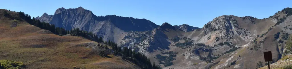 Albion BasinCampingPhoto: Recreation.gov (RIDB) / public domain8.5 mi
Source: Roamze catalog (indexable pages within 10 miles, PostGIS distance)
Also worth it near here
Best months: May–June and August–September. Best months have typical highs of 55–85 °F, lows of 30 °F or warmer (32 °F where the station doesn't record snow), at most one snowy day and no more than 12 wet days.
Jan
36° / 14°
11 wet
Feb
40° / 15°
10 wet
Mar
49° / 24°
10 wet
Apr
57° / 29°
10 wet
May
66° / 37°
11 wet
Jun
78° / 44°
7 wet
Jul
88° / 47°
5 wet
Aug
85° / 44°
8 wet
Sep
75° / 39°
8 wet
Oct
62° / 31°
9 wet
Nov
46° / 22°
10 wet
Dec
35° / 15°
11 wet
Typical high / low (°F) and days with rain or snow, 1991–2020. Measured at Snake Creek Powerhouse, UT, 2.7 mi away at 6,010 ft. This station doesn't record snowfall. Source: NOAA NCEI U.S. Climate Normals 1991–2020.
Map and trail data © OpenStreetMap contributors
