Betty Pass Caves Trail
- 0.0 mi
- distance
- 32 ft
- climb
- 5,156 ft
- high point
- Lollipop
- route
- Apr–May, Sep–Oct
- best months
Betty Pass Caves Trail is a short, easy hike on Bureau of Land Management land in Utah's Kanab Field Office, about 0.04 miles long with a total elevation gain of 32 feet. The trail rises from 5,124 feet to 5,156 feet, a gentle climb that makes it a quick stop rather than a full-day outing. Spring and fall are the most comfortable times to go. Typical averages from a nearby weather station in Escalante show May highs around 76°F and October highs around 68°F, while July averages reach 92°F and January lows drop to 19°F. The hike takes about half an hour, so plan on a short visit. The trail sits within a cluster of other routes, with Straight Cliffs Trail about 2.4 miles away and Upper Dry Fork Trail and Lower Dry Fork Trail each about 3 miles off. Peek-A-Boo Slot Canyon is roughly 3.4 miles away.
Local outfitters
- Escalante Outfitters29 mi away
- Canyons of Escalante RV Park29 mi away
Not on Roamze yet. Their page has how to reach them.
- Straight Cliffs TrailHiking2.4 mi
 Upper Dry Fork TrailHikingPhoto: John Fowler from Placitas, NM, USA, CC BY 2.0 (via Wikimedia Commons)3 mi
 Lower Dry Fork TrailHikingPhoto: Greg Willis from Denver, CO, usa, CC BY-SA 2.0 (via Wikimedia Commons)3 mi
- Dry Fork Coyote Gulch TrailHikingPhoto: John Fowler from Placitas, NM, USA, CC BY 2.0 (via Wikimedia Commons)3.2 mi
- Dry Fork Narrows TrailHikingPhoto: John Fowler from Placitas, NM, USA, CC BY 2.0 (via Wikimedia Commons)3.2 mi
- Peek-a-Boo Spooky Connector TrailHiking3.4 mi
- Peek-A-Boo Slot CanyonHiking3.4 mi
 Spooky Slot CanyonHikingPhoto: Greg Willis from Denver, CO, usa, CC BY-SA 2.0 (via Wikimedia Commons)3.7 mi
Source: Roamze catalog (indexable pages within 10 miles, PostGIS distance)
- Upper Dry Fork TrailHiking · ~5 min drivePhoto: John Fowler from Placitas, NM, USA, CC BY 2.0 (via Wikimedia Commons)
- Lower Dry Fork TrailHiking · ~5 min drivePhoto: Greg Willis from Denver, CO, usa, CC BY-SA 2.0 (via Wikimedia Commons)
 Coyote Gulch - Jacob Hamblin Arch TrailHiking · ~21 min drivePhoto: Greg Willis from Denver, CO, usa, CC BY-SA 2.0 (via Wikimedia Commons)
- Dry Fork Coyote Gulch TrailHiking · ~5 min drivePhoto: John Fowler from Placitas, NM, USA, CC BY 2.0 (via Wikimedia Commons)
- Straight Cliffs TrailHiking · ~4 min drive
 Coyote Gulch - Crack-In-The-Wall TrailHiking · ~25 min drivePhoto: Greg Willis from Denver, CO, usa, CC BY-SA 2.0 (via Wikimedia Commons)
- Dry Fork Narrows TrailHiking · ~5 min drivePhoto: John Fowler from Placitas, NM, USA, CC BY 2.0 (via Wikimedia Commons)
- Window Wind Arch TrailHiking · ~14 min drive
 Reflection Canyon TrailHiking · ~36 min drivePhoto: Jason Hollinger, CC BY 2.0 (via Wikimedia Commons)
- Spooky Slot CanyonHiking · ~6 min drivePhoto: Greg Willis from Denver, CO, usa, CC BY-SA 2.0 (via Wikimedia Commons)
Also worth it near here
 Metate ArchNatural arch · ~21 min drivePhoto: John Fowler from Placitas, NM, USA, CC BY 2.0 (via Wikimedia Commons)
 Escalante RiverCanoeing · ~33 min drivePhoto: Reid Priedhorsky (R27182818), CC BY-SA 2.5 (via Wikimedia Commons)
 Calf Creek CampgroundCamping · ~43 min drivePhoto: EduardMarmet — CC BY-SA 2.0 (via Flickr)
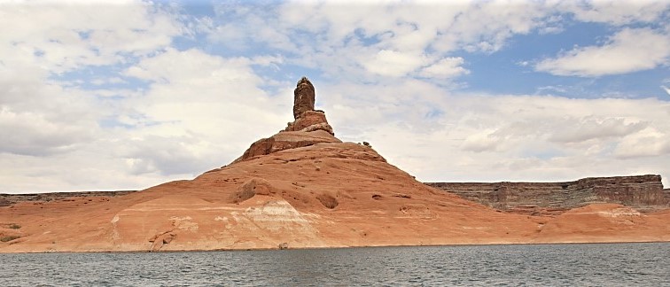 Cookie Jar ButteSummit · ~43 min drivePhoto: MS-R / Michael S-R, CC BY-SA 2.0 (via Wikimedia Commons)
Best time to visit Betty Pass Caves Trail
Best months: April–May and September–October. Best months have typical highs of 55–85 °F, lows of 30 °F or warmer (32 °F where the station doesn't record snow), at most one snowy day and no more than 12 wet days.
Jan
43° / 19°
4 wet
Feb
48° / 23°
5 wet
Mar
58° / 29°
4 wet
Apr
66° / 35°
4 wet
May
76° / 42°
4 wet
Jun
87° / 50°
3 wet
Jul
92° / 57°
7 wet
Aug
89° / 56°
9 wet
Sep
81° / 47°
6 wet
Oct
68° / 37°
4 wet
Nov
54° / 26°
3 wet
Dec
43° / 19°
4 wet
Typical high / low (°F) and days with rain or snow, 1991–2020. Measured at Escalante, UT, 28.5 mi away at 5,810 ft. The station sits about 700 ft higher than this place, so expect it a little warmer here. This station doesn't record snowfall. Source: NOAA NCEI U.S. Climate Normals 1991–2020.
Map and trail data © OpenStreetMap contributors
