Ledge E Campground
Campground
Campground · 2.7 mi from the trail
The Wine Glass is a natural arch in Utah's Bureau of Land Management Moab Field Office, about 10 miles from the town of Moab. It sits at roughly 5,560 feet, and the land is managed by the Bureau of Land Management. Spring and fall bring the most comfortable conditions. Typical averages from the Canyonlands-The Neck weather station, about 11.5 miles away, show May highs around 72°F and October highs around 65°F, while July averages reach 91°F. Nearby, Kane Creek Canyon Trail lies about 2.6 miles away and Lockhart Basin about 2.9 miles. Hatch Point Campground is about 3.4 miles off, and The Ledge Campground is about 3.6 miles away.
Ledge E Campground
Campground
 If it rainsCarter Pape, CC BY-SA 4.0 · Wikimedia Commons
Hell's Revenge
Attraction
Places © OpenStreetMap contributors, Places © Overture Maps Foundation · Photos: Carter Pape, CC BY-SA 4.0 (commons)
More in MoabElevation from USGS 3D Elevation Program terrain data (about 10 m resolution).
 Big BrainRock climbingPhoto: katsrcool, CC BY 2.0 (via Wikimedia Commons)3.5 miLedge C BouldersRock climbingPhoto: katsrcool, CC BY 2.0 (via Wikimedia Commons)3.5 mi
 Chicken Corners RoadHikingPhoto: Charles Skip Martin, CC BY 3.0 (via Wikimedia Commons)3.5 mi
Source: Roamze catalog (indexable pages within 10 miles, PostGIS distance)
 Corona ArchNatural arch · ~18 min drivePhoto: Michael Grindstaff, CC BY-SA 3.0 (via Wikimedia Commons)
 Pinto ArchNatural arch · ~18 min drivePhoto: Bureau of Land Management, Public domain (via Wikimedia Commons)
 Washer WomanNatural arch · ~22 min drivePhoto: Kristina D.C. Hoeppner, CC BY-SA 2.5 (via Wikimedia Commons)
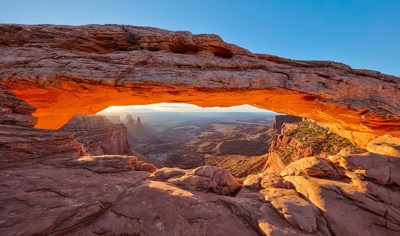 Mesa ArchNatural arch · ~24 min drivePhoto: Thomas Wolf, www.foto-tw.de, CC BY-SA 3.0 (via Wikimedia Commons)
 Looking Glass RockNatural arch · ~27 min drivePhoto: Thatcher Clay, CC BY 2.0 (via Wikimedia Commons)
 Turret ArchNatural arch · ~31 min drivePhoto: W. Bulach, CC BY-SA 4.0 (via Wikimedia Commons)
 South WindowNatural arch · ~31 min drivePhoto: KimonBerlin, CC BY-SA 2.0 (via Wikimedia Commons)
 North WindowNatural arch · ~31 min drivePhoto: W. Bulach, CC BY-SA 4.0 (via Wikimedia Commons)
 Musselman ArchNatural arch · ~15 min drivePhoto: Greg Willis from Denver, CO, usa, CC BY-SA 2.0 (via Wikimedia Commons)
 Wilson ArchNatural arch · ~29 min drivePhoto: Paul Kordwig Post.eingang, CC BY-SA 3.0 (via Wikimedia Commons)
Best months: April–June and September–October. Best months have typical highs of 55–85 °F, lows of 30 °F or warmer (32 °F where the station doesn't record snow), at most one snowy day and no more than 12 wet days.
Jan
37° / 22°
4 wet · 4 snow
Feb
43° / 27°
4 wet · 3 snow
Mar
54° / 35°
5 wet · 2 snow
Apr
62° / 40°
5 wet · 1 snow
May
72° / 50°
5 wet
Jun
85° / 62°
3 wet
Jul
91° / 68°
6 wet
Aug
88° / 66°
7 wet
Sep
79° / 57°
6 wet
Oct
65° / 44°
5 wet
Nov
49° / 33°
4 wet · 2 snow
Dec
37° / 23°
4 wet · 4 snow
Typical high / low (°F) and days with rain or snow, 1991–2020. Measured at Canyonlands-The Neck, UT, 11.5 mi away at 5,871 ft. Source: NOAA NCEI U.S. Climate Normals 1991–2020.
