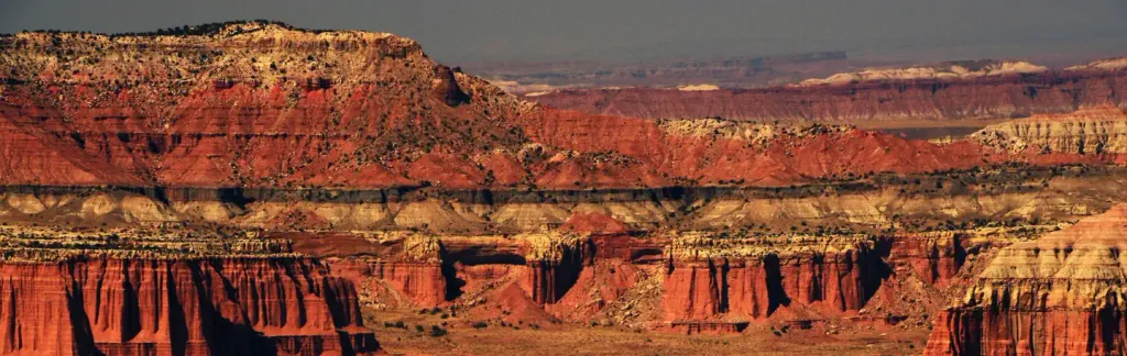
Cassidys Arch
 Photo: John Fowler from Placitas, NM, USA, CC BY 2.0 (via Wikimedia Commons)
- 5,916 ft
- elevation
- National Park Service
- managed by
- Mar–May, Sep–Oct
- best months
Is Cassidys Arch open right now?
No closures listed
The National Park Service lists no closures for Capitol Reef National Park.
As of · Source: NPS · Capitol Reef National Park. Agencies don't list every closure — check before you go.
Cassidys Arch is a natural arch in Capitol Reef National Park in southern Utah, managed by the National Park Service. The nearest town is Torrey, about 11 miles away, and the arch sits at roughly 5,900 feet. Spring and fall are the most comfortable times to visit. Typical averages from a nearby weather station show May highs around 74°F and October highs around 66°F, while July averages about 91°F and winter highs sit near 40°F. The Cassidy Arch hike starts about 0.7 miles away, and the Grand Wash Trail is a similar distance. Climbers can head to the Terrible Twos Wall, about 0.3 miles off, or the Grand Wash Boulders at about 0.6 miles.
- Elevation
- 5,916 ft
- Land manager
- National Park Service
Elevation from USGS 3D Elevation Program terrain data (about 10 m resolution).
 Terrible Twos WallRock climbingPhoto: The Dye Clan, CC BY-SA 3.0 (via Wikimedia Commons)0.3 mi
 Grand Wash BouldersRock climbingPhoto: Famartin, CC BY-SA 3.0 (via Wikimedia Commons)0.6 mi
- Cassidy ArchHiking0.7 mi
- Grand Wash TrailHiking0.7 mi
- Frying PanHiking1.7 mi
 Capitol Reef Group CampgroundCampingPhoto: Recreation.gov (RIDB) / public domain1.8 mi
 Fruita AreaRock climbingPhoto: brewbooks from near Seattle, USA, CC BY-SA 2.0 (via Wikimedia Commons)2.6 mi
- Fremont River Cua DispersedCamping6.8 mi
Source: Roamze catalog (indexable pages within 10 miles, PostGIS distance)
 Hickman Natural BridgeNatural arch · ~4 min drivePhoto: Aneta Kaluzna, CC BY-SA 2.5 (via Wikimedia Commons)
 Escalante Natural BridgeNatural arch · ~1h 1m drivePhoto: A. E. Crane, U.S. Department of Transportation, Public domain (via Wikimedia Commons)
 Metate ArchNatural arch · ~1h 22m drivePhoto: John Fowler from Placitas, NM, USA, CC BY 2.0 (via Wikimedia Commons)
 Dutchman ArchNatural arch · ~1h 23m drivePhoto: Greg Willis from Denver, CO, usa, CC BY-SA 2.0 (via Wikimedia Commons)
- Nels Johnson BridgeNatural arch · ~3 min drive
- The HonduNatural arch · ~52 min drive
- Phipps ArchNatural arch · ~1h 2m drive
- Brimhall BridgeNatural arch · ~1h 10m drive
- Horizon ArchNatural arch · ~1h 14m drive
- Cedar Wash ArchNatural arch · ~1h 17m drive
Also worth it near here
- Terrible Twos WallRock climbing · Next doorPhoto: The Dye Clan, CC BY-SA 3.0 (via Wikimedia Commons)
 Ferns NippleSummit · ~2 min drivePhoto: sf-dvs, CC BY 2.0 (via Wikimedia Commons)
- Capitol Reef Group CampgroundCamping · ~3 min drive
 Golden ThroneHiking · ~7 min drivePhoto: Greg Willis from Denver, CO, usa, CC BY-SA 2.0 (via Wikimedia Commons)
Best time to visit Cassidys Arch
Best months: March–May and September–October. Best months have typical highs of 55–85 °F, lows of 30 °F or warmer (32 °F where the station doesn't record snow), at most one snowy day and no more than 12 wet days.
Jan
41° / 21°
3 wet · 2 snow
Feb
47° / 26°
4 wet · 1 snow
Mar
57° / 34°
4 wet · 1 snow
Apr
65° / 39°
4 wet
May
74° / 48°
5 wet
Jun
86° / 58°
4 wet
Jul
91° / 65°
7 wet
Aug
88° / 63°
8 wet
Sep
80° / 55°
6 wet
Oct
66° / 43°
4 wet
Nov
51° / 30°
3 wet · 1 snow
Dec
40° / 21°
3 wet · 2 snow
Typical high / low (°F) and days with rain or snow, 1991–2020. Measured at Capitol Reef Np, UT, 2.9 mi away at 5,500 ft. Source: NOAA NCEI U.S. Climate Normals 1991–2020.
