Abrams Falls
- 1,491 ft
- elevation
- Sep–Nov
- best months
Is Abrams Falls open right now?
Closure in the area
There's a closure order in Great Smoky Mountains National Park. It doesn't name Abrams Falls, so check the source for the area it covers (4 listed).
Kuwohi Road Closed Due To Snow And Ice
Park closure covering Great Smoky Mountains National Park · NPS · Great Smoky Mountains National Park
Seasonal road closures
Park closure covering Great Smoky Mountains National Park · NPS · Great Smoky Mountains National Park
Straight Fork and the one-way section of Balsam Mountain Road closed.
Park closure covering Great Smoky Mountains National Park · NPS · Great Smoky Mountains National Park
Park Headquarters Road is closed
Park closure covering Great Smoky Mountains National Park · NPS · Great Smoky Mountains National Park
As of · Source: NPS · Great Smoky Mountains National Park. Agencies don't list every closure — check before you go.
Abrams Falls is a waterfall in Great Smoky Mountains National Park in Tennessee, about 8.5 miles from the town of Townsend. It sits at an elevation of 1,491 feet, and the Abrams Falls Trail starts about a mile away, making it the natural way to reach the falls. For comfortable weather, aim for late spring or early fall. Typical averages from a nearby weather station in Townsend show May highs around 74°F and September highs around 77°F, with September and October seeing the fewest wet days of the year. Several other trails lie within a couple of miles, including Rabbit Creek Trail and Wet Bottom Trail. Abrams Creek offers fishing about 2.3 miles away, and Abram's Creek Campground is about 3 miles off.
- Elevation
- 1,491 ft
Elevation from USGS 3D Elevation Program terrain data (about 10 m resolution).
 Abrams Falls TrailHikingPhoto: Bas van Oorschot, CC BY-SA 3.0 (via Wikimedia Commons)1.1 mi
 Rabbit Creek TrailHikingPhoto: Bas van Oorschot, CC BY-SA 3.0 (via Wikimedia Commons)1.9 mi
- Wet Bottom TrailHikingPhoto: Bas van Oorschot, CC BY-SA 3.0 (via Wikimedia Commons)2 mi
- Abrams CreekRiver fishing2.3 mi
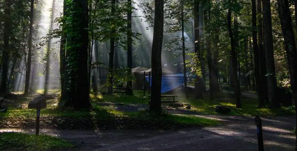 Abram's Creek CampgroundCampingPhoto: Recreation.gov (RIDB) / public domain3 mi
- Hesse CreekCanoeing3.8 mi
- Fire Tower AreaRock climbing3.9 mi
 Cades Cove CampgroundCampingPhoto: Recreation.gov (RIDB) / public domain5.8 mi
Source: Roamze catalog (indexable pages within 10 miles, PostGIS distance)
 Mingo FallsWaterfall · ~59 min drivePhoto: Kaldari, Public domain (via Wikimedia Commons)
 Cullasaja FallsWaterfall · ~1h 23m drivePhoto: Sdrtm at English Wikipedia, CC BY-SA 3.0 (via Wikimedia Commons)
- Laurel FallsWaterfall · ~29 min drive
- Wilson FallsWaterfall · ~38 min drive
- Rainbow FallsWaterfall · ~41 min drive
- Upper FallsWaterfall · ~41 min drive
- Big FallsWaterfall · ~41 min drive
- Middle FallsWaterfall · ~42 min drive
- Grotto FallsWaterfall · ~42 min drive
- Queens FallsWaterfall · ~45 min drive
Best time to visit Abrams Falls
Best months: September–November. Best months have typical highs of 55–85 °F, lows of 30 °F or warmer (32 °F where the station doesn't record snow), at most one snowy day and no more than 12 wet days.
Jan
47° / 26°
14 wet
Feb
51° / 29°
13 wet
Mar
59° / 34°
14 wet
Apr
69° / 43°
13 wet
May
74° / 51°
14 wet
Jun
79° / 59°
14 wet
Jul
81° / 63°
16 wet
Aug
81° / 61°
13 wet
Sep
77° / 56°
10 wet
Oct
68° / 44°
10 wet
Nov
59° / 34°
11 wet
Dec
50° / 29°
14 wet
Typical high / low (°F) and days with rain or snow, 1991–2020. Measured at Townsend 5s, TN, 5.8 mi away at 1,893 ft. This station doesn't record snowfall. Source: NOAA NCEI U.S. Climate Normals 1991–2020.
Closures we've recorded since August 2026
Abrams Falls Trail Closed on October 8
Great Smoky Mountains National Park · seen Aug 24, 2026 → lifted Oct 8, 2026 · National Park Service
