Apalachia Powerhouse Boat Launch
- Feb–May, Sep–Nov
- best months
Is Apalachia Powerhouse Boat Launch open right now?
Closure in the area
There's a closure order in Cherokee National Forest. It doesn't name Apalachia Powerhouse Boat Launch, so check the source for the area it covers (2 listed).
Ocoee River Flooding Damage - Nov 5
Agency closure covering Cherokee National Forest · USFS · Cherokee National Forest
Campsite limitations
Agency closure covering Cherokee National Forest · Order 08-04-00-22-180 · USFS · Cherokee National Forest
Emergency road closures due to storm damage
Agency alert covering Cherokee National Forest · USFS · Cherokee National Forest
As of · Source: USFS · Cherokee National Forest. Agencies don't list every closure — check before you go.
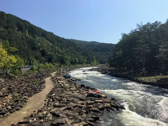
Apalachia Powerhouse Boat Launch is a Forest Service boat launch in the Ocoee Ranger District of Cherokee National Forest in Tennessee, about 7 miles from the town of Farner. It gives boaters a put-in on the forest's waterways, and the surrounding area offers plenty to pair with a day on the water. Spring and fall are the most comfortable times to visit. Typical averages from the nearby Tellico Plains weather station show October highs around 74°F with lows near 45°F, and April is similar at about 73°F by day and 44°F at night. July is the warmest month, with highs near 90°F. The Hiwassee River lies about 3 miles away, and the Coker Creek Falls Trail is roughly 4 miles off. Starr Mountain, a climbing area, is about 5.5 miles away, and Quinn Springs Pavilion offers camping within 7 miles.
- Managed by
- Forest Service
- Hiwassee RiverRiver fishing3.1 mi
- COKER CREEK FALLS TRAILHiking4.4 mi
- FISHERMAN'S TRAILHiking5.2 mi
- Starr MountainRock climbing5.5 mi
- Quinn Springs PavilionCamping6.7 mi
- Ocoee River AreaRiver fishing7.3 mi
 Thunder Rock CampgroundCampingPhoto: Recreation.gov (RIDB) / public domain7.6 mi
- GoForth Creek BouldersRock climbing7.6 mi
Source: Roamze catalog (indexable pages within 10 miles, PostGIS distance)
- Parksville Boat Launch ComplexBoat launch · ~17 min drive
- Ocoee River AreaFloat trip · ~12 min drive
- Conasauga CreekCanoeing · ~18 min drive
- Kings Slough LaunchBoat launch · ~23 min drive
- Thunder Rock CampgroundFloat trip · ~13 min drive
- South Chestuee CreekCanoeing · ~29 min drive
- Shooks Marina SlipwayBoat launch · ~30 min drive
- Parksville Lake Rv CampgroundFloat trip · ~15 min drive
- Chestuee CreekCanoeing · ~30 min drive
- Grape Creek SlipwayBoat launch · ~32 min drive
Also worth it near here
Best time to visit Apalachia Powerhouse Boat Launch
Best months: February–May and September–November. Best months have typical highs of 55–85 °F, lows of 30 °F or warmer (32 °F where the station doesn't record snow), at most one snowy day and no more than 12 wet days.
Jan
50° / 28°
9 wet · 1 snow
Feb
55° / 31°
10 wet · 1 snow
Mar
64° / 37°
9 wet
Apr
73° / 44°
9 wet
May
81° / 54°
10 wet
Jun
87° / 63°
10 wet
Jul
90° / 66°
11 wet
Aug
89° / 65°
9 wet
Sep
84° / 57°
7 wet
Oct
74° / 45°
7 wet
Nov
62° / 35°
8 wet
Dec
54° / 31°
10 wet
Typical high / low (°F) and days with rain or snow, 1991–2020. Measured at Tellico Plains, TN, 15.4 mi away at 910 ft. Source: NOAA NCEI U.S. Climate Normals 1991–2020.


Map and trail data © OpenStreetMap contributors
