Backbone Rock Campground
Campground
Campground · 3.1 mi from the trail
Closure in the area
There's a closure order in Cherokee National Forest. It doesn't name Laurel Creek, so check the source for the area it covers (2 listed).
Ocoee River Flooding Damage - Nov 5
Agency closure covering Cherokee National Forest · USFS · Cherokee National Forest
Campsite limitations
Agency closure covering Cherokee National Forest · Order 08-04-00-22-180 · USFS · Cherokee National Forest
Emergency road closures due to storm damage
Agency alert covering Cherokee National Forest · USFS · Cherokee National Forest
Roan Mountain Fire Restrictions
Agency alert covering Watauga Ranger District · Order 08-04-06-25-001 · USFS · Watauga Ranger District
As of · Source: USFS · Cherokee National Forest. Agencies don't list every closure — check before you go.
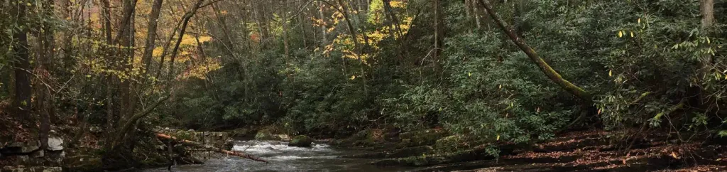
Laurel Creek is a 10-mile paddling stretch near Laurel Bloomery, Tennessee, within the Watauga Ranger District of Cherokee National Forest. It flows year-round, with typical average flows around 74 cubic feet per second and a gradient of about 58.7 feet per mile. Spring and fall are the most comfortable seasons to paddle. Typical averages from a nearby weather station show October highs around 68°F with lows near 41°F and about seven wet days, while May runs warmer at highs near 74°F. Backbone Rock Campground and the Rogers Ridge Trail are both within about 3 miles. Beaverdam Creek and Goose Creek, two other paddling spots, lie roughly 6 miles away.
Backbone Rock Campground
Campground
Elevated Flavors
American restaurant
Mountain Farm Life Museum
Museum
Places © OpenStreetMap contributors, Places © Overture Maps Foundation
More in JeffersonNot on Roamze yet. Their page has how to reach them.
 Backbone Rock CampgroundCampingPhoto: Recreation.gov (RIDB) / public domain3.1 mi
 Backbone Rock TrailHikingPhoto: photo by pfly, CC BY-SA 2.0 (via Wikimedia Commons)3.1 mi
Source: Roamze catalog (indexable pages within 10 miles, PostGIS distance)
 Wilson CreekCanoeing · ~1h 5m drivePhoto: Ken Thomas, Public domain (via Wikimedia Commons)
 Yadkin RiverCanoeing · ~1h 5m drivePhoto: unknown/w:NOAA, Public domain (via Wikimedia Commons)
 Russell ForkCanoeing · ~1h 9m drivePhoto: Magnolia677, CC BY 4.0 (via Wikimedia Commons)
 Roan CreekCanoeing · ~20 min drivePhoto: Brian Stansberry, CC BY 3.0 (via Wikimedia Commons)
Best months: April–October. Best months have typical highs of 55–85 °F, lows of 30 °F or warmer (32 °F where the station doesn't record snow), at most one snowy day and no more than 12 wet days.
Jan
46° / 23°
9 wet
Feb
49° / 25°
9 wet
Mar
57° / 31°
10 wet
Apr
67° / 39°
10 wet
May
74° / 49°
12 wet
Jun
80° / 56°
12 wet
Jul
82° / 60°
12 wet
Aug
81° / 59°
10 wet
Sep
77° / 52°
8 wet
Oct
68° / 41°
7 wet
Nov
58° / 31°
7 wet
Dec
49° / 26°
9 wet
Typical high / low (°F) and days with rain or snow, 1991–2020. Measured at Mtn City 2, TN, 7.1 mi away at 2,419 ft. This station doesn't record snowfall. Source: NOAA NCEI U.S. Climate Normals 1991–2020.
