Lone Oak Trail
- 1.8 mi
- round trip
- 3,003 ft
- climb
- 3,271 ft
- high point
- Out and back
- route
- Apr–Oct
- best months
Is Lone Oak Trail open right now?
Closure in the area
There's a closure order in Cherokee National Forest. It doesn't name Lone Oak Trail, so check the source for the area it covers (2 listed).
Ocoee River Flooding Damage - Nov 5
Agency closure covering Cherokee National Forest · USFS · Cherokee National Forest
Campsite limitations
Agency closure covering Cherokee National Forest · Order 08-04-00-22-180 · USFS · Cherokee National Forest
Emergency road closures due to storm damage
Agency alert covering Cherokee National Forest · USFS · Cherokee National Forest
As of · Source: USFS · Cherokee National Forest. Agencies don't list every closure — check before you go.
Lone Oak Trail is a hard out-and-back hike in Tennessee's Cherokee National Forest, within the Unaka Ranger District. The trail starts and ends at about 2,090 feet and climbs to a high point of 3,271 feet, with a total gain of about 3,000 feet over a route that is roughly 3.6 miles long. The climb is front-loaded, and the steepest stretch comes at about 0.9 miles from the trailhead, with a grade of around 28 percent. Summer and early fall are the most comfortable times to go. Typical averages from a nearby weather station show July highs around 80°F with lows near 59°F, and September highs around 74°F. That station sits about 350 feet below the trail's high point, so expect temperatures on the summit to run a little cooler. The estimated time for the hike is about 2.5 hours. Tip Top Trail is less than a mile away and White Rock Loop is about a mile off. For paddling, Buffalo Creek is about 3 miles away. Rock Creek Recreation Area, roughly 9 miles from the trail, has camping.
Local outfitters
- French Broad Adventures35 mi away
- Nantahala Outdoor Center35 mi away
Not on Roamze yet. Their page has how to reach them.
- Tip Top TrailHiking0.8 mi
- White Rock LoopHiking1 mi
- Buffalo CreekCanoeing3 mi
- Rail cut #3 - Tweetsie TrailRock climbing5.7 mi
- Cherokee CreekCanoeing6.2 mi
- Rock Creek Recreation AreaCamping8.7 mi
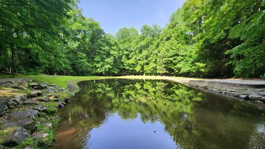 Rock Creek Recreation Area (Cherokee National Forest, TN)CampingPhoto: Recreation.gov (RIDB) / public domain8.7 mi
- Highball AreaRock climbing9.5 mi
Source: Roamze catalog (indexable pages within 10 miles, PostGIS distance)
- Tip Top TrailHiking · ~1 min drive
- White Rock LoopHiking · ~2 min drive
- The Noggin TrailHiking · ~2 min drive
- Dark Hollow HorseHiking · ~12 min drive
- Fork Knob TrailHiking · ~2 min drive
- Mud Hollow TrailHiking · ~3 min drive
- Buffalo Mountain TrailHiking · ~3 min drive
- LIMESTONE COVE TRAILHiking · ~13 min drive
- Green Mile TrailHiking · ~2 min drive
- Pinnacle Mountain Fire Tower TrailHiking · ~7 min drive
Best time to visit Lone Oak Trail
Best months: April–October. Best months have typical highs of 55–85 °F, lows of 30 °F or warmer (32 °F where the station doesn't record snow), at most one snowy day and no more than 12 wet days.
Jan
44° / 22°
Feb
48° / 25°
Mar
55° / 31°
Apr
65° / 38°
May
71° / 47°
Jun
77° / 55°
Jul
80° / 59°
Aug
78° / 58°
Sep
74° / 51°
Oct
67° / 40°
Nov
56° / 30°
Dec
48° / 25°
Typical high / low (°F) and days with rain or snow, 1991–2020. Measured at Roan Mtn 3sw, TN, 16.6 mi away at 2,923 ft. This station doesn't record snowfall. Source: NOAA NCEI U.S. Climate Normals 1991–2020.
Map and trail data © OpenStreetMap contributors
