Birchfield Camp Trail
- 2.7 mi
- round trip
- 2,368 ft
- climb
- 4,368 ft
- high point
- Out and back
- route
- Mar–Nov
- best months
Is Birchfield Camp Trail open right now?
Closure in the area
There's a closure order in Cherokee National Forest. It doesn't name Birchfield Camp Trail, so check the source for the area it covers (2 listed).
Ocoee River Flooding Damage - Nov 5
Agency closure covering Cherokee National Forest · USFS · Cherokee National Forest
Campsite limitations
Agency closure covering Cherokee National Forest · Order 08-04-00-22-180 · USFS · Cherokee National Forest
Emergency road closures due to storm damage
Agency alert covering Cherokee National Forest · USFS · Cherokee National Forest
As of · Source: USFS · Cherokee National Forest. Agencies don't list every closure — check before you go.
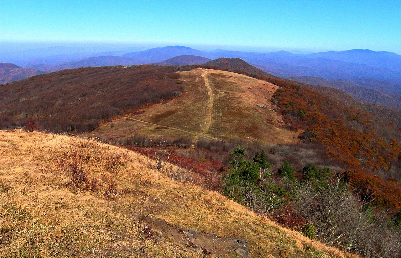
Birchfield Camp Trail is a moderate out-and-back hike in Tennessee's Cherokee National Forest, within the Unaka Ranger District. It stretches 5.4 miles round trip, with a front-loaded climb that starts at about 3,072 feet and peaks near 4,368 feet. The route's steepest section comes around 0.7 miles in, with a grade of about 26 percent. The trail is a long day rather than a quick outing. Plan for about three hours, and allow time to adjust to the climb. The trail's elevation gain is 2,368 feet round trip, so it's not a short climb to the top. Spring and fall are the most comfortable seasons. Typical averages from a nearby weather station run to highs of about 66°F in April and 67°F in October, with summer highs near 80°F. That station sits roughly 1,500 feet lower than the trail's high point, so temperatures up high run cooler. Several other trails sit close by, including Headwaters Trail about 0.1 mile away and Rocky Fork Trail and White Oak Flats Trail each about half a mile off. Horse Creek Recreation Area is about 5.8 miles away.
Local outfitters
- French Broad Adventures17 mi away
- Nantahala Outdoor Center17 mi away
Not on Roamze yet. Their page has how to reach them.
- Headwaters TrailHiking0.1 mi
- Rocky Fork TrailHiking0.5 mi
- White Oak Flats TrailHiking0.5 mi
- Bald MountainsRiver fishing1.6 mi
- South Indian CreekCanoeing2.1 mi
- Spivey CreekCanoeing5.5 mi
- Horse Creek Recreation AreaCamping5.8 mi
- Old Forge CampgroundCamping6.5 mi
Source: Roamze catalog (indexable pages within 10 miles, PostGIS distance)
 Wolf Laurel Nature TrailHiking · ~12 min drivePhoto: Will Thomas, CC BY-SA 3.0 (via Wikimedia Commons)
- Rocky Fork TrailHiking · Next door
- Blockstand Creek TrailHiking · ~1 min drive
- Anst - Appalachian RdHiking · ~3 min drive
- White Oak Flats TrailHiking · Next door
- Pete's Branch TrailHiking · ~9 min drive
- Flint Mountain TrailHiking · ~3 min drive
- Sarvis Cove TrailHiking · ~6 min drive
- Blockstand Creek Access TrailHiking · Next door
- Round Knob TrailHiking · ~9 min drive
Best time to visit Birchfield Camp Trail
Best months: March–November. Best months have typical highs of 55–85 °F, lows of 30 °F or warmer (32 °F where the station doesn't record snow), at most one snowy day and no more than 12 wet days.
Jan
45° / 26°
Feb
49° / 29°
Mar
56° / 34°
Apr
66° / 42°
May
73° / 49°
Jun
80° / 58°
Jul
83° / 61°
Aug
81° / 60°
Sep
76° / 54°
Oct
67° / 42°
Nov
57° / 34°
Dec
48° / 28°
Typical high / low (°F) and days with rain or snow, 1991–2020. Measured at Burnsville Ag, NC, 19.2 mi away at 2,825 ft. The station sits about 1,500 ft lower than this place, so expect it a little cooler here. This station doesn't record snowfall. Source: NOAA NCEI U.S. Climate Normals 1991–2020.
Map and trail data © OpenStreetMap contributors
