Anst - Appalachian Rd
- 17.0 mi
- round trip
- 7,712 ft
- climb
- 6,183 ft
- high point
- Out and back
- route
- Sep
- best months
Is Anst - Appalachian Rd open right now?
Closure in the area
There's a closure order in Appalachian National Scenic Trail. It doesn't name Anst - Appalachian Rd, so check the source for the area it covers.
List of trail closures post-Hurricane Helene
Park closure covering Appalachian National Scenic Trail · NPS · Appalachian National Scenic Trail
Black Bears Frequenting the McAfee Knob Area in Virginia
Park alert covering Appalachian National Scenic Trail · NPS · Appalachian National Scenic Trail
As of · Source: NPS · Appalachian National Scenic Trail. Agencies don't list every closure — check before you go.
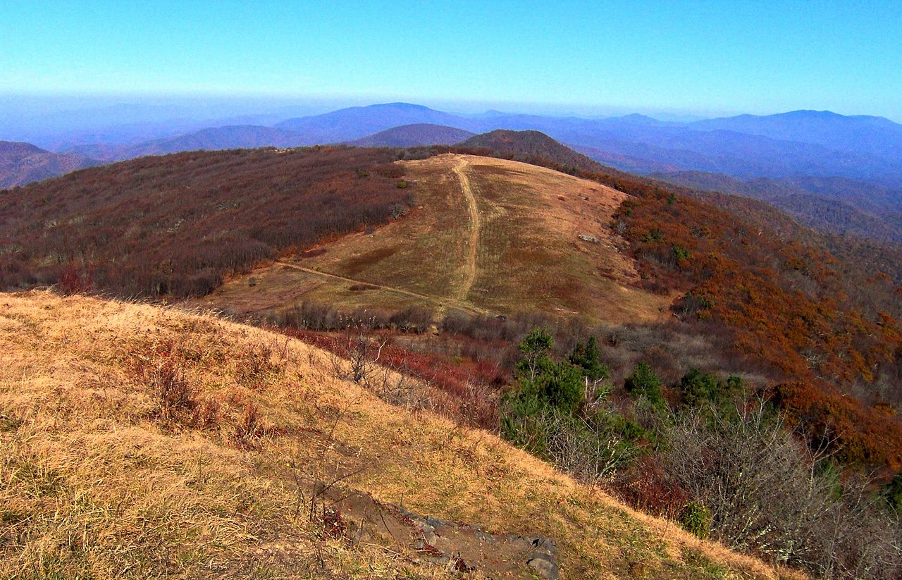
Anst - Appalachian Rd is a 17-mile expert-level hike on the Appalachian National Scenic Trail, set within the Appalachian Ranger District of Pisgah National Forest in western North Carolina. The Forest Service manages the land, and the trail crosses into Tennessee, so plan on an outing that spans both states. This is an out-and-back route. The climb runs from a starting point near 3,900 feet to a high point of about 6,180 feet, with a total gain of roughly 7,700 feet for the round trip. That makes it one of the steeper Appalachian Trail segments. For timing, late spring and early fall tend to be the most comfortable. Typical averages from the nearby Mt Mitchell weather station, at a similar elevation, show May highs around 58°F and September highs around 61°F. July is the wettest month, with about 18 days of precipitation. Bikes and horses are both allowed on this route, so the trail works for riders and pack animals. Flint Creek Trail and Flint Mountain Trail sit just a few tenths of a mile away.
Local outfitters
- French Broad Adventures15 mi away
- Nantahala Outdoor Center15 mi away
Not on Roamze yet. Their page has how to reach them.
Conditions and forecast on Hump Mountain
Daily highs and lows, wind and the chance of precipitation at the summit and route start for the next 7 days, from the Open-Meteo model.
- Flint Creek TrailHiking0.2 mi
- Flint Mountain TrailHiking0.4 mi
- Blockstand Creek Access TrailHiking1.4 mi
- Bald MountainsRiver fishing2.3 mi
- South Indian CreekCanoeing3.3 mi
- Shelton Laurel CreekCanoeing5.1 mi
- Horse Creek Recreation AreaCamping5.5 mi
- Old Forge CampgroundCamping5.5 mi
Source: Roamze catalog (indexable pages within 10 miles, PostGIS distance)
- Flint Creek TrailHiking · Next door
- Flint Mountain TrailHiking · Next door
- Headwaters TrailHiking · ~3 min drive
- Sarvis Cove TrailHiking · ~4 min drive
- Blockstand Creek Access TrailHiking · ~2 min drive
- Blockstand Creek TrailHiking · ~3 min drive
- Rocky Fork TrailHiking · ~4 min drive
- Birchfield Camp TrailHiking · ~3 min drive
- Jerry MillerHiking · ~5 min drive
- Round Knob TrailHiking · ~6 min drive
Best time to visit Anst - Appalachian Rd
Best months: September. Best months have typical highs of 55–85 °F, lows of 30 °F or warmer (32 °F where the station doesn't record snow), at most one snowy day and no more than 12 wet days.
Jan
34° / 17°
14 wet
Feb
36° / 18°
13 wet
Mar
41° / 24°
14 wet
Apr
50° / 32°
13 wet
May
58° / 41°
14 wet
Jun
64° / 49°
16 wet
Jul
67° / 52°
18 wet
Aug
66° / 51°
16 wet
Sep
61° / 46°
12 wet
Oct
54° / 37°
11 wet
Nov
45° / 28°
10 wet
Dec
38° / 21°
13 wet
Typical high / low (°F) and days with rain or snow, 1991–2020. Measured at Mt Mitchell, NC, 27 mi away at 6,240 ft. This station doesn't record snowfall. Source: NOAA NCEI U.S. Climate Normals 1991–2020.
Route details
- Distance
- 17.0 mi round trip
- Climbing
- About 7,712 ft
- Summit
- 5,589 ft
- Difficulty
- Expert
- Time
- About 7.5 hours
Questions about this route
How long is the Anst - Appalachian Rd on Hump Mountain?
About 17.0 mi round trip.
How much elevation gain is on the Anst - Appalachian Rd?
About 7,712 ft of climbing round trip.
How hard is the Anst - Appalachian Rd?
It is rated expert.
How long does the Anst - Appalachian Rd take?
About 7.5 hours round trip.
