Big Pine Hill
- 2,263 ft
- summit
- 1
- way up
- Apr–Oct
- best months
Big Pine Hill is a summit of 2,263 feet in Pennsylvania, set within the Thornhurst Tract about 7 miles from Bear Creek Village. It sits among a cluster of hiking trails, with Pine Hill Trail less than a mile away and Frank Gantz Trail about a mile off. Summer is the most comfortable time to visit. Typical averages from a nearby weather station at the Francis E Walter Dam show July highs around 79°F with lows near 58°F, and temperatures on the summit run cooler than those figures because the station sits roughly 750 feet lower. Several trails lie within a short drive. County Line Trail and Powder Magazine Trail are each about 1.2 miles away, and the Northeast Ridges and Valleys climbing area is about 5.4 miles off.
Conditions and forecast
Daily highs and lows, wind and the chance of precipitation at the summit and route start for the next 7 days, from the Open-Meteo model.
- Summit elevation
- 2,263 ft
Elevation from USGS 3D Elevation Program terrain data (about 10 m resolution).
Map © Mapbox © OpenStreetMap contributors Questions about Big Pine Hill
How tall is Big Pine Hill?
2,263 ft (690 m).
How many routes go to the summit of Big Pine Hill?
One: Pine Hill Trail.
- Prospect Rock2,061 ft · Pennsylvania1 route8.5 mi away
- West Mountain2,004 ft · Pennsylvania1 route20 mi away
- East Mountain1,989 ft · Pennsylvania1 route22 mi away
- Lee Hill1,184 ft · Pennsylvania1 route23 mi away
- Locust Mountain1,518 ft · Pennsylvania1 route27 mi away
- Mount Tammany1,521 ft · New Jersey2 routes33 mi away
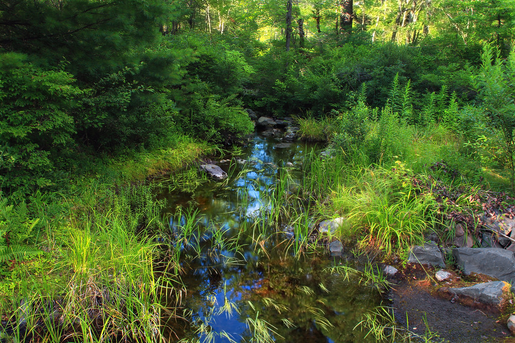 Pine Hill TrailHikingPhoto: Nicholas_T, CC BY 2.0 (via Flickr)0.9 mi
- Frank Gantz TrailHiking1 mi
- County Line TrailHiking1.2 mi
 Powder Magazine TrailHikingPhoto: Nicholas_T, CC BY 2.0 (via Flickr)1.2 mi
- Bear Swamp TrailHiking1.2 mi
- Sassafras Hill TrailHiking1.2 mi
- Northeast Ridges and ValleysRock climbing5.4 mi
 Lehigh RiverCanoeingPhoto: The original uploader was Malepheasant at English Wikipedia., CC BY-SA 2.0 (via Wikimedia Commons)7.5 mi
Source: Roamze catalog (indexable pages within 10 miles, PostGIS distance)
 Bald MountainSummit · ~25 min drivePhoto: The original uploader was Jrmski at English Wikipedia., CC BY-SA 3.0 (via Wikimedia Commons)
 Broad MountainSummit · ~44 min drivePhoto: Annotations, general knowledge, by FrankB, Public domain (via Wikimedia Commons)
 Mount MinsiSummit · ~56 min drivePhoto: Nicholas, CC BY 2.0 (via Wikimedia Commons)
 Buck MountainSummit · ~1h 1m drivePhoto: Jakec, CC BY-SA 4.0 (via Wikimedia Commons)
 Central MountainSummit · ~1h 4m drivePhoto: Jakec, CC BY-SA 4.0 (via Wikimedia Commons)
 McCauley MountainSummit · ~1h 7m drivePhoto: Jakec, CC BY-SA 4.0 (via Wikimedia Commons)
 Mount AraratSummit · ~1h 8m drivePhoto: Nicholas T, CC BY 2.0 (via Wikimedia Commons)
 Sugarloaf MountainSummit · ~1h 11m drivePhoto: Jln Dlphk, CC BY-SA 4.0 (via Wikimedia Commons)
 Turkey HillSummit · ~1h 17m drivePhoto: Jakec, CC BY-SA 4.0 (via Wikimedia Commons)
 Hawk MountainSummit · ~1h 17m drivePhoto: Zeete, CC BY-SA 4.0 (via Wikimedia Commons)
Best time to visit Big Pine Hill
Best months: April–October. Best months have typical highs of 55–85 °F, lows of 30 °F or warmer (32 °F where the station doesn't record snow), at most one snowy day and no more than 12 wet days.
Jan
31° / 16°
Feb
35° / 17°
Mar
43° / 24°
Apr
57° / 34°
May
67° / 45°
Jun
74° / 54°
Jul
79° / 58°
Aug
77° / 56°
Sep
71° / 49°
Oct
59° / 38°
Nov
47° / 29°
Dec
36° / 22°
Typical high / low (°F) and days with rain or snow, 1991–2020. Measured at Francis E Walter Dam, PA, 9.4 mi away at 1,509 ft. The station sits about 800 ft lower than this place, so expect it a little cooler here. This station doesn't record snowfall. Source: NOAA NCEI U.S. Climate Normals 1991–2020.
