Whipple Dam State Park
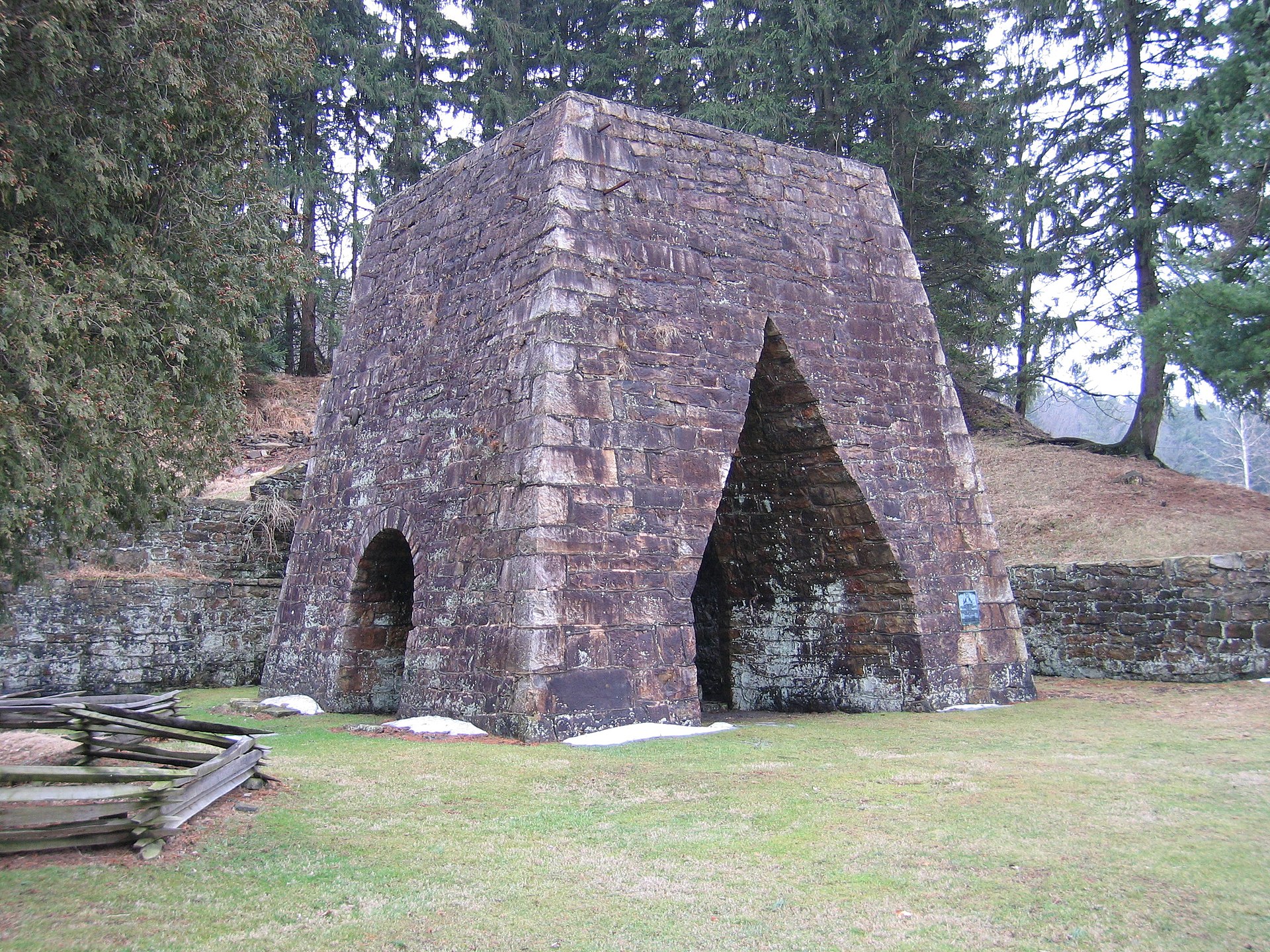
 Photo: Anne Oeldorf-Hirsch, CC BY 2.0 (via Wikimedia Commons)
- State Park and Recreation
- managed by
- Jun–Oct
- best months
Clear at last check
Weather is good · OpenWeather · checked 14 h ago
Whipple Dam State Park is a Pennsylvania state park managed by State Park and Recreation, about 3.4 miles from the town of Pine Grove Mills. It serves as a base for a cluster of trails and climbing areas, with Whipple Lake Trail starting just 0.6 miles away and Rudy Sawmill Trail about 1.6 miles off. Late spring through early fall is the most comfortable stretch for a visit. Typical averages from the nearby State College weather station show September highs around 72°F with lows near 54°F, while July peaks around 81°F. The park also makes a good anchor for a longer outing. Greenwood Furnace Camp is about 5.9 miles away, and the Eversince Area climbing area is about 3.1 miles off. Shaver Creek, a canoeing spot, lies roughly 7.1 miles away.
Park size
265 acres
Inside this park
Water
- Whipple Lake TrailHiking0.6 mi
- Rudy Sawmill TrailHiking1.6 mi
 Ironstone TrailHikingPhoto: cogdogblog, CC BY 2.0 (via Flickr)2 mi
- Eversince AreaRock climbing3.1 mi
- Greenwood Furnace CampCamping5.9 mi
- Shaver CreekCanoeing7.1 mi
- Hunter's Rocks (Rocky Ridge Natural Area)Rock climbing8.3 mi
- The GardenRock climbing8.4 mi
Source: Roamze catalog (indexable pages within 10 miles, PostGIS distance)
 Greenwood Furnace State ParkState park · ~10 min drivePhoto: Wherring, CC BY-SA 3.0 (via Wikimedia Commons)
 Penn Roosevelt State ParkState park · ~15 min drivePhoto: Clint, CC BY-SA 2.0 (via Wikimedia Commons)
 Black Moshannon State ParkState park · ~31 min drivePhoto: Nicholas, CC BY 2.0 (via Wikimedia Commons)
 Reeds Gap State ParkState park · ~35 min drivePhoto: Clint, CC BY-SA 2.0 (via Wikimedia Commons)
 Poe Paddy State ParkState park · ~44 min drivePhoto: Andrew Bossi from Laurel, MD, USA, CC BY-SA 2.0 (via Wikimedia Commons)
 Canoe Creek State ParkState park · ~44 min drivePhoto: Public domain (via Wikimedia Commons)
 Bald Eagle State ParkState park · ~46 min drivePhoto: U.S. Army Corps of Engineers from USA; cropped by Beyond My Ken (talk) 00:01, 29 January 2015 (UTC), Public domain (via Wikimedia Commons)
 Trough Creek State ParkState park · ~49 min drivePhoto: Pennsylvania Department of Conservation and Natural Resources, Pennsylvania Bureau of State Parks, probably Burt Ellsworth, the staff photographer, CC BY-SA 3.0 (via Wikimedia Commons)
 Fowlers Hollow State ParkState park · ~55 min drivePhoto: Clint, CC BY-SA 2.0 (via Wikimedia Commons)
 Prince Gallitzin State ParkState park · ~1h 1m drivePhoto: Robert Hale, CC BY 2.0 (via Wikimedia Commons)
Best time to visit Whipple Dam State Park
Best months: June–October. Best months have typical highs of 55–85 °F, lows of 30 °F or warmer (32 °F where the station doesn't record snow), at most one snowy day and no more than 12 wet days.
Jan
34° / 21°
13 wet
Feb
37° / 22°
11 wet
Mar
46° / 28°
12 wet
Apr
59° / 39°
13 wet
May
69° / 50°
14 wet
Jun
77° / 59°
12 wet
Jul
81° / 63°
12 wet
Aug
79° / 62°
12 wet
Sep
72° / 54°
11 wet
Oct
61° / 43°
11 wet
Nov
49° / 34°
11 wet
Dec
38° / 26°
13 wet
Typical high / low (°F) and days with rain or snow, 1991–2020. Measured at State College, PA, 7.4 mi away at 1,170 ft. We don't have this place's elevation, so higher spots nearby can run cooler. This station doesn't record snowfall. Source: NOAA NCEI U.S. Climate Normals 1991–2020.
