Phillips Creek
- 14.3 mi
- distance
- 4,289 ft
- high point
- Apr–Jun, Sep–Oct
- best months
Is Phillips Creek open right now?
No closures listed
The Forest Service lists no closures for Umatilla National Forest.
As of · Source: USFS · Umatilla National Forest. Agencies don't list every closure — check before you go.
Phillips Creek is a canoeing spot in eastern Oregon, on the Walla Walla Ranger District of the Umatilla National Forest. The Forest Service manages the land, and the town of Elgin is about 5 miles away. Summer is the most comfortable time to paddle. Typical averages from a nearby weather station in Elgin show July and August highs in the mid-80s with only four or five wet days a month, while winter brings highs in the low 40s and rain on about 13 days a month. That station sits roughly 1,600 feet below the creek, so temperatures at the water run cooler. Paddlers can pair a trip here with other streams close by. Dry Creek is about 4 miles away and Willow Creek about 8 miles. For time on foot, the Joseph Branch Community Trail is about 5 miles off and the Umatilla Rim Trail about 8 miles.
Local outfitters
- Minam Store Outfitters14 mi away
- White Pine Outfitters19 mi away
Not on Roamze yet. Their page has how to reach them.
- Dry CreekCanoeing3.7 mi
- Joseph Branch Community TrailHiking5.3 mi
- Umatilla Rim TrailHiking7.7 mi
- Willow CreekCanoeing7.8 mi
- BobcatCross-country skiing8.1 mi
- Thomas CreekCanoeing8.5 mi
- Woodland CgCamping9.5 mi
- North Fork Meacham CreekCanoeing9.8 mi
Source: Roamze catalog (indexable pages within 10 miles, PostGIS distance)
 North Fork Umatilla RiverCanoeing · ~18 min drivePhoto: United States Forest Service, Public domain (via Wikimedia Commons)
- Palmer Junction Boat LaunchBoat launch · ~21 min drive
 Umatilla RiverCanoeing · ~44 min drivePhoto: Bobjgalindo, CC BY-SA 4.0 (via Wikimedia Commons)
- Minam Boat LaunchBoat launch · ~25 min drive
 Catherine CreekCanoeing · ~47 min drivePhoto: Ian Poellet (User:Werewombat), CC BY-SA 3.0 (via Wikimedia Commons)
- Powwatka Bridge AccessBoat launch · ~57 min drive
 Wenaha RiverCanoeing · ~49 min drivePhoto: U.S. Forest Service, Public domain (via Wikimedia Commons)
- Mud Creek AccessBoat launch · ~58 min drive
 Walla Walla RiverCanoeing · ~54 min drivePhoto: Williamborg, Public domain (via Wikimedia Commons)
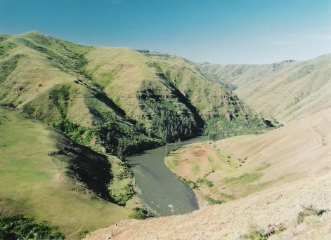 Grande Ronde RiverCanoeing · ~1h drivePhoto: Dsdugan, Public domain (via Wikimedia Commons)
Best time to visit Phillips Creek
Best months: April–June and September–October. Best months have typical highs of 55–85 °F, lows of 30 °F or warmer (32 °F where the station doesn't record snow), at most one snowy day and no more than 12 wet days.
Jan
40° / 24°
13 wet
Feb
45° / 25°
12 wet
Mar
53° / 28°
12 wet
Apr
60° / 32°
12 wet
May
69° / 39°
12 wet
Jun
76° / 44°
9 wet
Jul
86° / 47°
5 wet
Aug
87° / 46°
4 wet
Sep
78° / 40°
5 wet
Oct
63° / 32°
9 wet
Nov
48° / 28°
13 wet
Dec
39° / 23°
14 wet
Typical high / low (°F) and days with rain or snow, 1991–2020. Measured at Elgin, OR, 5 mi away at 2,697 ft. The station sits about 1,600 ft lower than this place, so expect it a little cooler here. This station doesn't record snowfall. Source: NOAA NCEI U.S. Climate Normals 1991–2020.
