McCoy Creek
- 19.4 mi
- distance
- 4,761 ft
- high point
- Jun–Sep
- best months
Is McCoy Creek open right now?
Closure in the area
There's a closure order in Wallowa-Whitman National Forest. It doesn't name McCoy Creek, so check the source for the area it covers.
Anthony Fire Area Closure
Agency closure covering Wallowa-Whitman National Forest · USFS · Wallowa-Whitman National Forest
PHASE B FIRE RESTRICTIONS WALLOW-WHITMAN NATIONAL FOREST
Agency alert covering Wallowa-Whitman National Forest · Order 06-16-00-25-01 · USFS · Wallowa-Whitman National Forest
PHASE A FIRE RESTRICTIONS Wallowa-Whitman NATIONAL FOREST
Agency alert covering Wallowa-Whitman National Forest · Order 06-16-00-25-00 · USFS · Wallowa-Whitman National Forest
As of · Source: USFS · Wallowa-Whitman National Forest. Agencies don't list every closure — check before you go.
McCoy Creek is a 19-mile paddling stretch near La Grande, Oregon, set within the La Grande Ranger District of the Wallowa-Whitman National Forest. The Forest Service manages the land along the creek, and the route is best approached with an eye to its intermittent nature, which can leave it dry in some seasons. Typical averages from a nearby weather station at Meacham put the average flow around 31 cubic feet per second, with a gradient of about 73.3 feet per mile. Summer is the most comfortable time to paddle. July and August bring typical highs near 79°F and only about four wet days a month, while winter months average around 17 wet days and lows in the low 20s. The Meacham station sits roughly 1,000 feet lower than the creek, so expect temperatures up the water to run cooler. Meadow Creek lies about 3 miles away for another paddling option. Frog Heaven Forest Camp and Spool Cart Campground are both within 10 miles for overnight stays.
Local outfitters
- White Pine Outfitters21 mi away
- Adventure-Fit28 mi away
Not on Roamze yet. Their page has how to reach them.
Source: Roamze catalog (indexable pages within 10 miles, PostGIS distance)
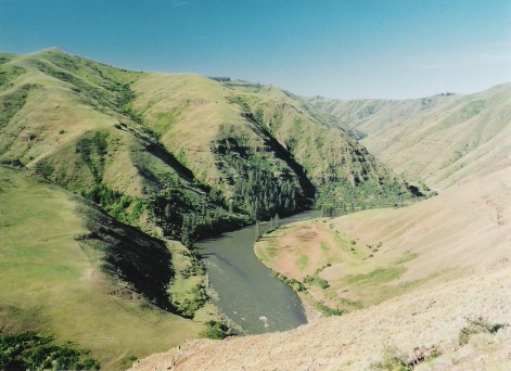 Grande Ronde RiverCanoeing · ~29 min drivePhoto: Dsdugan, Public domain (via Wikimedia Commons)
- Grande Ronde Boat LaunchBoat launch · ~45 min drive
 Birch CreekCanoeing · ~41 min drivePhoto: Bobjgalindo, CC BY-SA 4.0 (via Wikimedia Commons)
- Anthony Lake Boat LaunchBoat launch · ~48 min drive
 Umatilla RiverCanoeing · ~51 min drivePhoto: Bobjgalindo, CC BY-SA 4.0 (via Wikimedia Commons)
 Catherine CreekCanoeing · ~57 min drivePhoto: Ian Poellet (User:Werewombat), CC BY-SA 3.0 (via Wikimedia Commons)
 North Fork Umatilla RiverCanoeing · ~1h drivePhoto: United States Forest Service, Public domain (via Wikimedia Commons)
- Fly CreekCanoeing · ~20 min drive
- East Birch CreekCanoeing · ~23 min drive
- McKay CreekCanoeing · ~26 min drive
Best time to visit McCoy Creek
Best months: June–September. Best months have typical highs of 55–85 °F, lows of 30 °F or warmer (32 °F where the station doesn't record snow), at most one snowy day and no more than 12 wet days.
Jan
37° / 21°
17 wet
Feb
40° / 22°
15 wet
Mar
46° / 24°
17 wet
Apr
52° / 29°
15 wet
May
61° / 34°
14 wet
Jun
68° / 39°
9 wet
Jul
79° / 42°
4 wet
Aug
79° / 40°
4 wet
Sep
70° / 34°
6 wet
Oct
57° / 29°
11 wet
Nov
43° / 26°
15 wet
Dec
35° / 20°
17 wet
Typical high / low (°F) and days with rain or snow, 1991–2020. Measured at Meacham, OR, 14.7 mi away at 3,723 ft. The station sits about 1,000 ft lower than this place, so expect it a little cooler here. This station doesn't record snowfall. Source: NOAA NCEI U.S. Climate Normals 1991–2020.
