Rimrock Springs
- 1.0 mi
- round trip
- 143 ft
- climb
- 3,195 ft
- high point
- Out and back
- route
- May–Oct
- best months
Is Rimrock Springs open right now?
Closure in the area
There's a closure order in Ochoco National Forest. It doesn't name Rimrock Springs, so check the source for the area it covers.
Rowe Creek Complex Emergency Closure Order
Agency closure covering Ochoco National Forest · Order 06-07-26-04 · USFS · Ochoco National Forest
Blue-Green Algae Information
Agency alert covering Ochoco National Forest · USFS · Ochoco National Forest
Prescribed Fire information
Agency alert covering Ochoco National Forest · USFS · Ochoco National Forest
As of · Source: USFS · Ochoco National Forest. Agencies don't list every closure — check before you go.
Rimrock Springs is a short, easy hike in Oregon's Crooked River National Grassland, part of the Ochoco National Forest. The trail is about a mile long and rises roughly 90 feet from the trailhead, with the high point at about 3,195 feet. The climb is front-loaded, with the steepest stretch near the start, and the trail is natural-surfaced. The Forest Service manages the land, and the trailhead is named Rimrock Springs Trailhead. The most comfortable months for a visit are typically June through September. Typical averages from a nearby weather station at Grizzly, Oregon, show July and August highs in the low 80s with only three or four wet days a month, while winter brings highs around 40°F and a few snow days. The trail is open from June 1 through October 31, and the hike takes about half an hour. Bikes and horses are not allowed. Cole Loop Trail #854 lies about 1.6 miles away, and Ridge Rider - Warner Loop is about 4 miles off. Haystack Lake campground is about 4 miles away, and The Fourth Area climbing area is about 8 miles away.
Local outfitters
- Oregon Territory Outfitters28 mi away
- Expedition Old Growth28 mi away
Not on Roamze yet. Their page has how to reach them.
Best time to go · May–Oct
Best time to visit Rimrock Springs
Best months: May–October. Best months have typical highs of 55–85 °F, lows of 30 °F or warmer (32 °F where the station doesn't record snow), at most one snowy day and no more than 12 wet days.
Jan
42° / 23°
10 wet · 2 snow
Feb
45° / 23°
9 wet · 2 snow
Mar
51° / 25°
10 wet · 1 snow
Apr
57° / 27°
10 wet
May
66° / 33°
10 wet
Jun
73° / 37°
7 wet
Jul
84° / 41°
4 wet
Aug
83° / 41°
3 wet
Sep
75° / 36°
4 wet
Oct
62° / 30°
8 wet
Nov
48° / 26°
11 wet · 1 snow
Dec
41° / 22°
11 wet · 3 snow
Typical high / low (°F) and days with rain or snow, 1991–2020. Measured at Grizzly, OR, 6 mi away at 3,635 ft. Source: NOAA NCEI U.S. Climate Normals 1991–2020.
Keep exploring — more trails worth the drive
 Photo: Robert Ashworth from Bellingham, WA., USA, CC BY 2.0 (via Wikimedia Commons)
Grey Butte Trail
~13 min drive
1.31-mile out-and-back trail in Oregon with 966 ft of elevation gain.
Photo: Robert Ashworth from Bellingham, WA., USA, CC BY 2.0 (via Wikimedia Commons)Summit Trail
~16 min drive
0.76-mile out-and-back trail in Oregon with 765 ft of elevation gain.
 Photo: Ian Poellet, CC BY-SA 3.0 (via Wikimedia Commons)
Tam-A-Lau
~20 min drive
10.84-mile loop trail in Oregon with 1,674 ft elevation gain.
HIKE
RIDGE RIDER - COLE LOOP
~7 min drive
23.64-mile loop in Oregon with 2,797 ft elevation gain and loss.
 Photo: lamblukas, CC BY 2.0 (via Flickr)
Misery Ridge Trail
~17 min drive
1.88-mile out-and-back trail in Oregon with 2,140 ft gain and 3,296 ft max elevation.
Photo: Robert Ashworth from Bellingham, WA., USA, CC BY 2.0 (via Wikimedia Commons)Wolf Tree Trail
~16 min drive
2.18-mile out-and-back trail in Oregon with 610 ft elevation gain
HIKE
Cole Loop Trail #854
~3 min drive
19.4-mile out-and-back trail in Oregon with 1,903 ft elevation gain and loss.
HIKE
Cole Loop Trail #854
~11 min drive
22.34-mile out-and-back trail in Oregon with 3,366 ft elevation gain/loss.
Photo: lamblukas, CC BY 2.0 (via Flickr)Mesa Verde Trail
~17 min drive
0.74-mile out-and-back trail in Oregon with 1,045 ft elevation gain
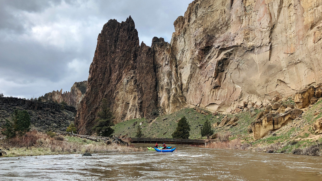 Photo: Northwest Rafting Company, CC BY 2.0 (via Flickr)
Homestead Trail
~17 min drive
0.86-mile out-and-back trail in Oregon with 195 ft elevation gain

