Island in Time Trail
- 0.4 mi
- one way
- 148 ft
- climb
- 2,414 ft
- high point
- Point to point
- route
- Mar–Jun, Sep–Oct
- best months
Is Island in Time Trail open right now?
No closures listed
The National Park Service lists no closures for John Day Fossil Beds National Monument.
As of · Source: NPS · John Day Fossil Beds National Monument. Agencies don't list every closure — check before you go.
The Island in Time Trail is a short, easy hike in John Day Fossil Beds National Monument in Oregon, managed by the National Park Service. The route is 0.38 miles long, with a total elevation gain of 148 feet, and it runs from a low point of about 2,257 feet to a high of about 2,414 feet. The climb is gentle, with the steepest stretch at about 10% grade near the start. Late spring and early fall are the most comfortable times to go. Typical averages from a nearby weather station show May highs around 73°F and September highs around 82°F, while July and August average in the low 90s. The trail makes an easy addition to a visit to the monument. The Blue Basin Loop Hike is about 0.2 miles away, and the Blue Basin Overlook Trail is about half a mile off. The Story in Stone Trail lies about 4 miles away.
Best time to go · Mar–Jun, Sep–Oct
Best time to visit Island in Time Trail
Best months: March–June and September–October. Best months have typical highs of 55–85 °F, lows of 30 °F or warmer (32 °F where the station doesn't record snow), at most one snowy day and no more than 12 wet days.
Jan
45° / 29°
Feb
50° / 29°
Mar
57° / 33°
Apr
63° / 37°
May
73° / 44°
Jun
81° / 49°
Jul
93° / 55°
Aug
92° / 53°
Sep
82° / 47°
Oct
68° / 39°
Nov
54° / 33°
Dec
46° / 27°
Typical high / low (°F) and days with rain or snow, 1991–2020. Measured at Dayville 8 Nw, OR, 2.7 mi away at 2,260 ft. This station doesn't record snowfall. Source: NOAA NCEI U.S. Climate Normals 1991–2020.
Keep exploring — more trails worth the drive
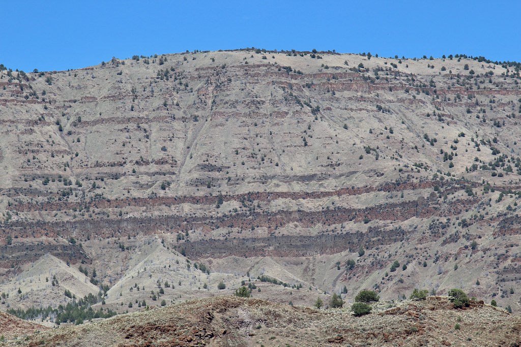 Photo: daveynin, CC BY 2.0 (via Flickr)
Story in Stone Trail
~7 min drive
0.32-mile loop trail in Oregon with 72 ft of elevation gain.
 Photo: xtaxta, CC BY 2.0 (via Wikimedia Commons)
Coffee Pot Trail #820B
~29 min drive
2.18-mile out-and-back trail in Oregon with 952 ft elevation gain
Photo: xtaxta, CC BY 2.0 (via Wikimedia Commons)BLACK CANYON
~32 min drive
9.84-mile out-and-back in Oregon with 2,770 ft gain and 6,315 ft max elevation.
HIKE
Field Trail
~38 min drive
16.44-mile out-and-back trail in Oregon with 3,128 ft elevation gain and loss.
Photo: xtaxta, CC BY 2.0 (via Wikimedia Commons)Owl Creek Trail #820A
~30 min drive
1.1-mile out-and-back trail in Oregon with 449 ft gain
 Photo: lamblukas, CC BY 2.0 (via Flickr)
Carroll Rim
~55 min drive
Carroll Rim is a 0.80-mile out-and-back trail in Oregon with 232 ft of elevation gain.
HIKE
Black Canyon
~30 min drive
13.20-mile out-and-back trail in Oregon with 692 ft gain and 2,342 ft loss.
HIKE
Mcclellan Mountain Trail #216
~44 min drive
9.92-mile out-and-back trail in Oregon with 1,268 ft gain.
 Photo: Moo.The.Cow, CC BY 2.0 (via Flickr)
Painted Hills Overlook
~54 min drive
0.32-mile out-and-back trail at Painted Hills Overlook in Oregon.
 Photo: U.S. Forest Service- Pacific Northwest Region, Public domain (via Wikimedia Commons)
Phlo Trail
~59 min drive
1.32-mile out-and-back trail in Oregon with 437 ft elevation gain
Map and trail data © OpenStreetMap contributors
