Interpretive Trail
- 0.9 mi
- round trip
- 160 ft
- climb
- 1,275 ft
- high point
- Out and back
- route
- Apr–Jun, Sep–Oct
- best months
Interpretive Trail is an easy hike on the Bureau of Land Management's Rogue River land unit in southwest Oregon, about 10 miles from Medford. The out-and-back route is roughly 1.8 miles long, with a total elevation gain of about 160 feet. The trail starts near 1,200 feet, climbs to about 1,275 feet, and returns to the starting point. The steepest section comes within the first 0.07 miles, with a grade of about 6 percent. Late spring and early fall are the most comfortable times to go. Typical averages from the Medford weather station, about 4.4 miles away, show May highs around 74°F and October highs around 70°F, while July and August average highs near 91°F. Several other trails lie close by. Upper Table Rock is about 1.8 miles away, and Lower Table Rock Trail is about 3.6 miles away. Paddlers can head to Little Butte Creek, about 5.7 miles off, and the Pali Trail is about 7.2 miles away.
Local outfitters
- The Fishin Hole Fly Shop12 mi away
- Ashland Family YMCA19 mi away
Not on Roamze yet. Their page has how to reach them.
Best time to go · Apr–Jun, Sep–Oct
Best time to visit Interpretive Trail
Best months: April–June and September–October. Best months have typical highs of 55–85 °F, lows of 30 °F or warmer (32 °F where the station doesn't record snow), at most one snowy day and no more than 12 wet days.
Jan
48° / 33°
13 wet · 1 snow
Feb
54° / 34°
11 wet · 1 snow
Mar
59° / 37°
13 wet · 1 snow
Apr
65° / 41°
11 wet
May
74° / 47°
9 wet
Jun
82° / 52°
4 wet
Jul
92° / 59°
2 wet
Aug
91° / 58°
2 wet
Sep
84° / 51°
3 wet
Oct
70° / 42°
7 wet
Nov
54° / 36°
13 wet
Dec
46° / 33°
14 wet · 1 snow
Typical high / low (°F) and days with rain or snow, 1991–2020. Measured at Medford Rogue Vly Ap, OR, 4.4 mi away at 1,297 ft. Source: NOAA NCEI U.S. Climate Normals 1991–2020.
Keep exploring — more trails worth the drive
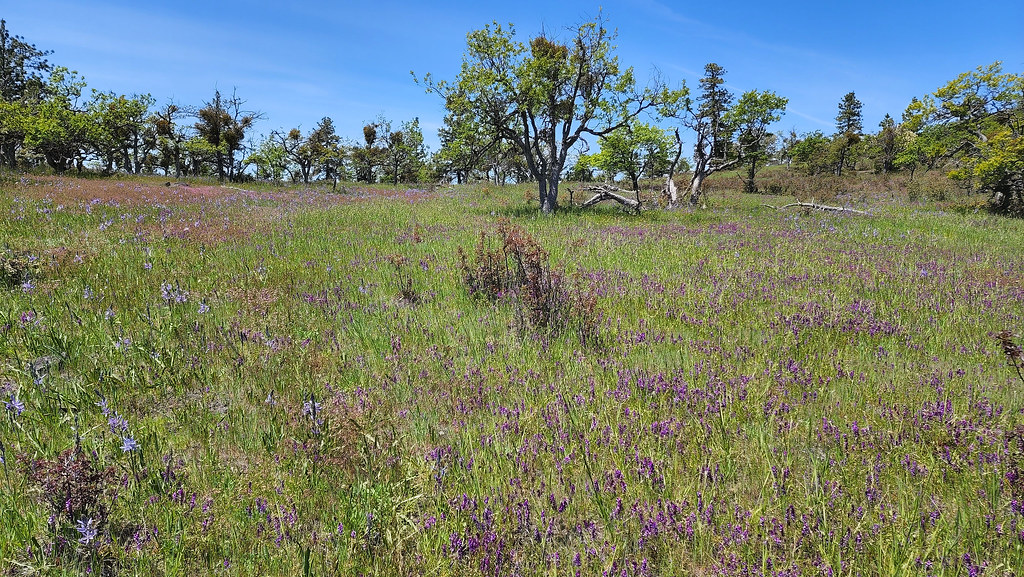 Photo: sloalan, Public Domain Dedication (CC0) (via Flickr)
Pali Trail
~12 min drive
2.4-mile out-and-back trail in Oregon with 805 ft elevation gain.
 Photo: sloalan, Public Domain Dedication (CC0) (via Flickr)
Twilight Trail
~13 min drive
3.58-mile out-and-back hike in Oregon with 1,307 ft gain and 2,666 ft max elevation.
Photo: sloalan, Public Domain Dedication (CC0) (via Flickr)CCC Trail
~13 min drive
2.26-mile out-and-back hike in Oregon with 605 ft elevation gain and loss.
 Photo: sloalan, Public Domain Dedication (CC0) (via Flickr)
Ponderosa Trail
~14 min drive
2.16-mile out-and-back hike in Oregon with 1,377 ft elevation gain
Photo: sloalan, Public Domain Dedication (CC0) (via Flickr)Oak Trail
~14 min drive
0.9-mile out-and-back trail in Oregon with 427 ft of elevation gain
HIKE
Upper Table Rock
~3 min drive
1.72-mile out-and-back trail at Upper Table Rock in Oregon
Photo: sloalan, Public Domain Dedication (CC0) (via Flickr)Lithic Trail
~14 min drive
2.5-mile out-and-back trail in Oregon with 775 ft elevation gain
HIKE
Lower Table Rock Trail
~6 min drive
Out-and-back climb to a scenic butte summit with valley views.
Photo: sloalan, Public Domain Dedication (CC0) (via Flickr)Manzanita Trail
~14 min drive
1.22-mile out-and-back trail in Oregon with 997 ft elevation gain
HIKE
Granite Bike Trail
~17 min drive
2.32-mile out-and-back bike trail in Oregon with 1,230 ft elevation gain.

Map and trail data © OpenStreetMap contributors
