Deschutes County Fairgrounds Expo Center
Campground
Campground · 4.6 mi from the trail
Dry Canyon Trail is a 2.4-mile easy hike on city land in Oregon, set at an elevation of about 2,900 feet. The trail is an out-and-back, with a steady climb of 484 feet one way to a high point of about 2,980 feet. The steepest section comes at about 1.3 miles, with a grade of 4 percent. Late spring and early fall are the most comfortable times to go. Typical averages from a nearby weather station in Redmond show May highs around 69°F and September highs near 79°F, while July and August average in the upper 80s. The trail sits close to several climbing areas, including Central Oregon Bouldering at 2.7 miles and the Main Area Boulders at 3.6 miles. For more walking, the River Trail and Rope-de-Dope Trail are both about 4.8 miles away.
Deschutes County Fairgrounds Expo Center
Campground
Places © OpenStreetMap contributors, Places © Overture Maps Foundation
More in SistersNot on Roamze yet. Their page has how to reach them.
 Downstream BouldersRock climbingPhoto: OSU Special Collections & Archives : Commons, No restrictions (via Wikimedia Commons)3.6 miWarmup-Hangout ZoneRock climbingPhoto: OSU Special Collections & Archives : Commons, No restrictions (via Wikimedia Commons)3.6 mi
 River TrailHikingPhoto: lamblukas, CC BY 2.0 (via Flickr)4.8 mi
 Rope-de-Dope TrailHikingPhoto: Kris Arnold from New York, USA, CC BY-SA 2.0 (via Wikimedia Commons)4.8 miRim Rock TrailHikingPhoto: Kris Arnold from New York, USA, CC BY-SA 2.0 (via Wikimedia Commons)4.9 mi
Source: Roamze catalog (indexable pages within 10 miles, PostGIS distance)
River TrailHiking · ~8 min drivePhoto: lamblukas, CC BY 2.0 (via Flickr)Rope-de-Dope TrailHiking · ~8 min drivePhoto: Kris Arnold from New York, USA, CC BY-SA 2.0 (via Wikimedia Commons) Canyon TrailHiking · ~9 min drivePhoto: lamblukas, CC BY 2.0 (via Flickr)Rim Rock TrailHiking · ~8 min drivePhoto: Kris Arnold from New York, USA, CC BY-SA 2.0 (via Wikimedia Commons)
 Mesa Verde TrailHiking · ~9 min drivePhoto: lamblukas, CC BY 2.0 (via Flickr)
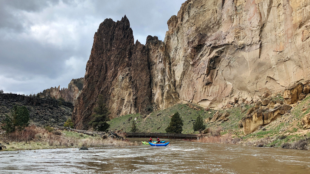 Homestead TrailHiking · ~9 min drivePhoto: Northwest Rafting Company, CC BY 2.0 (via Flickr)Misery Ridge TrailHiking · ~9 min drivePhoto: lamblukas, CC BY 2.0 (via Flickr)
 Wolf Tree TrailHiking · ~10 min drivePhoto: Robert Ashworth from Bellingham, WA., USA, CC BY 2.0 (via Wikimedia Commons)
Also worth it near here
Downstream BouldersRock climbing · ~6 min drivePhoto: OSU Special Collections & Archives : Commons, No restrictions (via Wikimedia Commons) Cline FallsWaterfall · ~7 min drivePhoto: Bonnie Moreland, CC0 (via Wikimedia Commons)
Best months: May–June and September–October. Best months have typical highs of 55–85 °F, lows of 30 °F or warmer (32 °F where the station doesn't record snow), at most one snowy day and no more than 12 wet days.
Jan
44° / 25°
9 wet
Feb
48° / 25°
7 wet
Mar
55° / 28°
8 wet
Apr
60° / 31°
8 wet
May
69° / 38°
8 wet
Jun
77° / 43°
5 wet
Jul
88° / 48°
3 wet
Aug
87° / 47°
3 wet
Sep
79° / 41°
4 wet
Oct
65° / 33°
6 wet
Nov
51° / 28°
8 wet
Dec
42° / 23°
9 wet
Typical high / low (°F) and days with rain or snow, 1991–2020. Measured at Redmond Roberts Fld, OR, 4.1 mi away at 3,043 ft. This station doesn't record snowfall. Source: NOAA NCEI U.S. Climate Normals 1991–2020.
Map and trail data © OpenStreetMap contributors
