320 Ridgeline
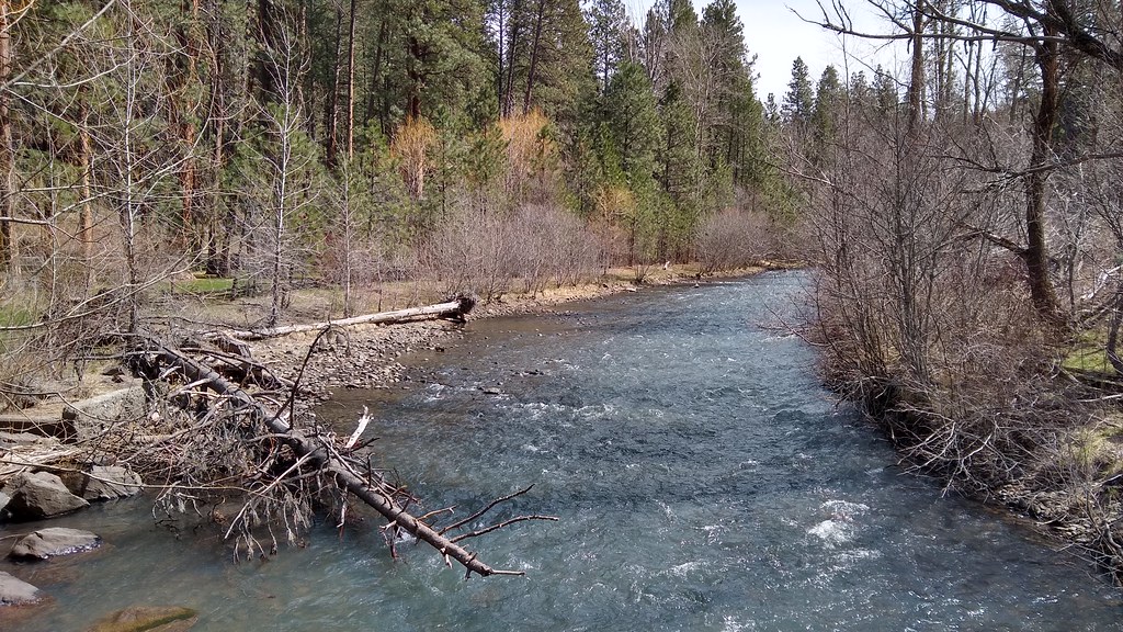
 Photo: mjfmjfmjf, CC BY 2.0 (via Flickr)
- 0.5 mi
- round trip
- 350 ft
- climb
- 5,209 ft
- high point
- Out and back
- route
- Jun–Sep
- best months
320 Ridgeline is a short, easy out-and-back hike in Oregon, about half a mile from the town of Perry. The route starts at roughly 5,069 feet and climbs to a high point of 5,209 feet, with a total gain of about 350 feet over the course of the trip. The climb is rolling, and the steepest stretch comes early, around 0.1 mile in, with a grade of about 12 percent. Summer is the most comfortable time to go. Typical averages from a nearby weather station in Meacham show July and August highs around 79°F with only about four wet days a month, while winter months bring highs in the mid-30s and rain on more than half the days. The hike takes about half an hour, and the trailhead sits close to several mountain biking routes, including 789 Doing Time and 716 Caffine, both about 0.1 mile away. Climbers can find the Concert Hall area about 3 miles off, and paddlers can head to Five Points Creek, about 4.4 miles away.
Local outfitters
- Adventure-Fit38 mi away
- Eagle Cap Mountain Guides41 mi away
Not on Roamze yet. Their page has how to reach them.
- 789 Doing TimeMountain biking0.1 mi
- 716 CaffineMountain biking0.1 mi
- 785 Fractured ZoneMountain biking0.2 mi
- Concert HallRock climbing3 mi
- Fiddlers HellRock climbing3 mi
- Five Points CreekCanoeing4.4 mi
- Summit Guard Station BunkhouseCamping7 mi
- Willow CreekCanoeing8.6 mi
Source: Roamze catalog (indexable pages within 10 miles, PostGIS distance)
- 724 Mera LoopHiking · ~2 min drivePhoto: mjfmjfmjf, CC BY 2.0 (via Flickr)
 North Fork Umatilla River TrailHiking · ~39 min drivePhoto: Forest Service Pacific Northwest Region, Public Domain Mark (via Flickr)
 Salmon Run TrailHiking · ~43 min drivePhoto: mjfmjfmjf, CC BY 2.0 (via Flickr)
- Grouse Mountain TrailHiking · ~41 min drive
- Joseph Branch Community TrailHiking · ~25 min drive
- Umatilla Rim TrailHiking · ~34 min drive
- Grande Ronde River TrailHiking · ~8 min drive
- Crib Point TrailHiking · ~45 min drive
- Rock Springs TrailHiking · ~33 min drive
- Murphy Creek TrailHiking · ~36 min drive
Best time to visit 320 Ridgeline
Best months: June–September. Best months have typical highs of 55–85 °F, lows of 30 °F or warmer (32 °F where the station doesn't record snow), at most one snowy day and no more than 12 wet days.
Jan
37° / 21°
17 wet
Feb
40° / 22°
15 wet
Mar
46° / 24°
17 wet
Apr
52° / 29°
15 wet
May
61° / 34°
14 wet
Jun
68° / 39°
9 wet
Jul
79° / 42°
4 wet
Aug
79° / 40°
4 wet
Sep
70° / 34°
6 wet
Oct
57° / 29°
11 wet
Nov
43° / 26°
15 wet
Dec
35° / 20°
17 wet
Typical high / low (°F) and days with rain or snow, 1991–2020. Measured at Meacham, OR, 17.2 mi away at 3,723 ft. The station sits about 1,500 ft lower than this place, so expect it a little cooler here. This station doesn't record snowfall. Source: NOAA NCEI U.S. Climate Normals 1991–2020.
Map and trail data © OpenStreetMap contributors
