Washita River
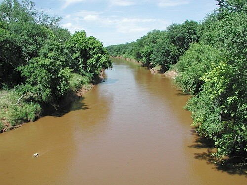 Photo: unknown NOAA employee, Public domain (via Wikimedia Commons)
- 208 mi
- distance
- 2,893 ft
- high point
- Mar–May, Sep–Nov
- best months
The Washita River is a canoeing route in western Oklahoma, running about 208 miles through land managed by the State Land Board on CLO Lands. It is a long stretch of water rather than a single trail, and the State Land Board oversees the land it crosses. Spring and fall are the most comfortable times to paddle. Typical averages from a nearby weather station show April highs around 71°F and October highs around 73°F, while July averages climb to about 94°F. Nearby, Black Kettle NG RD offers river fishing about 6 miles away. The NFS Trail and Battlefield Trail are both within about 8 miles for anyone who wants to add a hike to the trip.
Source: Roamze catalog (indexable pages within 10 miles, PostGIS distance)
 North Fork Red RiverCanoeing · ~1h 17m drivePhoto: Leaflet, CC BY-SA 4.0 (via Wikimedia Commons)
- Elk CreekCanoeing · ~1h 2m drive
- Sweetwater CreekCanoeing · ~1h 4m drive
- Deer CreekCanoeing · ~1h 19m drive
- Elm Fork Red RiverCanoeing · ~1h 24m drive
- Black Kettle Boating SiteBoat launch · ~23 min drive
- Skipout Lake Boating SiteBoat launch · ~31 min drive
- Spring Creek Boat RampBoat launch · ~33 min drive
- Lake Marvin Boating SiteBoat launch · ~1h 9m drive
Best time to visit Washita River
Best months: March–May and September–November. Best months have typical highs of 55–85 °F, lows of 30 °F or warmer (32 °F where the station doesn't record snow), at most one snowy day and no more than 12 wet days.
Jan
50° / 28°
Feb
53° / 30°
Mar
63° / 38°
Apr
71° / 47°
May
79° / 57°
Jun
88° / 66°
Jul
94° / 70°
Aug
91° / 68°
Sep
84° / 61°
Oct
73° / 49°
Nov
60° / 38°
Dec
50° / 29°
Typical high / low (°F) and days with rain or snow, 1991–2020. Measured at Cheyenne 6sw Mesonet, OK, 9.9 mi away at 2,277 ft. The station sits about 600 ft lower than this place, so expect it a little cooler here. This station doesn't record snowfall. Source: NOAA NCEI U.S. Climate Normals 1991–2020.
