Battlefield Trail
- 1.4 mi
- round trip
- 130 ft
- climb
- 1,990 ft
- high point
- Out and back
- route
- Mar–May, Sep–Nov
- best months
Is Battlefield Trail open right now?
Closure in the area
There's a closure order in Black Kettle National Grassland. It doesn't name Battlefield Trail, so check the source for the area it covers.
Temporary Area Closure for Youth Deer Hunt.
Agency closure covering Black Kettle National Grassland · Order 03-03-06-26-23 · USFS · Black Kettle National Grassland
No Winter Maintenance on Battlefield Trail
Park alert covering Washita Battlefield National Historic Site · NPS · Washita Battlefield National Historic Site
As of · Source: USFS · Black Kettle National Grassland. Agencies don't list every closure — check before you go.
Battlefield Trail is a short, easy hike of about 1.4 miles on land managed by the National Park Service, within Washita Battlefield National Historic Site in southwest Oklahoma. The route lies inside the site's boundaries, which overlap with Black Kettle National Grassland and Cibola National Forest. The trail is an out-and-back that rolls between a low of about 1,931 feet and a high of about 1,990 feet, with a total climb of about 130 feet. The steepest stretch comes at about 0.65 miles in, with a 9% grade. Because the route is only a little over 2 miles long, it works well as a quick walk rather than a full-day outing. Spring and fall are the most comfortable times to visit. Typical averages from a nearby weather station show October highs around 73°F and April highs around 71°F, while July highs average about 94°F. The closest neighbor is the NFS Trail, about 0.8 miles away. Blacktail Creek Campground sits roughly 4 miles off the trail, and the area's water sources are described in the page.
- NFS TrailHiking0.8 mi
- Black Kettle NG RDRiver fishing1.6 mi
- Croton CreekHiking6.5 mi
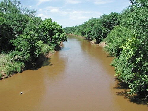 Washita RiverCanoeingPhoto: unknown NOAA employee, Public domain (via Wikimedia Commons)7.6 mi
- CREEK TRAIL SPURHiking8.8 mi
- Creek TrailHiking8.8 mi
- Black Kettle CampgroundCamping8.8 mi
- Upper LakeHiking9.3 mi
Source: Roamze catalog (indexable pages within 10 miles, PostGIS distance)
- NFS TrailHiking · ~1 min drive
- Croton CreekHiking · ~11 min drive
- CREEK TRAIL SPURHiking · ~15 min drive
- Creek TrailHiking · ~15 min drive
- Upper LakeHiking · ~16 min drive
- SkipoutHiking · ~18 min drive
- Centennial TrailHiking · ~40 min drive
- Riverside TrailHiking · ~41 min drive
- Lake MarvinHiking · ~56 min drive
- East Shore TrailHiking · ~56 min drive
Best time to visit Battlefield Trail
Best months: March–May and September–November. Best months have typical highs of 55–85 °F, lows of 30 °F or warmer (32 °F where the station doesn't record snow), at most one snowy day and no more than 12 wet days.
Jan
50° / 28°
Feb
53° / 30°
Mar
63° / 38°
Apr
71° / 47°
May
79° / 57°
Jun
88° / 66°
Jul
94° / 70°
Aug
91° / 68°
Sep
84° / 61°
Oct
73° / 49°
Nov
60° / 38°
Dec
50° / 29°
Typical high / low (°F) and days with rain or snow, 1991–2020. Measured at Cheyenne 6sw Mesonet, OK, 5.2 mi away at 2,277 ft. This station doesn't record snowfall. Source: NOAA NCEI U.S. Climate Normals 1991–2020.
Closures we've recorded since August 2026
No Winter Maintenance on Battlefield Trail
Washita Battlefield National Historic Site · seen Oct 31, 2026, no lift recorded · National Park Service
