Taloka Creek
- 10.2 mi
- distance
- 540 ft
- high point
- Feb–May, Oct–Nov
- best months
Taloka Creek is a 10-mile paddling stretch near Stigler, Oklahoma, about 2.7 miles from town. It is an intermittent waterway, and it may run dry in some seasons. USGS models an average flow of about 58 cubic feet per second and a gradient of about 5.2 feet per mile. Spring and fall are the most comfortable times to paddle. Typical averages from a nearby weather station show April highs around 73°F and October highs around 76°F, while July and August average in the mid-90s. Little Sans Bois Creek, another paddling route, lies about 6.8 miles away.
Source: Roamze catalog (indexable pages within 10 miles, PostGIS distance)
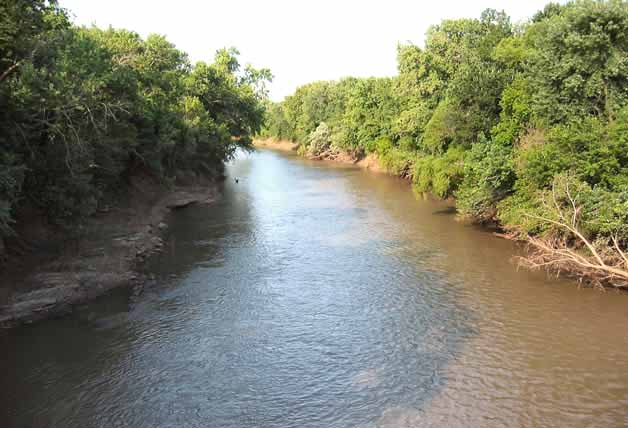 Neosho RiverCanoeing · ~1h 9m drivePhoto: Public domain (via Wikimedia Commons)
- Reeve's Slough Boat RampBoat launch · ~21 min drive
- Strayhorn LandingFloat trip · ~39 min drive
- Little Sans Bois CreekCanoeing · ~12 min drive
- Stoney Point Boat RampBoat launch · ~22 min drive
- Snake CreekFloat trip · ~45 min drive
- South Fork Dirty CreekCanoeing · ~17 min drive
- Tuff Boat RampBoat launch · ~23 min drive
- Pettit BayFloat trip · ~58 min drive
- Owl CreekCanoeing · ~28 min drive
Best time to visit Taloka Creek
Best months: February–May and October–November. Best months have typical highs of 55–85 °F, lows of 30 °F or warmer (32 °F where the station doesn't record snow), at most one snowy day and no more than 12 wet days.
Jan
50° / 25°
8 wet · 1 snow
Feb
56° / 30°
7 wet · 1 snow
Mar
64° / 38°
9 wet
Apr
73° / 46°
9 wet
May
80° / 56°
11 wet
Jun
89° / 65°
9 wet
Jul
96° / 69°
7 wet
Aug
95° / 67°
6 wet
Sep
88° / 60°
7 wet
Oct
76° / 48°
9 wet
Nov
63° / 37°
9 wet
Dec
53° / 29°
9 wet · 1 snow
Typical high / low (°F) and days with rain or snow, 1991–2020. Measured at Webbers Falls 5 Wsw, OK, 13.7 mi away at 550 ft. Source: NOAA NCEI U.S. Climate Normals 1991–2020.
