Saline Creek
- 22.0 mi
- distance
- 944 ft
- high point
- Mar–May, Sep–Nov
- best months
Saline Creek is a canoeing spot in Oklahoma, about 22 miles away on CLO Lands managed by the State Land Board. It is a paddling destination rather than a trail, so there is no climb to plan around, and the route is measured in miles of water rather than steps on foot. Spring and fall are the most comfortable times to paddle. Typical averages from a nearby weather station at Upper Spavinaw Port show April highs around 72°F and October highs around 73°F, while July and August average about 91°F. The closest nearby spot is The Water Front, a climbing area about 7 miles away.
Source: Roamze catalog (indexable pages within 10 miles, PostGIS distance)
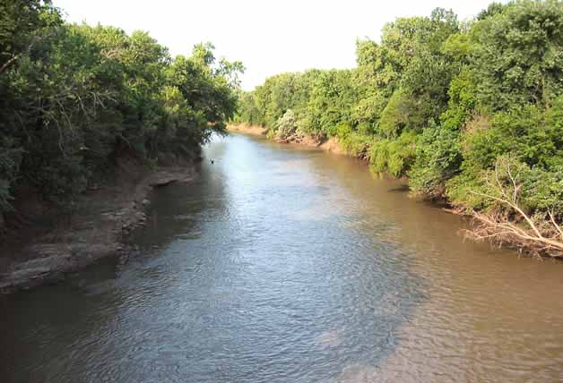 Neosho RiverCanoeing · ~57 min drivePhoto: Public domain (via Wikimedia Commons)
- Swepco Lake Boat RampBoat launch · ~41 min drive
- Pettit BayFloat trip · ~1h 5m drive
 Illinois RiverCanoeing · ~1h 16m drivePhoto: US Army Corps of Engineers, Public domain (via Wikimedia Commons)
- Long Bay LandingBoat launch · ~53 min drive
- Elk Creek LandingFloat trip · ~1h 5m drive
- Spring CreekCanoeing · ~19 min drive
- Carters LandingBoat launch · ~60 min drive
- Snake CreekFloat trip · ~1h 17m drive
- Tyner CreekCanoeing · ~40 min drive
Best time to visit Saline Creek
Best months: March–May and September–November. Best months have typical highs of 55–85 °F, lows of 30 °F or warmer (32 °F where the station doesn't record snow), at most one snowy day and no more than 12 wet days.
Jan
49° / 23°
Feb
54° / 26°
Mar
63° / 34°
Apr
72° / 43°
May
78° / 53°
Jun
86° / 62°
Jul
91° / 67°
Aug
91° / 65°
Sep
83° / 56°
Oct
73° / 43°
Nov
62° / 34°
Dec
52° / 26°
Typical high / low (°F) and days with rain or snow, 1991–2020. Measured at Upper Spavinaw Port, OK, 8.6 mi away at 795 ft. This station doesn't record snowfall. Source: NOAA NCEI U.S. Climate Normals 1991–2020.
