Lake Ashtabula
- 28.0 mi
- one way
- 683 ft
- climb
- 1,399 ft
- high point
- Point to point
- route
- May–Oct
- best months
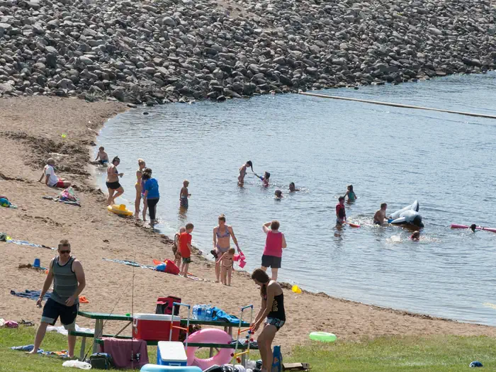
Lake Ashtabula is a hike in north-central North Dakota, managed by the Army Corps of Engineers and about 6 miles from the town of Rogers. The route is a point-to-point trail of roughly 28 miles with a one-way climb of 683 feet, so a round trip totals about 1,366 feet. The high point is about 1,400 feet and the low about 1,230, with the steepest stretch near 24.5 miles at a 12% grade. Summer is the most comfortable time to go. Typical averages from a nearby weather station in Valley City show July highs around 81°F and lows near 57°F, while January highs sit near 18°F. Bikes and horses are not allowed on this trail. The closest nearby spot is Mel Rieman Rec, a lake fishing area about a mile away. Valley City, another hike, lies roughly 10 miles off.
 Mel Rieman RecLake fishing1.2 mi
 Valley CityHikingPhoto: Magicpiano, CC BY-SA 4.0 (via Wikimedia Commons)9.9 mi
Source: Roamze catalog (indexable pages within 10 miles, PostGIS distance)
- Valley CityHiking · ~17 min drivePhoto: Magicpiano, CC BY-SA 4.0 (via Wikimedia Commons)
- North ClausenHiking · ~43 min drive
- Sorby SegmentHiking · ~54 min drive
- Kathryn To Clausen SpringsHiking · ~44 min drive
- North Country TrailHiking · ~59 min drive
- Redetzke Ridge TrailHiking · ~59 min drive
- Willow Slough TrailHiking · ~59 min drive
- River View TrailHiking · ~59 min drive
- Valley View TrailHiking · ~60 min drive
- Nelson 80 TrailHiking · ~60 min drive
Best time to visit Lake Ashtabula
Best months: May–October. Best months have typical highs of 55–85 °F, lows of 30 °F or warmer (32 °F where the station doesn't record snow), at most one snowy day and no more than 12 wet days.
Jan
18° / -2°
5 wet
Feb
23° / 1°
5 wet
Mar
36° / 14°
5 wet
Apr
53° / 28°
6 wet
May
67° / 41°
9 wet
Jun
76° / 53°
10 wet
Jul
81° / 57°
9 wet
Aug
80° / 54°
7 wet
Sep
71° / 45°
6 wet
Oct
56° / 32°
6 wet
Nov
38° / 18°
5 wet
Dec
24° / 6°
5 wet
Typical high / low (°F) and days with rain or snow, 1991–2020. Measured at Valley City 3 Nnw, ND, 7 mi away at 1,210 ft. This station doesn't record snowfall. Source: NOAA NCEI U.S. Climate Normals 1991–2020.
