Harmon Lake Recreational Trail
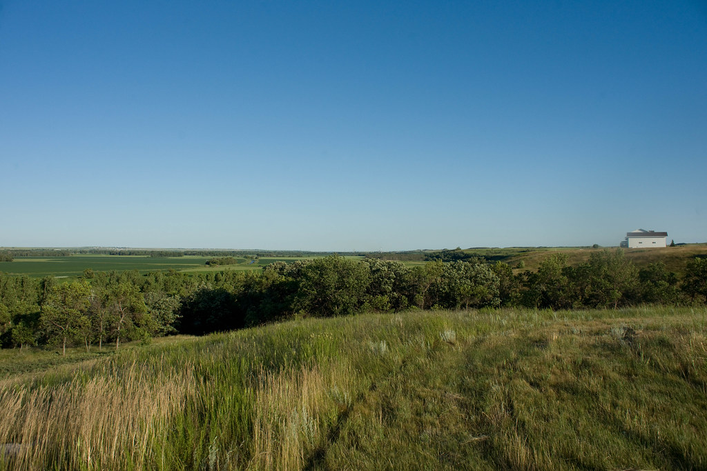 Photo: In memoriam afiler, CC BY-SA 2.0 (via Flickr)
- 9.0 mi
- loop
- 219 ft
- climb
- 1,773 ft
- high point
- Loop
- route
- May–Oct
- best months
Clear at last check
Weather is good · OpenWeather · checked 17 h ago
Harmon Lake Recreational Trail is a 9-mile loop in North Dakota, about a mile from the town of Harmon. The trail rises from 1,741 feet to 1,773 feet, with the steepest stretch at about 5.9 miles in, where the grade reaches 9 percent. The climb is moderate, and the route is rated as such. Summer is the most comfortable time to go. Typical averages from a nearby weather station in Mandan show July highs around 83°F with lows near 58°F, while winter highs stay in the 20s. Dogs are allowed on a leash, and bikes are permitted. Horses are not. The trail is open year-round, and the closest neighbor is Chutes and Ladders, under a mile away. Would You Rather, a climbing area, and Dogwood Loop are both within about 10 miles.
Best time to go · May–Oct
Best time to visit Harmon Lake Recreational Trail
Best months: May–October. Best months have typical highs of 55–85 °F, lows of 30 °F or warmer (32 °F where the station doesn't record snow), at most one snowy day and no more than 12 wet days.
Jan
22° / 3°
5 wet
Feb
27° / 6°
4 wet
Mar
40° / 18°
5 wet
Apr
54° / 30°
7 wet
May
67° / 43°
10 wet
Jun
76° / 53°
10 wet
Jul
83° / 58°
9 wet
Aug
82° / 56°
7 wet
Sep
72° / 46°
6 wet
Oct
56° / 32°
5 wet
Nov
40° / 19°
4 wet
Dec
27° / 8°
5 wet
Typical high / low (°F) and days with rain or snow, 1991–2020. Measured at Mandan Exp Stn, ND, 9.4 mi away at 1,750 ft. This station doesn't record snowfall. Source: NOAA NCEI U.S. Climate Normals 1991–2020.
Keep exploring — more trails worth the drive
 Photo: Magicpiano, CC BY-SA 4.0 (via Wikimedia Commons)
Fishing Loop
~15 min drive
0.99-mile out-and-back fishing trail in North Dakota with 144 ft gain.
 Photo: Barbara Brannon, CC BY 2.0 (via Flickr)
North Country National Scenic Trail
~1h 18m drive
11.81-mile out-and-back trail on North Country National Scenic Trail in North Dakota
HIKE
-100.89570809946883
~1h 10m drive
Moderate 7-mile out-and-back trail through North Dakota prairie and badlands.
HIKE
North Country National Scenic Trail (Nd)
~1h 19m drive
447.36-mile point-to-point trail in North Dakota with 1,541 ft gain.
 Photo: Magicpiano, CC BY-SA 4.0 (via Wikimedia Commons)
Dogwood Loop
~16 min drive
1.86-mile loop in North Dakota with 143 ft gain.
HIKE
Roughrider Trail
~33 min drive
22.13-mile out-and-back trail in North Dakota with 235 ft gain.
Photo: Magicpiano, CC BY-SA 4.0 (via Wikimedia Commons)Bridge Loop
~19 min drive
0.95-mile loop trail in North Dakota with 122 ft elevation gain.
HIKE
Chain Of Lakes Recreation Area
~52 min drive
11.81-mile out-and-back trail in North Dakota with 288 ft elevation gain.
 Photo: Stabbur's Master, CC BY-SA 2.0 (via Flickr)
Mato-tope Trail
~23 min drive
1.37-mile out-and-back trail in North Dakota with 187 ft elevation gain.
HIKE
Mcclusky Canal
~53 min drive
50.07-mile point-to-point trail in North Dakota with 450 ft elevation gain.
Map and trail data © OpenStreetMap contributors
