Mountain · 1 route
The Pinnacle
4,838 ft · North Carolina
- Summit
- 4,838 ft
- Routes
- 1 way up
Route up The Pinnacle
About The Pinnacle
The Pinnacle is a summit of 4,838 feet in the Nantahala Ranger District of the National Forests in North Carolina, about 4 miles from the town of Sylva. The land also falls within an NC Land and Water Fund Project. Summer is the most comfortable time to go. Typical averages from the nearby Newfound Gap, TN weather station, at a similar elevation, show July highs around 74°F with lows near 57°F, while winter highs stay in the upper 30s. The Pinnacle Trail starts just 0.1 mile away, and the West Fork Trail and East Fork Trail are both within about a mile. For paddling, Scott Creek is about 3 miles off.
Forecast on The Pinnacle
Daily highs and lows, wind and the chance of precipitation at the summit and route start for the next 7 days, from the Open-Meteo model.
Questions about The Pinnacle
How tall is The Pinnacle?
4,838 ft (1,475 m).
How many routes go to the summit of The Pinnacle?
One: Pinnacle Trail.
Mountains nearby
- Waterrock Knob6,289 ft · North Carolina2 routes4.3 mi away
- Browning Knob6,253 ft · North Carolina2 routes4.5 mi away
 Mount Lyn Lowry6,241 ft · North Carolina1 route5.6 mi awayPhoto: Thomson200, CC0 (via Wikimedia Commons)
- Piney Ridge Knob4,712 ft · North Carolina1 route7.2 mi away
- Plott Balsam6,095 ft · North Carolina1 route7.2 mi away
- Wesner Bald5,643 ft · North Carolina1 route8.3 mi away
Facts about this place
When to go
Best time to go: May–Sep. The mildest months here, with typical highs of 66–74°F and lows of 47–57°F.
Typical monthly averages (not a forecast) from the Newfound Gap, TN weather station, 18 mi away. High / low in °F.
- Jan39° high22° low
- Feb42° high25° low
- Mar49° high30° low
- Apr58° high38° low
- May66° high47° low
- Jun71° high54° low
- Jul74° high57° low
- Aug72° high56° low
- Sep68° high51° low
- Oct59° high41° low
- Nov50° high32° low
- Dec43° high27° low
Where it is
- Nantahala Ranger District · Ranger district
- National Forests in North Carolina · National forest
- NC Land and Water Fund Project · Public land
- Nearest town
- Sylva, North Carolina · 3.9 mi
Source: USFS EDW boundaries; NIFC Jurisdictional Units; USGS GNIS populated places
Conditions
Active alerts for Nantahala Ranger District as of Oct 9, 2026:
Arrowood Glade Alcohol Prohibitions- Nantahala Ranger District
information · posted Aug 24, 2026
Finger Lake Area Prohibitions- Nantahala Ranger District
information · posted Aug 24, 2026
Connely Creek Road (NFSR 86) Closure
information · posted Aug 24, 2026
Source: USFS forest alerts
Nearby
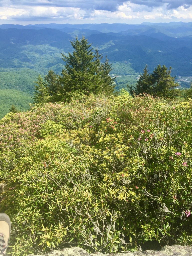 Pinnacle TrailHikingPhoto: w_lemay, Public Domain Dedication (CC0) (via Flickr)0.1 mi
 West Fork TrailHikingPhoto: w_lemay, Public Domain Dedication (CC0) (via Flickr)0.8 mi
- East Fork TrailHikingPhoto: w_lemay, Public Domain Dedication (CC0) (via Flickr)1.1 mi
- Scott CreekCanoeing2.8 mi
- Bunches CreekCanoeing7.8 mi
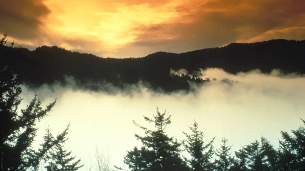 Tow String Horse CampCampingPhoto: Recreation.gov (RIDB) / public domain9.3 mi
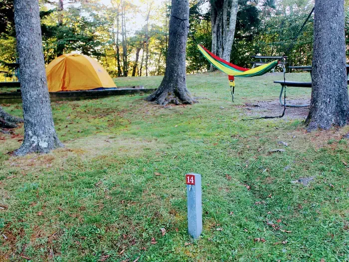 Balsam Mountain CampgroundCampingPhoto: Recreation.gov (RIDB) / public domain9.4 mi
- Savannah CreekCanoeing9.7 mi
Source: Roamze catalog (indexable pages within 10 miles, PostGIS distance)
Is The Pinnacle open right now?
Closure in the area
There's a closure order in National Forests in North Carolina. It doesn't name The Pinnacle, so check the source for the area it covers (2 listed).
Rainbow Springs Road closed for reconstruction
Agency closure covering National Forests in North Carolina · USFS · National Forests in North Carolina
Closures in anticipation of Hurricane Isaias
Agency closure covering National Forests in North Carolina · USFS · National Forests in North Carolina
Siddie Fields Day Use Area closed for improvements
Agency alert covering National Forests in North Carolina · USFS · National Forests in North Carolina
Pisgah National Forest Driving Safety Alert
Agency alert covering National Forests in North Carolina · USFS · National Forests in North Carolina
As of · Source: USFS · National Forests in North Carolina. Agencies don't list every closure — check before you go.
Best time to visit The Pinnacle
Best months: September–October. Best months have typical highs of 55–85 °F, lows of 30 °F or warmer (32 °F where the station doesn't record snow), at most one snowy day and no more than 12 wet days.
Jan
39° / 22°
13 wet
Feb
42° / 25°
12 wet
Mar
49° / 30°
13 wet
Apr
58° / 38°
13 wet
May
66° / 47°
15 wet
Jun
71° / 54°
16 wet
Jul
74° / 57°
16 wet
Aug
72° / 56°
14 wet
Sep
68° / 51°
11 wet
Oct
59° / 41°
10 wet
Nov
50° / 32°
10 wet
Dec
43° / 27°
12 wet
Typical high / low (°F) and days with rain or snow, 1991–2020. Measured at Newfound Gap, TN, 17.9 mi away at 5,040 ft. This station doesn't record snowfall. Source: NOAA NCEI U.S. Climate Normals 1991–2020.
