Big Stamp
- 4,437 ft
- summit
- 1
- way up
Is Big Stamp open right now?
Closure in the area
There's a closure order in National Forests in North Carolina. It doesn't name Big Stamp, so check the source for the area it covers (2 listed).
Maple Sally Road Closure
Agency closure covering National Forests in North Carolina · USFS · National Forests in North Carolina
Table Rock Road construction starts Nov. 2, 2026
Agency closure covering National Forests in North Carolina · USFS · National Forests in North Carolina
Temporary Closure - The Elk Falls Trail
Agency alert covering National Forests in North Carolina · USFS · National Forests in North Carolina
Rainbow Springs Road closed for reconstruction
Agency alert covering National Forests in North Carolina · USFS · National Forests in North Carolina
Siddie Fields Day Use Area closed for improvements
Agency alert covering National Forests in North Carolina · USFS · National Forests in North Carolina
As of · Source: USFS · National Forests in North Carolina. Agencies don't list every closure — check before you go.
Big Stamp is a summit of 4,437 feet in the Tusquittee Ranger District of the National Forests in North Carolina, about 4 miles from the town of Andrews. The closest neighbors are Phillips Ridge, a hike about 1.4 miles away, and Bald Springs, a hike about 1.6 miles away. Fires Creek, a canoeing spot, is about 1.6 miles off, and Jackrabbit Mountain Campground is about 9 miles away.
Conditions and forecast
Daily highs and lows, wind and the chance of precipitation at the summit and route start for the next 7 days, from the Open-Meteo model.
- Summit elevation
- 4,437 ft
Elevation from USGS 3D Elevation Program terrain data (about 10 m resolution).
Map © Mapbox © OpenStreetMap contributors Questions about Big Stamp
How tall is Big Stamp?
4,437 ft (1,352 m).
How many routes go to the summit of Big Stamp?
One: Rockhouse Creek.
When is the best time to climb Big Stamp?
Year-round.
- Julie High Top3,375 ft · North Carolina1 route2.7 mi away
- Big Peachtree Bald4,185 ft · North Carolina1 route2.8 mi away
- Beal Knob4,492 ft · North Carolina1 route3.2 mi away
- Chestnut Stomp Knob4,407 ft · North Carolina1 route3.2 mi away
- Johnson Bald4,947 ft · North Carolina2 routes3.8 mi away
- Sassafras Knob4,678 ft · North Carolina2 routes4.0 mi away
- PHILLIPS RIDGEHiking1.4 mi
- Fires CreekCanoeing1.6 mi
- Bald SpringsHiking1.6 mi
- Rockhouse CreekHiking1.9 mi
- Valley RiverCanoeing5.8 mi
- Peachtree CreekCanoeing7 mi
- Nantahala Lake Dispersed Camping Site - Lake AccesCamping8.6 mi
 Jackrabbit Mountain CampgroundCampingPhoto: Miles Buddy, CC BY-SA 3.0 (via Wikimedia Commons)9.2 mi
Source: Roamze catalog (indexable pages within 10 miles, PostGIS distance)
 Wesser BaldSummit · ~28 min drivePhoto: Chuck Williams, CC BY 3.0 (via Wikimedia Commons)
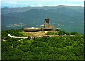 Brasstown BaldSummit · ~31 min drivePhoto: Public domain (via Wikimedia Commons)
- Whiteoak KnobSummit · ~2 min drive
- Julie High TopSummit · ~5 min drive
- Big Peachtree BaldSummit · ~5 min drive
- Graveyard High TopSummit · ~5 min drive
- Defeat KnobSummit · ~5 min drive
- Shortoff KnobSummit · ~5 min drive
- Beal KnobSummit · ~5 min drive
- Chestnut Stomp KnobSummit · ~6 min drive
