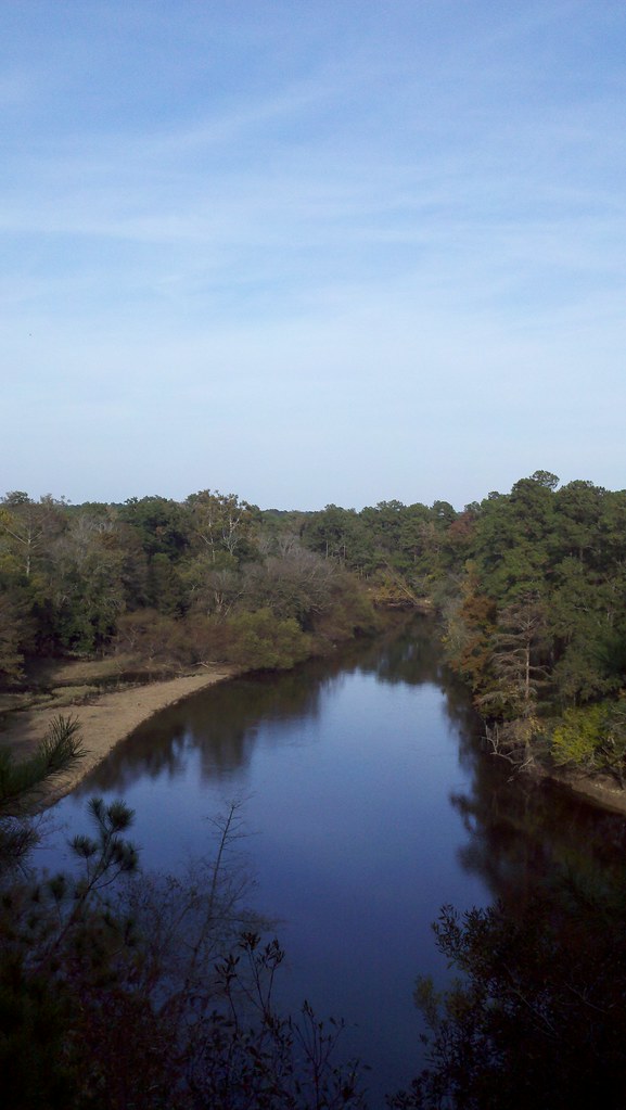
Falling Creek
- 15.0 mi
- distance
- 116 ft
- high point
- Sep–May
- best months
Falling Creek is a 15-mile paddling stretch near La Grange, North Carolina, about a mile from the town of Parrots. It runs on average about 60 cubic feet per second and drops roughly 6 feet per mile. The flow is intermittent, and the creek may run dry in some seasons, so plan around that when you go. Spring and fall are the most comfortable times to paddle. Typical averages from a nearby weather station in Kinston show October highs around 76°F with lows near 53°F, while July highs average about 91°F. Other paddling routes lie within about 10 miles. Bear Creek is about 6.6 miles away, Wheat Swamp about 7.3 miles, and the Mountains-to-Sea Trail: Segment 11A-16A about 8.3 miles. Southwest Creek is about 9.1 miles away.
- Bear CreekCanoeing6.6 mi
- Wheat SwampCanoeing7.3 mi
- Mountains-to-Sea Trail: Segment 11A-16ACanoeing8.3 mi
- Southwest CreekCanoeing9.1 mi
Source: Roamze catalog (indexable pages within 10 miles, PostGIS distance)
- Bear CreekCanoeing · ~11 min drive
- State Park Canoe Tie-UoBoat launch · ~19 min drive
- Wheat SwampCanoeing · ~13 min drive
- Cliffs of the Neusse Canoe LaunchBoat launch · ~20 min drive
- Mountains-to-Sea Trail: Segment 11A-16ACanoeing · ~14 min drive
- Prices landing boating access areaBoat launch · ~23 min drive
- Southwest CreekCanoeing · ~16 min drive
- Goldsborough Boating Access AreaBoat launch · ~31 min drive
- Stoney CreekCanoeing · ~27 min drive
- Smithfield BAABoat launch · ~1h 7m drive
Best time to visit Falling Creek
Best months: September–May. Best months have typical highs of 55–85 °F, lows of 30 °F or warmer (32 °F where the station doesn't record snow), at most one snowy day and no more than 12 wet days.
Jan
56° / 35°
8 wet
Feb
60° / 37°
8 wet
Mar
67° / 42°
8 wet
Apr
75° / 51°
8 wet
May
82° / 59°
8 wet
Jun
88° / 68°
9 wet
Jul
91° / 71°
11 wet
Aug
89° / 70°
10 wet
Sep
84° / 64°
8 wet
Oct
76° / 53°
7 wet
Nov
67° / 44°
7 wet
Dec
59° / 38°
8 wet
Typical high / low (°F) and days with rain or snow, 1991–2020. Measured at Kinston Ag Rsch, NC, 7.7 mi away at 60 ft. Source: NOAA NCEI U.S. Climate Normals 1991–2020.