KOA Kampground
Campground
Campground · 5.2 mi from the trail
Summit Trail is a moderate hike of about 1.8 miles one way, with a total elevation gain of about 1,500 feet. The trail is an out-and-back, and the climb is front-loaded, with the steepest stretch at about 0.4 miles from the start. The route runs from a low point of about 4,600 feet to a high point of about 5,500 feet, with the full round trip gaining and losing roughly 2,090 feet. The nearest town is Pottertown, about 1.7 miles away. For comfortable weather, late summer into early fall is the best bet. Typical averages from the Beech Mtn weather station, about 14 miles away and at a similar elevation, show September highs near 63°F with lows around 51°F, and October sees the fewest wet days of the year, with typical averages from a nearby weather station. Beech Tree Trail and Backcountry Trail both start within a quarter mile. For time on the water, the South Fork New River is about 5.5 miles away and Cove Creek about 6.2 miles away.
KOA Kampground
Campground
Originals Only Gallery
Gallery
Places © OpenStreetMap contributors
More in JeffersonNot on Roamze yet. Their page has how to reach them.
Daily highs and lows, wind and the chance of precipitation at the summit and route start for the next 7 days, from the Open-Meteo model.
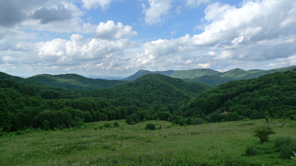 Beech Tree TrailHikingPhoto: ionntag, CC BY 2.0 (via Flickr)0.1 miBackcountry TrailHikingPhoto: ionntag, CC BY 2.0 (via Flickr)0.2 mi
 Boone United TrailHikingPhoto: Nathan Adams, CC BY-SA 3.0 (via Wikimedia Commons)7.5 mi
 Roan CreekCanoeingPhoto: Brian Stansberry, CC BY 3.0 (via Wikimedia Commons)8 mi
Source: Roamze catalog (indexable pages within 10 miles, PostGIS distance)
Beech Tree TrailHiking · Next doorPhoto: ionntag, CC BY 2.0 (via Flickr)Backcountry TrailHiking · Next doorPhoto: ionntag, CC BY 2.0 (via Flickr) Mountains-to-Sea TrailHiking · ~21 min drivePhoto: pedrik, CC BY 2.0 (via Flickr)
 Mountains-to-Sea TrailHiking · ~20 min drivePhoto: Larry Lamb, CC BY-SA 3.0 (via Wikimedia Commons)Backcountry TrailHiking · ~1 min drivePhoto: ionntag, CC BY 2.0 (via Flickr)Mountains-to-Sea TrailHiking · ~20 min drivePhoto: Larry Lamb, CC BY-SA 3.0 (via Wikimedia Commons)Boone United TrailHiking · ~13 min drivePhoto: Nathan Adams, CC BY-SA 3.0 (via Wikimedia Commons)
 Mountains-to-Sea TrailHiking · ~19 min drivePhoto: pmuellr, CC BY 2.0 (via Flickr)
Best months: September–October. Best months have typical highs of 55–85 °F, lows of 30 °F or warmer (32 °F where the station doesn't record snow), at most one snowy day and no more than 12 wet days.
Jan
35° / 20°
19 wet · 9 snow
Feb
37° / 22°
18 wet · 9 snow
Mar
43° / 28°
17 wet · 6 snow
Apr
53° / 36°
16 wet · 2 snow
May
61° / 46°
17 wet
Jun
66° / 54°
17 wet
Jul
69° / 57°
18 wet
Aug
68° / 56°
16 wet
Sep
63° / 51°
12 wet
Oct
55° / 41°
12 wet · 1 snow
Nov
46° / 31°
13 wet · 3 snow
Dec
39° / 24°
18 wet · 6 snow
Typical high / low (°F) and days with rain or snow, 1991–2020. Measured at Beech Mtn, NC, 14.3 mi away at 5,053 ft. Source: NOAA NCEI U.S. Climate Normals 1991–2020.
About 1.8 mi round trip.
About 2,090 ft of climbing round trip.
It is rated moderate.
About 1.5 hours round trip.
Map and trail data © OpenStreetMap contributors
