Sedge Trail
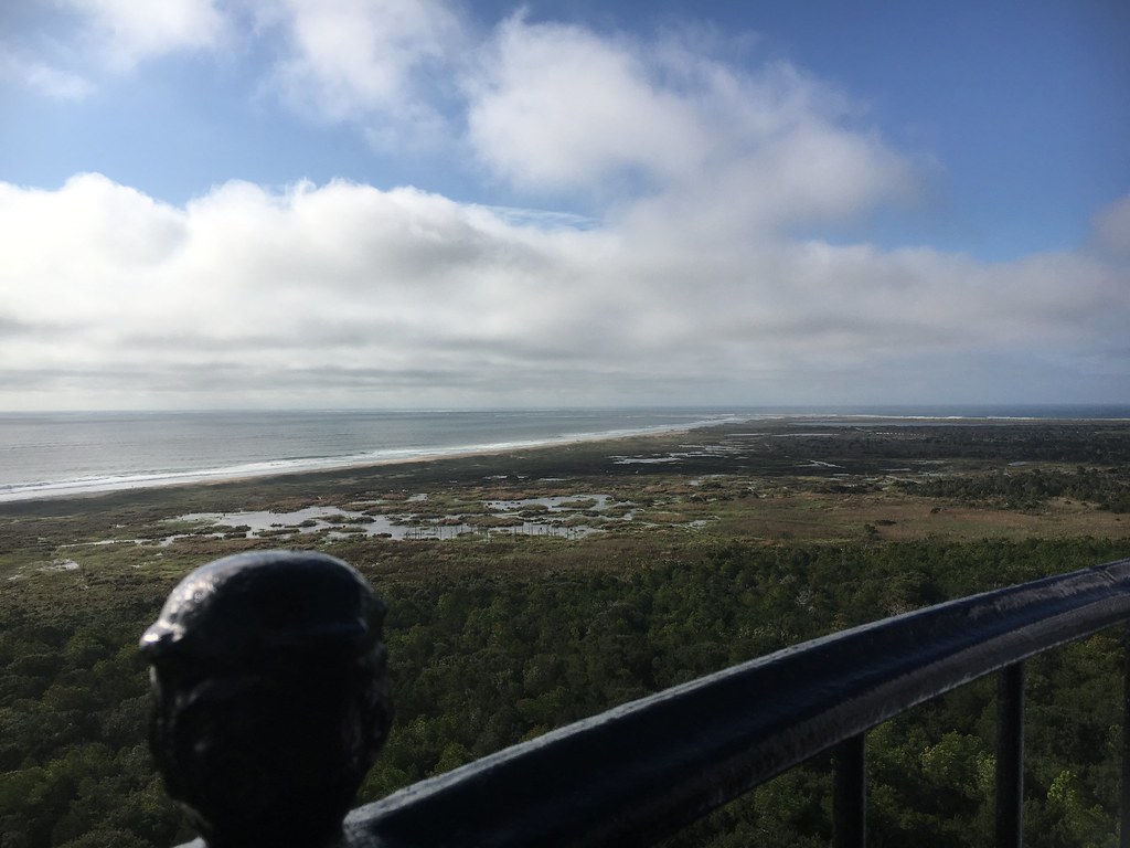 Photo: CapeHatterasNPS, Public Domain Mark (via Flickr)
- 1.0 mi
- round trip
- 78 ft
- climb
- 23 ft
- high point
- Out and back
- route
- Feb–Jun, Sep–Dec
- best months
Is Sedge Trail open right now?
Closure in the area
There's a closure order in Cape Hatteras National Seashore. It doesn't name Sedge Trail, so check the source for the area it covers (2 listed).
Project Safety Closure in Place Near Southernmost Groin in Buxton
Park closure covering Cape Hatteras National Seashore · NPS · Cape Hatteras National Seashore
Closure of Billy Mitchell Airport for Repaving Project
Park closure covering Cape Hatteras National Seashore · NPS · Cape Hatteras National Seashore
As of · Source: NPS · Cape Hatteras National Seashore. Agencies don't list every closure — check before you go.
Sedge Trail is a short out-and-back hike in North Carolina managed by the National Park Service. The trail is 0.98 miles and gains 78 feet of elevation.
Local outfitters
- Equine Adventures3 mi away
Not on Roamze yet. Their page has how to reach them.
- Ridge TrailHiking · Next doorPhoto: CapeHatterasNPS, Public Domain Mark (via Flickr)
 Lookout Loop TrailHiking · Next doorPhoto: Ken Lund from Reno, Nevada, USA, CC BY-SA 2.0 (via Wikimedia Commons)
 East TrailHiking · Next doorPhoto: Ken Lund, CC BY-SA 2.0 (via Flickr)
- North TrailHiking · Next doorPhoto: Ken Lund, CC BY-SA 2.0 (via Flickr)
- Buxton WoodsHiking · Next doorPhoto: Ken Lund, CC BY-SA 2.0 (via Flickr)
 Boundary TrailHiking · ~2 min drivePhoto: CapeHatterasNPS, Public Domain Mark (via Flickr)
- HI RD Frisco Water Plant RoadHiking · ~2 min drivePhoto: CapeHatterasNPS, Public Domain Mark (via Flickr)
 Loran Road TrailHiking · ~3 min drivePhoto: CapeHatterasNPS, Public Domain Mark (via Flickr)
 HI ML Buxton Woods TrailHiking · ~3 min drivePhoto: CapeHatterasNPS, Public Domain Mark (via Flickr)
 OI TR Hammock Hills Nature TrailHiking · ~38 min drivePhoto: Scott Thompson, CC BY 3.0 (via Wikimedia Commons)
Best time to visit Sedge Trail
Best months: February–June and September–December. Best months have typical highs of 55–85 °F, lows of 30 °F or warmer (32 °F where the station doesn't record snow), at most one snowy day and no more than 12 wet days.
Jan
54° / 40°
Feb
57° / 41°
Mar
62° / 46°
Apr
69° / 55°
May
77° / 63°
Jun
84° / 71°
Jul
87° / 75°
Aug
87° / 74°
Sep
82° / 71°
Oct
74° / 61°
Nov
65° / 52°
Dec
58° / 45°
Typical high / low (°F) and days with rain or snow, 1991–2020. Measured at Frisco 2nne, NC, 2.3 mi away at 0 ft. This station doesn't record snowfall. Source: NOAA NCEI U.S. Climate Normals 1991–2020.
