Dare County: Cape Hatteras Lighthouse
- National Park Service
- managed by
- Feb–Jun, Sep–Dec
- best months
Is Dare County: Cape Hatteras Lighthouse open right now?
Closure in the area
There's a closure order in Cape Hatteras National Seashore. It doesn't name Dare County: Cape Hatteras Lighthouse, so check the source for the area it covers (2 listed).
Project Safety Closure in Place Near Southernmost Groin in Buxton
Park closure covering Cape Hatteras National Seashore · NPS · Cape Hatteras National Seashore
Closure of Billy Mitchell Airport for Repaving Project
Park closure covering Cape Hatteras National Seashore · NPS · Cape Hatteras National Seashore
As of · Source: NPS · Cape Hatteras National Seashore. Agencies don't list every closure — check before you go.
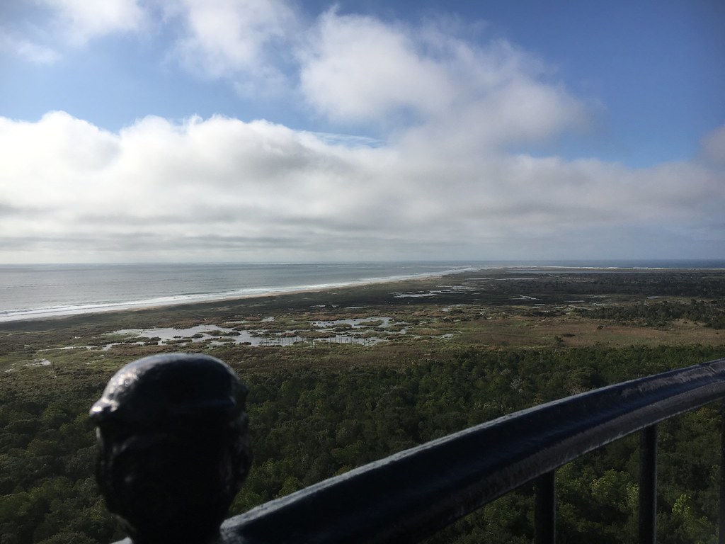
Cape Hatteras Lighthouse sits on the North Carolina coast within Cape Hatteras National Seashore, about 0.8 miles from the town of Buxton. The lighthouse is a National Park Service unit, and the surrounding seashore makes it a natural anchor for a day on the beach or a longer stay in the area. For comfortable weather, late spring and early fall are the best bets. Typical averages from a nearby weather station in Frisco show May highs around 77°F and September highs around 82°F, while July and August average about 87°F. Several trails and a campground lie close by. The HI ML Buxton Woods Trail is just 0.3 miles away, and Cap'n B RV Park is about 1.1 miles off. Open Ponds Trail and Lookout Loop Trail are both within about 2 miles.
- Parking
- Large lot
- Fee
- Free
- Restrooms
- None
 HI ML Buxton Woods TrailHikingPhoto: CapeHatterasNPS, Public Domain Mark (via Flickr)0.3 mi
- Cap'n B RV ParkCamping1.1 mi
- Open Ponds TrailHiking1.2 mi
 Lookout Loop TrailHikingPhoto: Ken Lund from Reno, Nevada, USA, CC BY-SA 2.0 (via Wikimedia Commons)2 mi
 Ridge TrailHikingPhoto: CapeHatterasNPS, Public Domain Mark (via Flickr)2.3 mi
 Buxton WoodsHikingPhoto: Ken Lund, CC BY-SA 2.0 (via Flickr)2.7 mi
- North TrailHikingPhoto: Ken Lund, CC BY-SA 2.0 (via Flickr)2.7 mi
 HI RD Frisco Water Plant RoadHikingPhoto: CapeHatterasNPS, Public Domain Mark (via Flickr)3.6 mi
Source: Roamze catalog (indexable pages within 10 miles, PostGIS distance)
- Dare County: Ramp 38Beach · ~8 min drive
- Dare County: Frisco Bathhouse Sandy Bay Day Use AreaBeach · ~12 min drive
- Dare County: Frisco Hatteras AccessBeach · ~14 min drive
- Dare County: Ramp 34Beach · ~15 min drive
- Dare County: Graveyard Atlantic Museum and Ramp 55Beach · ~18 min drive
- Dare County: Ramp 32 / Little Kinnakeet Beach TrailBeach · ~18 min drive
- Dare County: Ramp 30Beach · ~22 min drive
- Dare County: Ramp 27Beach · ~26 min drive
- Ocracoke: Unnamed Beach AccessBeach · ~27 min drive
- Dare County: Ramp 25Beach · ~29 min drive
Also worth it near here
Best time to visit Dare County: Cape Hatteras Lighthouse
Best months: February–June and September–December. Best months have typical highs of 55–85 °F, lows of 30 °F or warmer (32 °F where the station doesn't record snow), at most one snowy day and no more than 12 wet days.
Jan
54° / 40°
Feb
57° / 41°
Mar
62° / 46°
Apr
69° / 55°
May
77° / 63°
Jun
84° / 71°
Jul
87° / 75°
Aug
87° / 74°
Sep
82° / 71°
Oct
74° / 61°
Nov
65° / 52°
Dec
58° / 45°
Typical high / low (°F) and days with rain or snow, 1991–2020. Measured at Frisco 2nne, NC, 4.6 mi away at 0 ft. We don't have this place's elevation, so higher spots nearby can run cooler. This station doesn't record snowfall. Source: NOAA NCEI U.S. Climate Normals 1991–2020.
