Attic Window
Campground
Campground · 0.7 mi from the trail
 Photo: Thomson200, CC0 (via Wikimedia Commons)
Closure in the area
There's a closure order in National Forests in North Carolina. It doesn't name Grandfather Extension Trail, so check the source for the area it covers (2 listed).
Maple Sally Road Closure
Agency closure covering National Forests in North Carolina · USFS · National Forests in North Carolina
Table Rock Road construction starts Nov. 2, 2026
Agency closure covering National Forests in North Carolina · USFS · National Forests in North Carolina
Pisgah National Forest Begins Removing Hazardous Fuel Left by Helene via Helicopters
Agency alert covering National Forests in North Carolina · USFS · National Forests in North Carolina
Temporary Closure - The Elk Falls Trail
Agency alert covering National Forests in North Carolina · USFS · National Forests in North Carolina
Rainbow Springs Road closed for reconstruction
Agency alert covering National Forests in North Carolina · USFS · National Forests in North Carolina
As of · Source: USFS · National Forests in North Carolina. Agencies don't list every closure — check before you go.
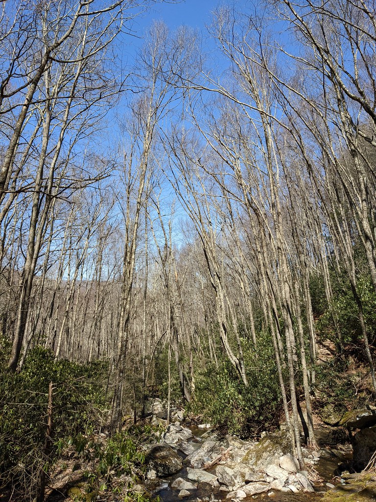
Grandfather Extension Trail is a short, easy hike in the Grandfather Ranger District of the National Forests in North Carolina, about 0.4 miles long and roughly 0.8 miles round trip. It rises from about 5,070 feet to a high point of 5,258 feet, with a total climb of about 618 feet, and the steepest stretch comes at about 0.3 miles in. Summer is the most comfortable time to go. Typical averages from a nearby weather station at Grandfather Mtn, NC, run to highs around 72°F in July and 71°F in August, with lows near 57°F. Winter is cold, with January highs around 37°F and lows near 21°F. The trail sits close to several other routes. Black Rock Trail is about 0.1 mile away and Underwood Trail about 0.3 mile. Climbers can find Upper Tier and Sunken Treasure about 1.5 miles off.
Attic Window
Campground
Places © OpenStreetMap contributors
More in Spruce PineNot on Roamze yet. Their page has how to reach them.
Black Rock TrailHikingPhoto: Thomson200, CC0 (via Wikimedia Commons)0.1 mi Underwood TrailHikingPhoto: jlh_lunasea, CC BY-SA 2.0 (via Flickr)0.3 mi
 Upper TierRock climbingPhoto: pmuellr, CC BY 2.0 (via Flickr)1.5 miSunken TreasureRock climbingPhoto: pmuellr, CC BY 2.0 (via Flickr)1.6 mi
 Wilson CreekCanoeingPhoto: Ken Thomas, Public domain (via Wikimedia Commons)6.2 mi
Source: Roamze catalog (indexable pages within 10 miles, PostGIS distance)
Bridge TrailHiking · Next doorPhoto: jlh_lunasea, CC BY-SA 2.0 (via Flickr) Tanawha TrailHiking · ~1 min drivePhoto: chascow, CC BY 2.0 (via Flickr)
 Profile TrailHiking · ~3 min drivePhoto: npdoty, CC BY 2.0 (via Flickr)Grandfather TrailHiking · Next doorPhoto: jlh_lunasea, CC BY-SA 2.0 (via Flickr)
 Tanawha TrailHiking · ~1 min drivePhoto: Matthew Trudeau Photography from Murrells inlet , USA, CC0 (via Wikimedia Commons)
 Lost Cove LoopHiking · ~8 min drivePhoto: Todd Lewis, CC BY-SA 3.0 (via Wikimedia Commons)Grandfather TrailHiking · Next doorPhoto: Thomson200, CC0 (via Wikimedia Commons)Tanawha TrailHiking · ~2 min drivePhoto: Matthew Trudeau Photography from Murrells inlet , USA, CC0 (via Wikimedia Commons)Timber RidgeHiking · ~9 min drivePhoto: Todd Lewis, CC BY-SA 3.0 (via Wikimedia Commons)Underwood TrailHiking · Next doorPhoto: jlh_lunasea, CC BY-SA 2.0 (via Flickr)
Best months: September–October. Best months have typical highs of 55–85 °F, lows of 30 °F or warmer (32 °F where the station doesn't record snow), at most one snowy day and no more than 12 wet days.
Jan
37° / 21°
14 wet
Feb
40° / 23°
13 wet
Mar
46° / 29°
14 wet
Apr
55° / 38°
14 wet
May
62° / 47°
15 wet
Jun
69° / 54°
16 wet
Jul
72° / 58°
16 wet
Aug
71° / 57°
16 wet
Sep
66° / 51°
12 wet
Oct
57° / 41°
12 wet
Nov
48° / 32°
11 wet
Dec
42° / 26°
13 wet
Typical high / low (°F) and days with rain or snow, 1991–2020. Measured at Grandfather Mtn, NC, 0.2 mi away at 5,280 ft. This station doesn't record snowfall. Source: NOAA NCEI U.S. Climate Normals 1991–2020.
Map and trail data © OpenStreetMap contributors

