Black Cohosh Trail
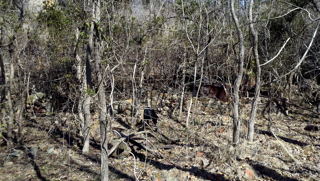 Photo: bobistraveling, CC BY 2.0 (via Flickr)
- 0.7 mi
- round trip
- 180 ft
- climb
- 576 ft
- high point
- Out and back
- route
- Mar–Jun, Sep–Nov
- best months
Black Cohosh Trail is an easy out-and-back hike in North Carolina, about 0.7 miles from Windy Hill Farm. The route is short, with a total length of about 1.5 miles, and it rises roughly 90 feet from the start to a high point of about 576 feet. The trail is a gentle walk. The steepest stretch comes within the first 0.06 miles, with a grade of about 4 percent, and the climb totals about 180 feet for the round trip. The trip takes about half an hour, so it fits easily into a short visit to the area. Spring and fall are the most comfortable times to go. Typical averages from a nearby weather station in Durham run from highs around 71°F in April and October to about 88°F in July. October is also the driest month of the year, with about eight wet days. Several other trails start close by. Springhouse Loop and Quartz Loop are each about 0.2 miles away, and Flat Tail Trail is about 0.3 miles away. The Eastern Region climbing area lies about 2.9 miles off.
Local outfitters
- Haw River Trail18 mi away
Not on Roamze yet. Their page has how to reach them.
 Springhouse LoopHikingPhoto: bobistraveling, CC BY 2.0 (via Flickr)0.2 mi
 Quartz LoopHikingPhoto: npdoty, CC BY 2.0 (via Flickr)0.2 mi
- Flat Tail TrailHikingPhoto: bobistraveling, CC BY 2.0 (via Flickr)0.3 mi
- Lava LoopHikingPhoto: npdoty, CC BY 2.0 (via Flickr)0.3 mi
- Eastern RegionRock climbing2.9 mi
- New Hope CreekCanoeing4.6 mi
- Carrboro/University Lake bouldersRock climbing8.5 mi
 Eno RiverCanoeingPhoto: Ildar Sagdejev (Specious), CC BY-SA 3.0 (via Wikimedia Commons)8.7 mi
Source: Roamze catalog (indexable pages within 10 miles, PostGIS distance)
- Springhouse LoopHiking · Next doorPhoto: bobistraveling, CC BY 2.0 (via Flickr)
 New Hope Creek Trail NorthHiking · ~5 min drivePhoto: Larry Lamb, CC BY-SA 3.0 (via Wikimedia Commons)
 Cox Mountain TrailHiking · ~7 min drivePhoto: LFLamb, CC BY-SA 2.0 (via Flickr)
- Quartz LoopHiking · Next doorPhoto: npdoty, CC BY 2.0 (via Flickr)
- Flat Tail TrailHiking · Next doorPhoto: bobistraveling, CC BY 2.0 (via Flickr)
- Lava LoopHiking · Next doorPhoto: npdoty, CC BY 2.0 (via Flickr)
- Buckeye LoopHiking · Next doorPhoto: bobistraveling, CC BY 2.0 (via Flickr)
- Running Cedar TrailHiking · Next doorPhoto: bobistraveling, CC BY 2.0 (via Flickr)
 Dairy Farm TrailHiking · Next doorPhoto: npdoty, CC BY 2.0 (via Flickr)
- Stony Creek Bluff TrailHiking · Next doorPhoto: npdoty, CC BY 2.0 (via Flickr)
Best time to visit Black Cohosh Trail
Best months: March–June and September–November. Best months have typical highs of 55–85 °F, lows of 30 °F or warmer (32 °F where the station doesn't record snow), at most one snowy day and no more than 12 wet days.
Jan
50° / 30°
11 wet
Feb
54° / 32°
10 wet
Mar
62° / 39°
11 wet
Apr
71° / 47°
10 wet
May
77° / 55°
11 wet
Jun
84° / 63°
10 wet
Jul
88° / 67°
11 wet
Aug
86° / 66°
10 wet
Sep
80° / 60°
8 wet
Oct
71° / 48°
8 wet
Nov
61° / 38°
9 wet
Dec
53° / 33°
10 wet
Typical high / low (°F) and days with rain or snow, 1991–2020. Measured at Durham 11 W, NC, 4.8 mi away at 562 ft. This station doesn't record snowfall. Source: NOAA NCEI U.S. Climate Normals 1991–2020.
Map and trail data © OpenStreetMap contributors
